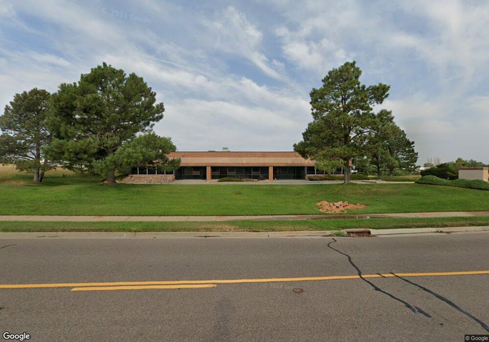
7135 S Tucson Way Centennial, CO 80112
Estimated Value: $1,969,679
--
Bed
4
Baths
10,096
Sq Ft
$195/Sq Ft
Est. Value
About This Home
This home is located at 7135 S Tucson Way, Centennial, CO 80112 and is currently priced at $1,969,679, approximately $195 per square foot. 7135 S Tucson Way is a home located in Arapahoe County with nearby schools including Red Hawk Ridge Elementary School, Liberty Middle School, and Grandview High School.
Ownership History
Date
Name
Owned For
Owner Type
Purchase Details
Closed on
Jul 31, 2023
Sold by
Drj Holding Company Llc
Bought by
Arapahoe County Water And Wastewater Authorit
Current Estimated Value
Purchase Details
Closed on
Oct 7, 2022
Sold by
Ihc Scott Inc
Bought by
Drj Holding Company Llc
Purchase Details
Closed on
Jul 28, 1994
Sold by
Grossman Steven W and Grossman Steven
Bought by
Interstate Highway Construction Inc
Purchase Details
Closed on
Oct 11, 1990
Sold by
Conversion Arapco
Bought by
Grossman Steven W
Purchase Details
Closed on
Jul 1, 1985
Bought by
Conversion Arapco
Create a Home Valuation Report for This Property
The Home Valuation Report is an in-depth analysis detailing your home's value as well as a comparison with similar homes in the area
Home Values in the Area
Average Home Value in this Area
Purchase History
| Date | Buyer | Sale Price | Title Company |
|---|---|---|---|
| Arapahoe County Water And Wastewater Authorit | $2,880,000 | First American Title | |
| Drj Holding Company Llc | -- | -- | |
| Interstate Highway Construction Inc | $495,000 | Stewart Title | |
| Grossman Steven W | -- | -- | |
| Conversion Arapco | -- | -- |
Source: Public Records
Tax History Compared to Growth
Tax History
| Year | Tax Paid | Tax Assessment Tax Assessment Total Assessment is a certain percentage of the fair market value that is determined by local assessors to be the total taxable value of land and additions on the property. | Land | Improvement |
|---|---|---|---|---|
| 2024 | $49,400 | $59,952 | -- | -- |
| 2023 | $49,400 | $484,065 | $0 | $0 |
| 2022 | $37,374 | $333,210 | $0 | $0 |
| 2021 | $36,741 | $333,210 | $0 | $0 |
| 2020 | $31,288 | $270,570 | $0 | $0 |
| 2019 | $30,395 | $270,570 | $0 | $0 |
| 2018 | $30,085 | $248,820 | $0 | $0 |
| 2017 | $29,855 | $248,820 | $0 | $0 |
| 2016 | $31,514 | $243,310 | $0 | $0 |
| 2015 | $30,908 | $243,310 | $0 | $0 |
| 2014 | -- | $204,948 | $0 | $0 |
| 2013 | -- | $208,230 | $0 | $0 |
Source: Public Records
Map
Nearby Homes
- 7222 S Blackhawk St Unit 105
- 7212 S Blackhawk St Unit 1203
- 6681 S Abilene Way
- 6471 S Potomac St
- 6526 S Abilene St
- 7440 S Blackhawk St Unit 4-305
- 7440 S Blackhawk St Unit 15-103
- 7440 S Blackhawk St Unit 9204
- 7440 S Blackhawk St Unit 14-202
- 7440 S Blackhawk St Unit 2-104
- 7440 S Blackhawk St Unit 14-103
- 6473 S Abilene St
- 13543 E Longview Ave
- 13552 E Weaver Place
- 6373 Village Ln
- 13794 E Caley Dr
- 6352 S Abilene St
- 14022 E Fair Place
- 6319 S Blackhawk Way
- 11478 E Briarwood Cir
- 7165 S Tucson Way
- 7074 S Revere Pkwy
- 6786 S Revere Pkwy Unit 120
- 13253 E Briarwood Ave
- 6751 S Potomac St
- 14105 E Easter Ave
- 6839 S Atchison Way
- 6839 S Atchison St
- 13303 E Adam Aircraft Cir Unit C39
- 13303 E Adam Aircraft Cir Unit 7
- 13303 E Adam Aircraft Cir Unit 6
- 13303 E Adam Aircraft Cir Unit 33
- 13303 E Adam Aircraft Cir Unit 44
- 13303 E Adam Aircraft Cir Unit C46
- 13303 E Adam Aircraft Cir Unit 32
- 13303 E Adam Aircraft Cir Unit 31
- 13303 E Adam Aircraft Cir Unit D60
- 13303 E Adam Aircraft Cir Unit 42
- 13303 E Adam Aircraft Cir Unit 38
- 13303 E Adam Aircraft Cir Unit 24