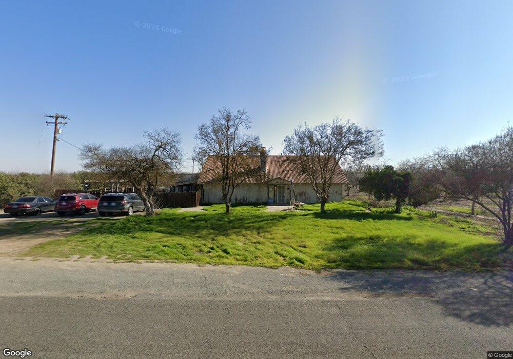
7137 13th Ave Hanford, CA 93230
Estimated Value: $556,000 - $604,000
3
Beds
2
Baths
2,704
Sq Ft
$213/Sq Ft
Est. Value
About This Home
This home is located at 7137 13th Ave, Hanford, CA 93230 and is currently estimated at $576,156, approximately $213 per square foot. 7137 13th Ave is a home located in Kings County with nearby schools including Sierra Pacific High School, Frontier Elementary School, and Pioneer Elementary School.
Ownership History
Date
Name
Owned For
Owner Type
Purchase Details
Closed on
Jun 25, 2024
Sold by
Harry And Nancy Miya Survivors Trust and Miya Nancy
Bought by
Miya Melynda K
Current Estimated Value
Purchase Details
Closed on
Mar 22, 2024
Sold by
Harry And Nancy Miya Living Trust and Miya Nancy
Bought by
Harry And Nancy Miya Survivors Trust and Miya
Purchase Details
Closed on
Mar 19, 2008
Sold by
Miya Melynda K
Bought by
Miya Melynda K
Purchase Details
Closed on
Dec 5, 2002
Sold by
Soares Edward Anthony and Soares Claudine Hazel
Bought by
Miya Harry and Miya Nancy
Create a Home Valuation Report for This Property
The Home Valuation Report is an in-depth analysis detailing your home's value as well as a comparison with similar homes in the area
Home Values in the Area
Average Home Value in this Area
Purchase History
| Date | Buyer | Sale Price | Title Company |
|---|---|---|---|
| Miya Melynda K | -- | None Listed On Document | |
| Harry And Nancy Miya Survivors Trust | -- | None Listed On Document | |
| Miya Melynda K | -- | None Available | |
| Miya Mark K | -- | None Available | |
| Miya Michael K | -- | None Available | |
| Miya Michael K | -- | None Available | |
| Miya Harry | $500,000 | Chicago Title Company |
Source: Public Records
Tax History Compared to Growth
Tax History
| Year | Tax Paid | Tax Assessment Tax Assessment Total Assessment is a certain percentage of the fair market value that is determined by local assessors to be the total taxable value of land and additions on the property. | Land | Improvement |
|---|---|---|---|---|
| 2025 | $3,386 | $390,000 | $186,755 | $203,245 |
| 2023 | $3,386 | $302,507 | $159,071 | $143,436 |
| 2022 | $3,280 | $296,576 | $155,952 | $140,624 |
| 2021 | $3,222 | $290,762 | $152,895 | $137,867 |
| 2020 | $3,230 | $287,780 | $151,327 | $136,453 |
| 2019 | $3,179 | $282,137 | $148,360 | $133,777 |
| 2018 | $3,161 | $276,605 | $145,451 | $131,154 |
| 2017 | $3,106 | $271,181 | $142,599 | $128,582 |
| 2016 | $2,939 | $265,864 | $139,803 | $126,061 |
| 2015 | $2,848 | $137,703 | $137,703 | $0 |
| 2014 | $2,870 | $256,741 | $135,006 | $121,735 |
Source: Public Records
Map
Nearby Homes
- 2341 W Ambassador Way
- 2463 Madeline Dr
- 2439 Madeline Dr
- 2328 Madeline Dr
- 2516 Cortner St
- 2198 N Mitchell St
- 2190 N Mitchell St
- 2390 Chardonnay Place
- 1938 W Van Gogh St
- 2435 Vintage Place
- 1744 Dali Way
- 1795 W Van Gogh
- 1674 Castoro Way
- 1674 W Castoro Way
- 1172 W Pepper Dr
- 2283 W Andrew Ln
- 2476 W Bristol Ln
- 1109 W Cinnamon Ave
- 12937 Flint Ave
- 12793 Flint Ave
- 12613 Flint Ave
- 7581 13th Ave
- 7530 13th Ave
- 7570 13th Ave
- 7612 13th Ave
- 7597 13th Ave
- 12532 Flint Ave
- 7685 13th Ave
- 12383 Flint Ave
- 12357 Flint Ave
- 7813 13th Ave
- 12235 Flint Ave
- 7929 13th Ave
- 12958 Fargo Ave
- 12898 Fargo Ave
- 12844 Fargo Ave
- 7246 12th Ave
- 12792 Fargo Ave