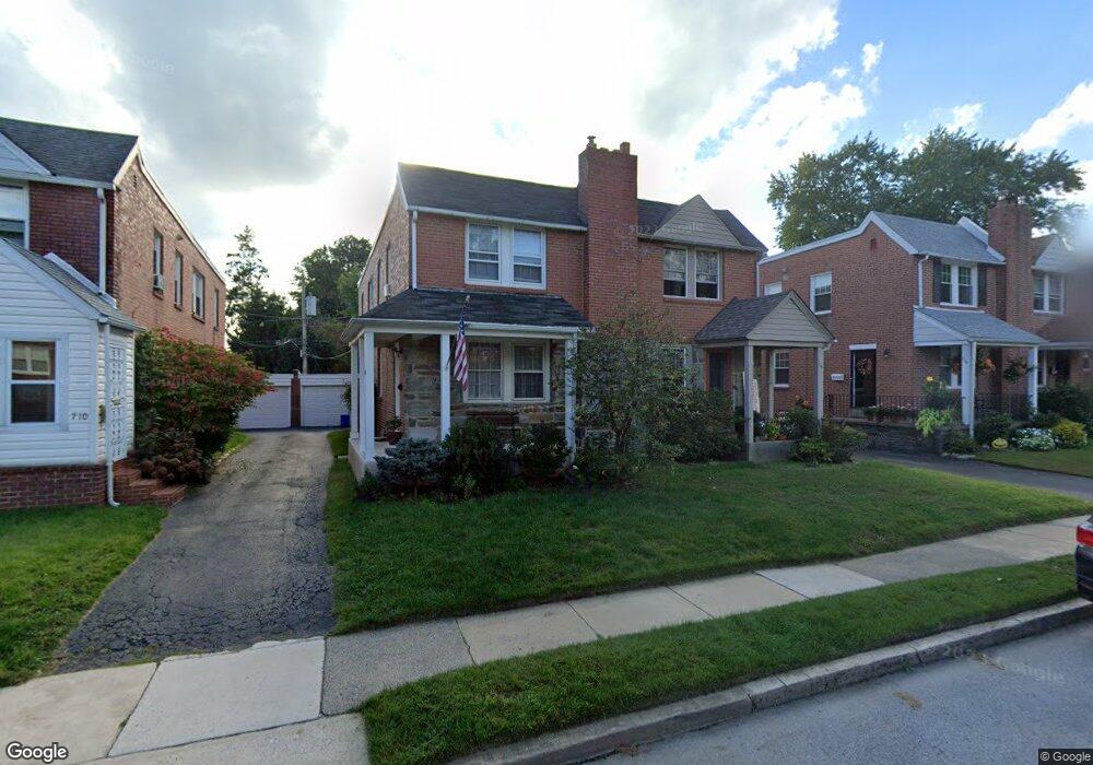
714 Clarendon Rd Drexel Hill, PA 19026
Estimated Value: $241,000 - $295,000
3
Beds
1
Bath
1,440
Sq Ft
$185/Sq Ft
Est. Value
About This Home
This home is located at 714 Clarendon Rd, Drexel Hill, PA 19026 and is currently estimated at $265,837, approximately $184 per square foot. 714 Clarendon Rd is a home located in Delaware County with nearby schools including Aronimink El School, Drexel Hill Middle School, and Upper Darby High School.
Ownership History
Date
Name
Owned For
Owner Type
Purchase Details
Closed on
Feb 24, 2014
Sold by
Smith Janet and Smith Whitney J
Bought by
Mcgurk William and Smith Janet
Current Estimated Value
Purchase Details
Closed on
Feb 27, 2009
Sold by
Cras Janet and Smith Whitney J
Bought by
Smith Janet and Smith Whitney J
Home Financials for this Owner
Home Financials are based on the most recent Mortgage that was taken out on this home.
Original Mortgage
$87,000
Interest Rate
5.18%
Mortgage Type
New Conventional
Purchase Details
Closed on
Jan 18, 1999
Sold by
Bevilacqua John E
Bought by
Cras Janet and Smith Whitney J
Home Financials for this Owner
Home Financials are based on the most recent Mortgage that was taken out on this home.
Original Mortgage
$91,800
Interest Rate
6.7%
Create a Home Valuation Report for This Property
The Home Valuation Report is an in-depth analysis detailing your home's value as well as a comparison with similar homes in the area
Home Values in the Area
Average Home Value in this Area
Purchase History
| Date | Buyer | Sale Price | Title Company |
|---|---|---|---|
| Mcgurk William | $73,435 | None Available | |
| Smith Janet | -- | None Available | |
| Cras Janet | $102,000 | Commonwealth Land Title Ins |
Source: Public Records
Mortgage History
| Date | Status | Borrower | Loan Amount |
|---|---|---|---|
| Previous Owner | Smith Janet | $87,000 | |
| Previous Owner | Cras Janet | $91,800 |
Source: Public Records
Tax History Compared to Growth
Tax History
| Year | Tax Paid | Tax Assessment Tax Assessment Total Assessment is a certain percentage of the fair market value that is determined by local assessors to be the total taxable value of land and additions on the property. | Land | Improvement |
|---|---|---|---|---|
| 2025 | $5,583 | $132,020 | $38,210 | $93,810 |
| 2024 | $5,583 | $132,020 | $38,210 | $93,810 |
| 2023 | $5,531 | $132,020 | $38,210 | $93,810 |
| 2022 | $5,382 | $132,020 | $38,210 | $93,810 |
| 2021 | $7,257 | $132,020 | $38,210 | $93,810 |
| 2020 | $6,050 | $93,530 | $29,570 | $63,960 |
| 2019 | $5,944 | $93,530 | $29,570 | $63,960 |
| 2018 | $5,875 | $93,530 | $0 | $0 |
| 2017 | $5,723 | $93,530 | $0 | $0 |
| 2016 | $513 | $93,530 | $0 | $0 |
| 2015 | $513 | $93,530 | $0 | $0 |
| 2014 | $513 | $93,530 | $0 | $0 |
Source: Public Records
Map
Nearby Homes
- 4938 State Rd
- 921 Addingham Ave
- 5233 Arrowhead Ln
- 833 Anderson Ave
- 837 Alexander Ave
- 5042 Sylvia Rd
- 920 Alexander Ave
- 820 Wilde Ave
- 1042 Blythe Ave
- 412 N Rolling Rd
- 1029 Belfield Ave
- 543 Bloomfield Ave
- 523 Bloomfield Ave
- 4410 School Ln
- 4400 School Ln
- 1102 Childs Ave
- 521 Blythe Ave
- 4123 School Ln
- 4426 Huey Ave
- 414 Stanfield Rd
- 712 Clarendon Rd
- 716 Clarendon Rd
- 710 Clarendon Rd
- 718 Clarendon Rd
- 708 Clarendon Rd
- 4900 State Rd
- 4920 State Rd
- 706 Clarendon Rd
- 4922 State Rd
- 704 Clarendon Rd
- 4909 Woodland Ave
- 4924 State Rd
- 4911 Woodland Ave
- 702 Clarendon Rd
- 4913 Woodland Ave
- 717 Clarendon Rd
- 715 Clarendon Rd
- 719 Clarendon Rd
- 4926 State Rd
- 713 Clarendon Rd