
Seller's Agent in 2022
Monica Bess
Bess Blvd Real Estate Co
(419) 310-1016
46 in this area
160 Total Sales

Estimated Value: $192,000 - $720,000
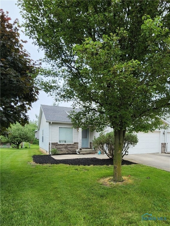
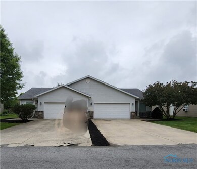
INVESTMENT or HOMEOWNER you have a unique and rare opportunity to purchase this stand alone 2 unit condo. Just think you could leave in one unit and rent the extra unit OR you can be a landlord on both units. Call today for an appointment.
Last Agent to Sell the Property
Bess Blvd Real Estate Co License #2016002322 Listed on: 03/29/2022
| Date | Buyer | Sale Price | Title Company |
|---|---|---|---|
| Holica Enterprises Llc | $1,125 | None Listed On Document | |
| -- | -- | -- | |
| Crow Andrew N | -- | None Available |
| Date | Status | Borrower | Loan Amount |
|---|---|---|---|
| Open | Holica Enterprises Llc | $652,000 | |
| Closed | Holica Enterprises Llc | $58,500 |
| Date | Event | Price | List to Sale | Price per Sq Ft |
|---|---|---|---|---|
| 08/17/2022 08/17/22 | Sold | $500,000 | +138.1% | $65 / Sq Ft |
| 03/29/2022 03/29/22 | For Sale | $210,000 | -- | $27 / Sq Ft |
| Year | Tax Paid | Tax Assessment Tax Assessment Total Assessment is a certain percentage of the fair market value that is determined by local assessors to be the total taxable value of land and additions on the property. | Land | Improvement |
|---|---|---|---|---|
| 2025 | $1,553 | $50,370 | $3,640 | $46,730 |
| 2024 | $1,410 | $43,300 | $3,010 | $40,290 |
| 2023 | $1,410 | $43,650 | $3,360 | $40,290 |
| 2022 | $1,422 | $37,950 | $3,090 | $34,860 |
| 2021 | $1,294 | $37,950 | $3,090 | $34,860 |
| 2020 | $1,293 | $37,950 | $3,090 | $34,860 |
| 2019 | $1,291 | $37,950 | $3,090 | $34,860 |
| 2018 | $1,167 | $34,920 | $3,090 | $31,830 |
| 2017 | $1,185 | $34,920 | $3,090 | $31,830 |
| 2016 | -- | $34,920 | $3,090 | $31,830 |
| 2015 | -- | $34,290 | $3,090 | $31,200 |
| 2014 | -- | $34,290 | $3,090 | $31,200 |
| 2013 | -- | $34,290 | $3,090 | $31,200 |
Seller's Agent in 2022
Monica Bess
Bess Blvd Real Estate Co
(419) 310-1016
46 in this area
160 Total Sales
Source: Northwest Ohio Real Estate Information Service (NORIS)
MLS Number: 6084444
APN: 06-580222.0100
Disclaimer: Certain information contained herein is derived from information provided by parties other than Homes.com. All information provided is deemed reliable, but is not guaranteed to be accurate and should be independently verified.
![]() IDX information is provided exclusively for personal, non-commercial use, and may not be used for any purpose other than to identify prospective properties consumers may be interested in purchasing. Information is deemed reliable but not guaranteed. ©2026 NORIS. All rights reserved.
IDX information is provided exclusively for personal, non-commercial use, and may not be used for any purpose other than to identify prospective properties consumers may be interested in purchasing. Information is deemed reliable but not guaranteed. ©2026 NORIS. All rights reserved.
Ask me questions while you tour the home.