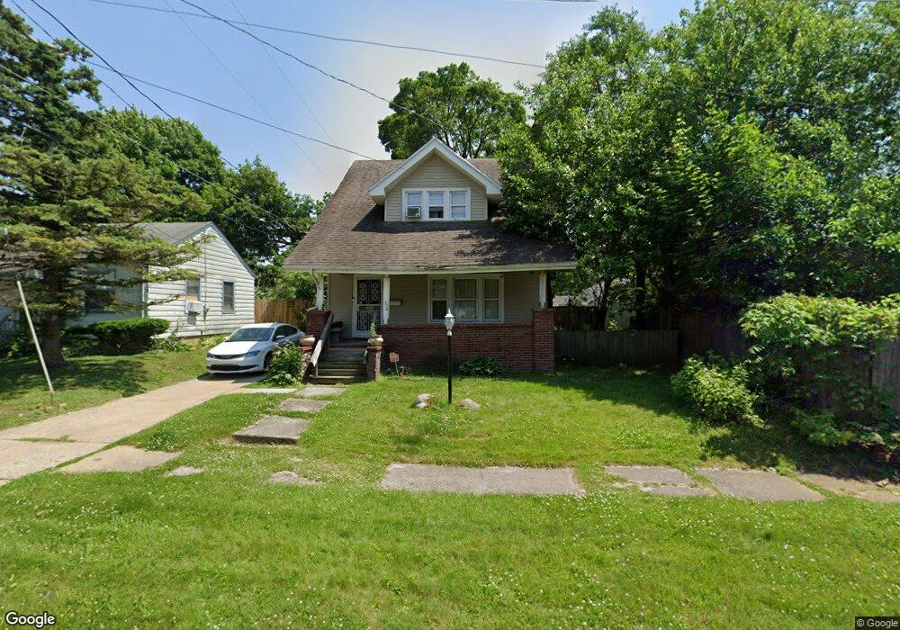
714 Perry St Flint, MI 48504
Mott Park NeighborhoodEstimated Value: $76,000 - $78,340
3
Beds
2
Baths
1,242
Sq Ft
$62/Sq Ft
Est. Value
About This Home
This home is located at 714 Perry St, Flint, MI 48504 and is currently estimated at $77,085, approximately $62 per square foot. 714 Perry St is a home located in Genesee County with nearby schools including Durant-Tuuri-Mott Elementary School, St John Vianney Catholic School, and First Flint Seventh-day Adventist Christian School.
Ownership History
Date
Name
Owned For
Owner Type
Purchase Details
Closed on
Jul 30, 2024
Sold by
Chapman Martin
Bought by
Hall Quomon
Current Estimated Value
Purchase Details
Closed on
Dec 30, 2013
Sold by
Young James D and Young Diane M
Bought by
The Roc Inc
Purchase Details
Closed on
Jun 30, 2004
Sold by
Jackson Alphonso R and Hud
Bought by
Young James D and Young Diane M
Purchase Details
Closed on
May 21, 2003
Sold by
Varela Aaron C and Varela Bobbi J
Bought by
Countrywide Home Loans Inc
Purchase Details
Closed on
Apr 11, 2003
Sold by
Countrywide Home Loans Inc
Bought by
Hud
Create a Home Valuation Report for This Property
The Home Valuation Report is an in-depth analysis detailing your home's value as well as a comparison with similar homes in the area
Home Values in the Area
Average Home Value in this Area
Purchase History
| Date | Buyer | Sale Price | Title Company |
|---|---|---|---|
| Hall Quomon | -- | None Listed On Document | |
| The Roc Inc | -- | None Available | |
| Young James D | $52,000 | Wolverton Title Research Co | |
| Countrywide Home Loans Inc | $61,176 | -- | |
| Hud | -- | -- |
Source: Public Records
Tax History Compared to Growth
Tax History
| Year | Tax Paid | Tax Assessment Tax Assessment Total Assessment is a certain percentage of the fair market value that is determined by local assessors to be the total taxable value of land and additions on the property. | Land | Improvement |
|---|---|---|---|---|
| 2025 | $1,029 | $34,000 | $0 | $0 |
| 2024 | $931 | $31,400 | $0 | $0 |
| 2023 | $913 | $24,800 | $0 | $0 |
| 2022 | $0 | $21,900 | $0 | $0 |
| 2021 | $950 | $19,200 | $0 | $0 |
| 2020 | $856 | $16,400 | $0 | $0 |
| 2019 | $833 | $13,300 | $0 | $0 |
| 2018 | $836 | $11,900 | $0 | $0 |
| 2017 | $862 | $0 | $0 | $0 |
| 2016 | $857 | $0 | $0 | $0 |
| 2015 | -- | $0 | $0 | $0 |
| 2014 | -- | $0 | $0 | $0 |
| 2012 | -- | $16,900 | $0 | $0 |
Source: Public Records
Map
Nearby Homes
- 820 N Chevrolet Ave
- 913 Perry St
- 849 Frank St
- 448 Dougherty Place
- 2332 Nolen Dr
- 709 Cadillac St
- 2008 University Ave
- 1017 Perry St
- 1016 Dupont St
- 2448 Thomas St
- 2410 Sloan St
- 1813 Stevenson St
- 2539 Norbert St
- 1717 Wolcott St
- 3119 Sherwood Dr
- 612 Bradley Ave
- 2553 Thomas St
- 227 W 5th Ave Unit 3
- 3617 Sherwood Dr
- 1409 Prospect St
- 718 Perry St
- 2040 Monteith St
- 2044 Monteith St
- 2034 Monteith St
- 722 Perry St
- 2029 Joliet St
- 2025 Joliet St
- 2026 Monteith St
- 2021 Joliet St
- 2102 Monteith St
- 2020 Monteith St
- 2201 Joliet St
- 715 Woodbridge St
- 2017 Joliet St
- 2037 Monteith St
- 2043 Monteith St
- 848 Perry St
- 2031 Monteith St
- 2108 Monteith St
- 2025 Monteith St