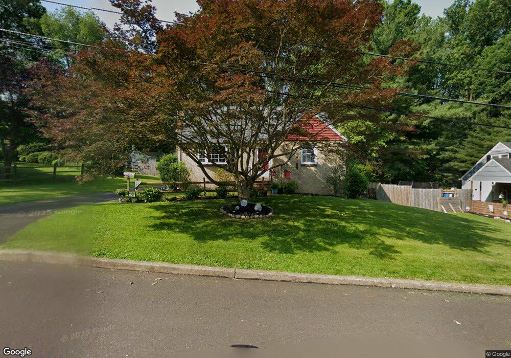
714 Sampson Ave Willow Grove, PA 19090
Estimated Value: $365,000 - $396,000
4
Beds
1
Bath
1,187
Sq Ft
$321/Sq Ft
Est. Value
About This Home
This home is located at 714 Sampson Ave, Willow Grove, PA 19090 and is currently estimated at $381,331, approximately $321 per square foot. 714 Sampson Ave is a home located in Montgomery County with nearby schools including Upper Moreland Intermediate School, Upper Moreland Primary School, and Upper Moreland Middle School.
Ownership History
Date
Name
Owned For
Owner Type
Purchase Details
Closed on
Apr 23, 2021
Sold by
Clinton Sharon A
Bought by
Clinton Nichole M and Gow David A
Current Estimated Value
Home Financials for this Owner
Home Financials are based on the most recent Mortgage that was taken out on this home.
Original Mortgage
$215,300
Outstanding Balance
$194,700
Interest Rate
3.1%
Mortgage Type
New Conventional
Estimated Equity
$186,631
Purchase Details
Closed on
Aug 25, 2016
Sold by
Franklin Lorraine and Franklin John J
Bought by
Franklin Dorothy Lorraine
Purchase Details
Closed on
Jan 1, 1969
Bought by
Franklin John J and Franklin Lorraine D
Create a Home Valuation Report for This Property
The Home Valuation Report is an in-depth analysis detailing your home's value as well as a comparison with similar homes in the area
Home Values in the Area
Average Home Value in this Area
Purchase History
| Date | Buyer | Sale Price | Title Company |
|---|---|---|---|
| Clinton Nichole M | $260,000 | None Available | |
| Franklin Dorothy Lorraine | -- | Attorney | |
| Franklin John J | -- | -- |
Source: Public Records
Mortgage History
| Date | Status | Borrower | Loan Amount |
|---|---|---|---|
| Open | Clinton Nichole M | $215,300 |
Source: Public Records
Tax History Compared to Growth
Tax History
| Year | Tax Paid | Tax Assessment Tax Assessment Total Assessment is a certain percentage of the fair market value that is determined by local assessors to be the total taxable value of land and additions on the property. | Land | Improvement |
|---|---|---|---|---|
| 2025 | $5,858 | $123,260 | $57,210 | $66,050 |
| 2024 | $5,858 | $123,260 | $57,210 | $66,050 |
| 2023 | $5,615 | $123,260 | $57,210 | $66,050 |
| 2022 | $5,281 | $123,260 | $57,210 | $66,050 |
| 2021 | $5,210 | $123,260 | $57,210 | $66,050 |
| 2020 | $5,038 | $123,260 | $57,210 | $66,050 |
| 2019 | $4,928 | $123,260 | $57,210 | $66,050 |
| 2018 | $4,927 | $123,260 | $57,210 | $66,050 |
| 2017 | $4,707 | $123,260 | $57,210 | $66,050 |
| 2016 | $4,659 | $123,260 | $57,210 | $66,050 |
| 2015 | $4,553 | $123,260 | $57,210 | $66,050 |
| 2014 | $4,421 | $123,260 | $57,210 | $66,050 |
Source: Public Records
Map
Nearby Homes
- 1014 N York Rd
- 1006 N York Rd Unit 1
- 612 Brook St
- 605 Fairhill St
- 605 Crown St
- 885 N York Rd Unit 12C
- 505 Crown St
- 14 Knock N Knoll Cir Unit L-14
- 509 Lincoln Ave
- 310 Dallas Rd
- 510 Grant Ave
- 250 Lawnton Rd
- 211 Madison Rd
- 3505 Whitehall Dr
- 16 Lawnton Rd
- 204 Cowbell Rd
- 22 Fitzwatertown Rd Unit F-4
- 69 Crooked Billet Rd
- 1948 Lukens Ave
- 1972 Coolidge Ave
- 716 Sampson Ave
- 710 Sampson Ave
- 711 Brook St
- 711 Sampson Ave
- 709 Sampson Ave
- 718 Sampson Ave
- 707 Sampson Ave
- 713 Sampson Ave
- 648 Sampson Ave
- 703 Sampson Ave
- 703 Brook St
- 620 Beechwood Rd
- 622 Beechwood Rd
- 618 Beechwood Rd
- 701 Sampson Ave
- 624 Beechwood Rd
- 646 Sampson Ave
- 616 Beechwood Rd
- 723 Sampson Ave Unit 151
- 626 Beechwood Rd