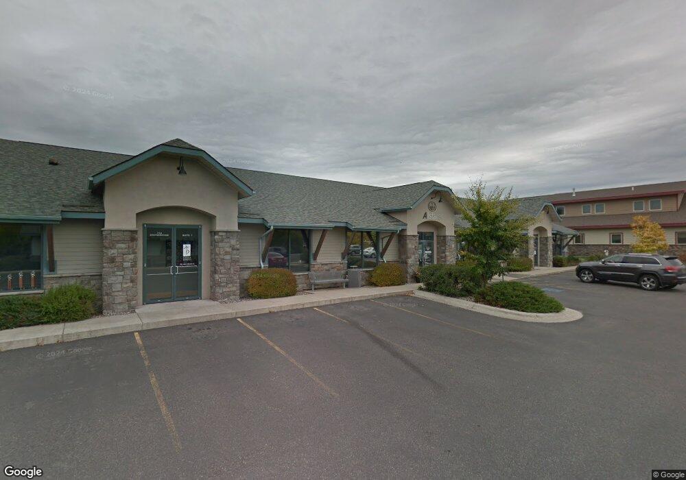
714 Stoneridge Dr Unit 3A Bozeman, MT 59715
North Bozeman NeighborhoodEstimated Value: $1,211,503
--
Bed
--
Bath
772
Sq Ft
$1,569/Sq Ft
Est. Value
About This Home
This home is located at 714 Stoneridge Dr Unit 3A, Bozeman, MT 59715 and is currently estimated at $1,211,503, approximately $1,569 per square foot. 714 Stoneridge Dr Unit 3A is a home located in Gallatin County with nearby schools including Lincoln Titus Elementary School, Emily Dickinson School, and William G. Houston Middle School.
Ownership History
Date
Name
Owned For
Owner Type
Purchase Details
Closed on
Apr 5, 2016
Sold by
Baber Thomas J and Baber Nancy K
Bought by
Carpenter Karyn A
Current Estimated Value
Home Financials for this Owner
Home Financials are based on the most recent Mortgage that was taken out on this home.
Original Mortgage
$668,383
Outstanding Balance
$529,942
Interest Rate
3.62%
Mortgage Type
Commercial
Estimated Equity
$681,561
Purchase Details
Closed on
Sep 23, 2005
Sold by
L A S T Llc
Bought by
Baber Thomas J and Baber Nancy K
Create a Home Valuation Report for This Property
The Home Valuation Report is an in-depth analysis detailing your home's value as well as a comparison with similar homes in the area
Home Values in the Area
Average Home Value in this Area
Purchase History
| Date | Buyer | Sale Price | Title Company |
|---|---|---|---|
| Carpenter Karyn A | -- | American Land Title Company | |
| Baber Thomas J | -- | Stewart Title Of Bozeman |
Source: Public Records
Mortgage History
| Date | Status | Borrower | Loan Amount |
|---|---|---|---|
| Open | Carpenter Karyn A | $668,383 |
Source: Public Records
Tax History Compared to Growth
Tax History
| Year | Tax Paid | Tax Assessment Tax Assessment Total Assessment is a certain percentage of the fair market value that is determined by local assessors to be the total taxable value of land and additions on the property. | Land | Improvement |
|---|---|---|---|---|
| 2025 | $7,700 | $908,000 | $0 | $0 |
| 2024 | $10,186 | $1,093,000 | $0 | $0 |
| 2023 | $9,847 | $1,093,000 | $0 | $0 |
| 2022 | $8,243 | $767,800 | $0 | $0 |
| 2021 | $9,096 | $767,800 | $0 | $0 |
| 2020 | $8,445 | $706,700 | $0 | $0 |
| 2019 | $8,637 | $706,700 | $0 | $0 |
| 2018 | $8,845 | $670,700 | $0 | $0 |
| 2017 | $8,755 | $670,700 | $0 | $0 |
| 2016 | $8,509 | $645,000 | $0 | $0 |
| 2015 | $8,519 | $645,000 | $0 | $0 |
| 2014 | $11,405 | $711,814 | $0 | $0 |
Source: Public Records
Map
Nearby Homes
- TBD N 19th Ave
- 928 Mountain Ash Ave
- 907 N 17th Ave
- 510 N 23rd Ave
- 420 N 22nd Ave
- 402 & 404 N 19th Ave
- 403 N 18th Ave
- 748 Rogers Way Unit C
- 748 Rogers Way Unit A
- 748 Rogers Way
- 748 Rogers Way Unit B
- 740 Rogers Way Unit C
- 740 Rogers Way Unit B
- 740 Rogers Way Unit A
- 318 & 320 N 19th
- 745 Rogers Way
- 152 Laager Loop
- 163 Wagon Train Trail
- 894 Rogers Way
- 818 Matheson Way
- 714 Stoneridge Dr
- 714 Stoneridge Dr Unit 1
- 710 Stoneridge Dr
- 822 N Stoneridge Dr
- 822 N Stoneridge Dr Unit A2
- 822 N Stoneridge Dr Unit A-1
- 808 Stoneridge Dr Unit 2
- 808 Stoneridge Dr
- 804 N 19th Ave
- 804 N 19th Ave
- 1928 N 22nd Ave Unit 2
- 1928 N 22nd Ave
- 1910 N 22nd Ave Unit 2 & 3
- 1910 N 22nd Ave Unit 2
- 1910 N 22nd Ave Unit 1
- 1910 N 22nd Ave Unit 1&2
- 1910 N 22nd Ave Unit 3
- 1910 N 22nd Ave
- 2020 Charlotte St
- 2149 Durston Rd