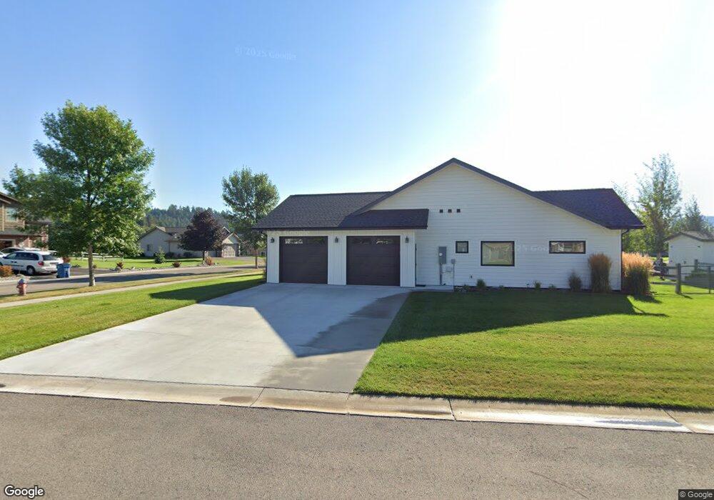
715 & 727 Mill Camp Rd Bigfork, MT 59911
Estimated Value: $537,000
3
Beds
3
Baths
1,910
Sq Ft
$281/Sq Ft
Est. Value
About This Home
This home is located at 715 & 727 Mill Camp Rd, Bigfork, MT 59911 and is currently estimated at $537,000, approximately $281 per square foot. 715 & 727 Mill Camp Rd is a home located in Flathead County with nearby schools including Bigfork Elementary School, Bigfork Middle School, and Bigfork High School.
Ownership History
Date
Name
Owned For
Owner Type
Purchase Details
Closed on
Apr 30, 2020
Sold by
Ibex Builders Inc
Bought by
Rogers Daniel J and Daniel J Rogers Family Trust
Current Estimated Value
Purchase Details
Closed on
May 29, 2018
Sold by
Cowin William
Bought by
Idex Blvd Inc
Home Financials for this Owner
Home Financials are based on the most recent Mortgage that was taken out on this home.
Original Mortgage
$40,625
Interest Rate
4.4%
Mortgage Type
Commercial
Create a Home Valuation Report for This Property
The Home Valuation Report is an in-depth analysis detailing your home's value as well as a comparison with similar homes in the area
Home Values in the Area
Average Home Value in this Area
Purchase History
| Date | Buyer | Sale Price | Title Company |
|---|---|---|---|
| Rogers Daniel J | -- | Premier Title | |
| Idex Blvd Inc | -- | Insured Title |
Source: Public Records
Mortgage History
| Date | Status | Borrower | Loan Amount |
|---|---|---|---|
| Previous Owner | Idex Blvd Inc | $40,625 |
Source: Public Records
Tax History Compared to Growth
Tax History
| Year | Tax Paid | Tax Assessment Tax Assessment Total Assessment is a certain percentage of the fair market value that is determined by local assessors to be the total taxable value of land and additions on the property. | Land | Improvement |
|---|---|---|---|---|
| 2025 | $584 | $186,145 | $0 | $0 |
| 2024 | $660 | $118,233 | $0 | $0 |
| 2023 | $646 | $118,233 | $0 | $0 |
| 2022 | $539 | $70,494 | $0 | $0 |
| 2021 | $554 | $70,494 | $0 | $0 |
| 2020 | $526 | $66,642 | $0 | $0 |
| 2019 | $506 | $66,642 | $0 | $0 |
| 2018 | $502 | $62,962 | $0 | $0 |
| 2017 | $484 | $62,962 | $0 | $0 |
| 2016 | $353 | $45,730 | $0 | $0 |
| 2015 | $331 | $45,730 | $0 | $0 |
| 2014 | $432 | $35,913 | $0 | $0 |
Source: Public Records
Map
Nearby Homes
- 1048 Mill Creek Dr
- 1050 Mill Creek Dr
- 39 Golf Terrace Unit 5
- 73 Golf Terrace
- 715 Doug Fir Cir
- 85 Golf Terrace
- 618 Spruce Place
- 94 Golf Terrace
- 1067 Boat Club Dr
- 137 & 133 Eagle Bend Dr
- 440 Holt Dr
- 1066 Lake Pointe Dr
- 1114 Lake Pointe Dr
- 44 Rock Ridge Way
- 486 Hogue Dr
- 1001 Lake Pointe Dr
- 1193 Whispering Rock Rd
- 132 N Crestview Terrace
- 224 Crestview Dr
- 130 S Crestview Terrace
- 727 Mill Camp Rd
- 715 Mill Camp Rd Unit 30
- 715 Mill Camp Rd
- 735 Mill Camp Rd
- 735 Mill Camp Rd Unit 29
- Lots 52-60 Old Sawyer Way
- 718 Mill Camp Rd
- 722 Mill Camp Rd
- 726 Mill Camp Rd
- 714 Mill Camp Rd
- 730 Mill Camp Rd
- 1201 Mill Creek Dr Unit Lot 6
- 1201 Mill Creek Dr
- Lots 81-82 Mill Creek Dr
- 1215 Mill Creek Dr Unit Lot 5 Mill Creek
- 1215 Mill Creek Dr
- 738 Mill Camp Rd
- 514 Skid Trail
- 1168 Mill Creek Dr
- 1181 Mill Creek Dr Unit Lot 7