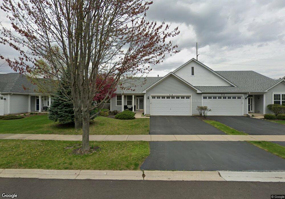
715 Bellevue Cir Oswego, IL 60543
North Oswego NeighborhoodEstimated Value: $268,365 - $302,000
2
Beds
2
Baths
1,296
Sq Ft
$224/Sq Ft
Est. Value
About This Home
This home is located at 715 Bellevue Cir, Oswego, IL 60543 and is currently estimated at $290,841, approximately $224 per square foot. 715 Bellevue Cir is a home located in Kendall County with nearby schools including Churchill Elementary School, Plank Junior High School, and Oswego East High School.
Ownership History
Date
Name
Owned For
Owner Type
Purchase Details
Closed on
Jan 14, 2026
Sold by
Pejskar Karianne and Stephen G Utrosa Declaration Of Trust
Bought by
Urban Kari Anne
Current Estimated Value
Home Financials for this Owner
Home Financials are based on the most recent Mortgage that was taken out on this home.
Original Mortgage
$132,156
Outstanding Balance
$132,037
Interest Rate
6.5%
Mortgage Type
New Conventional
Estimated Equity
$158,804
Purchase Details
Closed on
Jan 28, 2011
Sold by
Utrosa Stephen
Bought by
Utrosa Stephen G
Purchase Details
Closed on
Apr 12, 2007
Sold by
Hovstone Properties Illinois Llc
Bought by
Utrosa Stephen and Utrosa Jean
Home Financials for this Owner
Home Financials are based on the most recent Mortgage that was taken out on this home.
Original Mortgage
$164,003
Interest Rate
6.19%
Mortgage Type
Purchase Money Mortgage
Create a Home Valuation Report for This Property
The Home Valuation Report is an in-depth analysis detailing your home's value as well as a comparison with similar homes in the area
Home Values in the Area
Average Home Value in this Area
Purchase History
| Date | Buyer | Sale Price | Title Company |
|---|---|---|---|
| Urban Kari Anne | -- | Liberty Title | |
| Utrosa Stephen G | -- | None Available | |
| Utrosa Stephen | $173,000 | Chicago Title Insurance Co |
Source: Public Records
Mortgage History
| Date | Status | Borrower | Loan Amount |
|---|---|---|---|
| Open | Urban Kari Anne | $132,156 | |
| Previous Owner | Utrosa Stephen | $164,003 |
Source: Public Records
Tax History
| Year | Tax Paid | Tax Assessment Tax Assessment Total Assessment is a certain percentage of the fair market value that is determined by local assessors to be the total taxable value of land and additions on the property. | Land | Improvement |
|---|---|---|---|---|
| 2024 | $5,973 | $74,230 | $11,686 | $62,544 |
| 2023 | $5,299 | $64,548 | $10,162 | $54,386 |
| 2022 | $5,299 | $58,680 | $9,238 | $49,442 |
| 2021 | $5,402 | $57,738 | $9,090 | $48,648 |
| 2020 | $5,402 | $57,166 | $9,000 | $48,166 |
| 2019 | $5,487 | $57,166 | $9,000 | $48,166 |
| 2018 | $4,800 | $49,368 | $13,624 | $35,744 |
| 2017 | $4,665 | $45,501 | $12,557 | $32,944 |
| 2016 | $2,243 | $43,129 | $11,902 | $31,227 |
| 2015 | $4,524 | $41,470 | $11,444 | $30,026 |
| 2014 | -- | $39,875 | $11,004 | $28,871 |
| 2013 | -- | $40,278 | $11,115 | $29,163 |
Source: Public Records
Map
Nearby Homes
- 820 Bellevue Cir
- 0000 Fifth St
- 786 Bohannon Cir
- 790 Bohannon Cir
- 303 Springbrook Trail S Unit 1
- 309 Springbrook Trail S
- 121 Preakness Dr
- 420 Raintree Dr
- 410 Manchester Rd
- 700 N Sparkle Ct
- 628 Ebony Dr
- 112 Waterbury Cir
- 651 Henry Ln
- 810 Georgetown Dr
- 473 Dancer Ln Unit 473-D
- 49 Waterbury Cir
- 2071 Wiesbrook Dr
- 380 Risen Star Ln
- 57 Seton Creek Dr
- 611 Paris Ave
- 713 Bellevue Cir
- 713 Bellevue Cir Unit 2
- 715 Bellevue Cir Unit 1
- 715 Bellevue Cir Unit 2
- 717 Bellevue Cir
- 709 Bellevue Cir
- 719 Bellevue Cir
- 711 Bellevue Cir
- 721 Bellevue Cir
- 714 Bellevue Cir
- 714 Bellevue Cir Unit 2
- 712 Bellevue Cir
- 716 Bellevue Cir
- 710 Bellevue Cir
- 718 Bellevue Cir
- 718 Bellevue Cir Unit 2
- 707 Bellevue Cir
- 723 Bellevue Cir
- 705 Bellevue Cir
- 706 Bellevue Cir
Your Personal Tour Guide
Ask me questions while you tour the home.