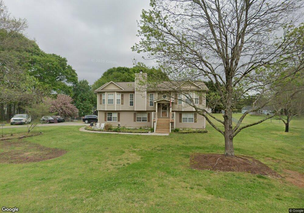
715 Cliffside Dr Bethlehem, GA 30620
Estimated Value: $355,050 - $408,000
3
Beds
3
Baths
2,355
Sq Ft
$159/Sq Ft
Est. Value
About This Home
This home is located at 715 Cliffside Dr, Bethlehem, GA 30620 and is currently estimated at $375,513, approximately $159 per square foot. 715 Cliffside Dr is a home located in Barrow County with nearby schools including Yargo Elementary School, Haymon-Morris Middle School, and Apalachee High School.
Ownership History
Date
Name
Owned For
Owner Type
Purchase Details
Closed on
Apr 6, 2011
Sold by
Dale Eric and Dale Laurie
Bought by
Dale Eric
Current Estimated Value
Purchase Details
Closed on
Mar 21, 1994
Sold by
Baber Kyle L
Bought by
Dale Eric Laurie
Home Financials for this Owner
Home Financials are based on the most recent Mortgage that was taken out on this home.
Original Mortgage
$89,146
Interest Rate
7.1%
Mortgage Type
FHA
Create a Home Valuation Report for This Property
The Home Valuation Report is an in-depth analysis detailing your home's value as well as a comparison with similar homes in the area
Home Values in the Area
Average Home Value in this Area
Purchase History
| Date | Buyer | Sale Price | Title Company |
|---|---|---|---|
| Dale Eric | -- | -- | |
| Dale Eric Laurie | $89,900 | -- |
Source: Public Records
Mortgage History
| Date | Status | Borrower | Loan Amount |
|---|---|---|---|
| Previous Owner | Dale Eric Laurie | $89,146 |
Source: Public Records
Tax History
| Year | Tax Paid | Tax Assessment Tax Assessment Total Assessment is a certain percentage of the fair market value that is determined by local assessors to be the total taxable value of land and additions on the property. | Land | Improvement |
|---|---|---|---|---|
| 2025 | $2,592 | $111,208 | $22,000 | $89,208 |
| 2024 | $2,630 | $108,616 | $22,000 | $86,616 |
| 2023 | $1,838 | $93,097 | $20,400 | $72,697 |
| 2022 | $2,334 | $83,869 | $20,400 | $63,469 |
| 2021 | $2,057 | $70,229 | $16,000 | $54,229 |
| 2020 | $2,057 | $70,229 | $16,000 | $54,229 |
| 2019 | $2,093 | $70,229 | $16,000 | $54,229 |
| 2018 | $1,773 | $60,499 | $13,200 | $47,299 |
| 2017 | $1,456 | $50,008 | $13,200 | $36,808 |
| 2016 | $1,381 | $48,652 | $13,200 | $35,452 |
| 2015 | $1,401 | $49,082 | $13,200 | $35,882 |
| 2014 | $1,222 | $42,779 | $6,468 | $36,311 |
| 2013 | -- | $40,993 | $6,468 | $34,525 |
Source: Public Records
Map
Nearby Homes
- 1256 Loganville Hwy
- 1129 Loganville Hwy
- 732 Ridgeland Rd
- 1309 Tom Miller Rd
- 1111 Otis Dr
- 209 Angie Way
- 1202 Benton Ct
- 611 Mcdowell Ln
- 631 Saddle Ridge Dr
- 923 Downing Dr
- 253 Meadows Dr
- 907 Downing Dr
- 286 Meadows Dr
- 308 Meadows Dr
- 73 Silverleaf Trail
- 85 Silverleaf Trail
- 78 Silverleaf Trail
- 64 Silverleaf Trail
- 226 Silverleaf Trail
- 1562 Pointe South Cir
- 713 Cliffside Dr
- 712 Cliffside Dr
- 716 Cliffside Dr
- 716 Cliffside Dr Unit 8
- 608 Bridle Creek Dr
- 705 Ridgeland Rd
- 610 Bridle Creek Dr
- 703 Ridgeland Rd
- 709 Ridgeland Rd
- 612 Bridle Creek Dr
- 714 Cliffside Dr
- 1169 Loganville Hwy
- 1161 Loganville Hwy
- 1171 Loganville Hwy
- 614 Bridle Creek Dr
- 713 Ridgeland Rd
- 701 Ridgeland Rd
- 616 Bridle Creek Dr
- 609 Bridle Creek Dr
- 607 Bridle Creek Dr
Your Personal Tour Guide
Ask me questions while you tour the home.