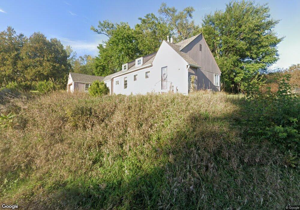
715 Mckenzie Ave Council Bluffs, IA 51503
McKenzie Avenue NeighborhoodEstimated Value: $232,548 - $260,000
3
Beds
1
Bath
1,369
Sq Ft
$181/Sq Ft
Est. Value
About This Home
This home is located at 715 Mckenzie Ave, Council Bluffs, IA 51503 and is currently estimated at $247,637, approximately $180 per square foot. 715 Mckenzie Ave is a home located in Pottawattamie County with nearby schools including College View Elementary School, Gerald W. Kirn Middle School, and Abraham Lincoln High School.
Ownership History
Date
Name
Owned For
Owner Type
Purchase Details
Closed on
Nov 6, 2008
Sold by
Secretary Of Veterans Affairs
Bought by
Morris Jo A
Current Estimated Value
Home Financials for this Owner
Home Financials are based on the most recent Mortgage that was taken out on this home.
Original Mortgage
$70,713
Outstanding Balance
$47,326
Interest Rate
6.48%
Mortgage Type
Purchase Money Mortgage
Estimated Equity
$200,311
Purchase Details
Closed on
Jun 24, 2008
Sold by
Doebelin Steven J and Doebelin Roxann L
Bought by
Countrywide Home Loans Inc
Create a Home Valuation Report for This Property
The Home Valuation Report is an in-depth analysis detailing your home's value as well as a comparison with similar homes in the area
Home Values in the Area
Average Home Value in this Area
Purchase History
| Date | Buyer | Sale Price | Title Company |
|---|---|---|---|
| Morris Jo A | $72,900 | None Available | |
| Countrywide Home Loans Inc | -- | None Available |
Source: Public Records
Mortgage History
| Date | Status | Borrower | Loan Amount |
|---|---|---|---|
| Open | Morris Jo A | $70,713 |
Source: Public Records
Tax History Compared to Growth
Tax History
| Year | Tax Paid | Tax Assessment Tax Assessment Total Assessment is a certain percentage of the fair market value that is determined by local assessors to be the total taxable value of land and additions on the property. | Land | Improvement |
|---|---|---|---|---|
| 2025 | $3,636 | $230,000 | $70,000 | $160,000 |
| 2024 | $3,636 | $190,800 | $60,800 | $130,000 |
| 2023 | $3,596 | $190,800 | $60,800 | $130,000 |
| 2022 | $3,260 | $147,900 | $46,600 | $101,300 |
| 2021 | $4,999 | $147,900 | $46,600 | $101,300 |
| 2020 | $2,964 | $147,900 | $46,600 | $101,300 |
| 2019 | $3,074 | $128,100 | $26,800 | $101,300 |
| 2018 | $3,012 | $128,100 | $26,800 | $101,300 |
| 2017 | $2,862 | $120,772 | $26,782 | $93,990 |
| 2015 | $2,794 | $120,772 | $26,782 | $93,990 |
| 2014 | $2,798 | $120,772 | $26,782 | $93,990 |
Source: Public Records
Map
Nearby Homes
- 944 Mckenzie Ave
- 1011 Simms Ave
- 638 Simms Ave
- 627 Spencer Ave
- 500 Spencer Ave
- 407 Spencer Ave
- 440 Simms Ave
- 401 Spencer Ave
- 415 Midland Dr
- 162 N Linden Ave
- 155 S Linden Ave
- 212 Highland Dr
- 242 Elmwood Dr
- 1.12 AC Railroad Ave & Hwy 6
- 116 Spencer Ave
- 2231 N Broadway
- 118 Euclid Ave
- 222 Locust Lodge Ave
- 1553 N Broadway
- 18267 Northline Dr
- 717 Mckenzie Ave
- 110 Mckenzie Cir
- 108 Mckenzie Cir
- 112 Mckenzie Cir
- 114 Mckenzie Cir
- 116 Mckenzie Cir
- 118 Mckenzie Cir
- 728 Mckenzie Ave
- 724 Mckenzie Ave
- 120 Mckenzie Cir
- 732 Mckenzie Ave
- 104 Mckenzie Cir
- 122 Mckenzie Cir
- 720 Mckenzie Ave
- 102 Mckenzie Cir
- 124 Mckenzie Cir
- 801 Mckenzie Ave
- 804 Mckenzie Ave
- 100 Mckenzie Cir
- 100 Mckenzie Cir