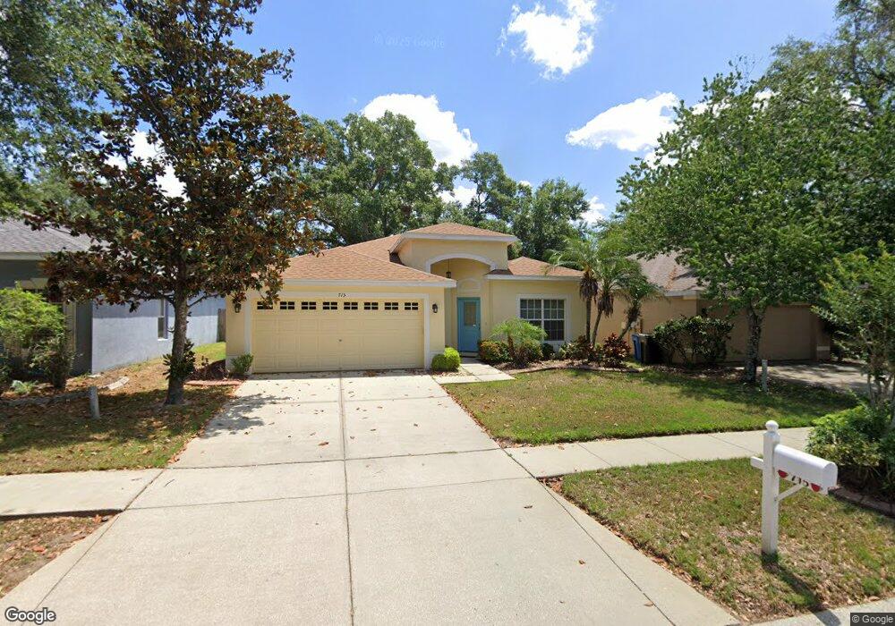
715 Parsons Pointe St Unit B Seffner, FL 33584
Estimated Value: $338,230 - $366,000
3
Beds
2
Baths
1,705
Sq Ft
$207/Sq Ft
Est. Value
About This Home
This home is located at 715 Parsons Pointe St Unit B, Seffner, FL 33584 and is currently estimated at $352,808, approximately $206 per square foot. 715 Parsons Pointe St Unit B is a home located in Hillsborough County with nearby schools including Lopez Elementary School, Burnett Middle School, and Armwood High School.
Ownership History
Date
Name
Owned For
Owner Type
Purchase Details
Closed on
Aug 29, 2003
Sold by
The Ryland Group Inc
Bought by
Brown Stephen J and Brown Patricia J
Current Estimated Value
Home Financials for this Owner
Home Financials are based on the most recent Mortgage that was taken out on this home.
Original Mortgage
$117,300
Outstanding Balance
$52,795
Interest Rate
6.28%
Mortgage Type
Unknown
Estimated Equity
$300,013
Create a Home Valuation Report for This Property
The Home Valuation Report is an in-depth analysis detailing your home's value as well as a comparison with similar homes in the area
Home Values in the Area
Average Home Value in this Area
Purchase History
| Date | Buyer | Sale Price | Title Company |
|---|---|---|---|
| Brown Stephen J | $146,700 | Ryland Title Company |
Source: Public Records
Mortgage History
| Date | Status | Borrower | Loan Amount |
|---|---|---|---|
| Open | Brown Stephen J | $117,300 |
Source: Public Records
Tax History
| Year | Tax Paid | Tax Assessment Tax Assessment Total Assessment is a certain percentage of the fair market value that is determined by local assessors to be the total taxable value of land and additions on the property. | Land | Improvement |
|---|---|---|---|---|
| 2025 | $1,898 | $117,603 | -- | -- |
| 2024 | $1,898 | $114,289 | -- | -- |
| 2023 | $1,804 | $110,960 | $0 | $0 |
| 2022 | $1,659 | $107,728 | $0 | $0 |
| 2021 | $1,933 | $104,590 | $0 | $0 |
| 2020 | $1,854 | $103,146 | $0 | $0 |
| 2019 | $1,770 | $100,827 | $0 | $0 |
| 2018 | $1,719 | $98,947 | $0 | $0 |
| 2017 | $1,689 | $143,958 | $0 | $0 |
| 2016 | $1,654 | $94,919 | $0 | $0 |
| 2015 | $1,667 | $94,259 | $0 | $0 |
| 2014 | $1,643 | $93,511 | $0 | $0 |
| 2013 | -- | $92,129 | $0 | $0 |
Source: Public Records
Map
Nearby Homes
- 503 de Resine Carre St Unit 503DR
- 763 Star Pointe Dr
- 634 Auxerre Cir Unit 634AC
- 605 de Resine Carre St Unit 605DR
- 131 Elina Sky Dr
- 603 U S 92
- 502 Calhoun Ave
- 920 Brinwood Dr
- 801 N Kingsway Rd
- 762 Parsons Mooring Ct
- 719 Vineyard Reserve Ct
- 821 Walnut Dr
- 106 Winston Manor Cir
- 788 Parsons Mooring Ct
- 215 Fern Gulley Dr
- 403 Thicket Crest Rd
- 508 Running Horse Rd
- 408 Thicket Crest Rd
- 106 Phillips Dr
- 304 Apache Ln
- 717 Parsons Pointe St
- 713 Parsons Pointe St
- 719 Parsons Pointe St
- 711 Parsons Pointe St Unit B
- 721 Parsons Pointe St
- 709 Parsons Pointe St Unit B
- 716 Parsons Pointe St Unit B
- 714 Parsons Pointe St
- 718 Parsons Pointe St Unit B
- 712 Parsons Pointe St
- 503 de Resine Carre St Unit 503DR
- 720 Parsons Pointe St
- 723 Parsons Pointe St
- 707 Parsons Pointe St Unit B
- 722 Parsons Pointe St
- 710 Parsons Pointe St Unit B
- 725 Parsons Pointe St Unit B
- 705 Parsons Pointe St
- 710 Star Pointe Dr Unit B
- 712 Star Pointe Dr Unit B
Your Personal Tour Guide
Ask me questions while you tour the home.