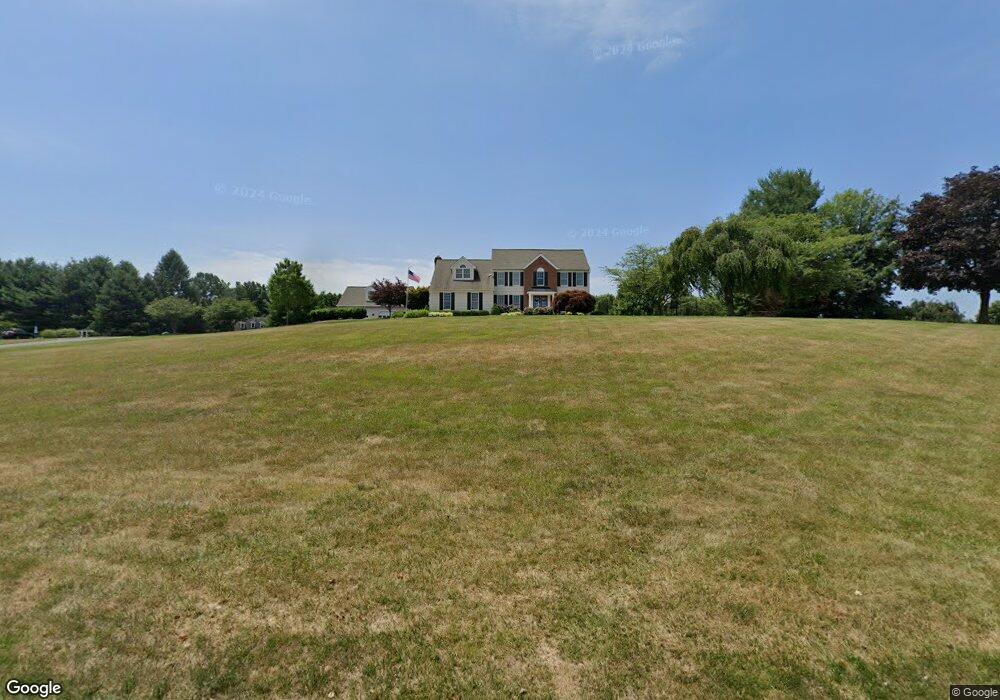
715 Pheasant Dr Forest Hill, MD 21050
Estimated Value: $662,000 - $893,000
Studio
3
Baths
3,006
Sq Ft
$258/Sq Ft
Est. Value
About This Home
This home is located at 715 Pheasant Dr, Forest Hill, MD 21050 and is currently estimated at $774,639, approximately $257 per square foot. 715 Pheasant Dr is a home located in Harford County with nearby schools including Forest Hill Elementary School, North Harford Middle School, and North Harford High School.
Ownership History
Date
Name
Owned For
Owner Type
Purchase Details
Closed on
May 5, 2020
Sold by
Russo William J and Russo Terry L
Bought by
Russo William J and Russo Terry L
Current Estimated Value
Purchase Details
Closed on
Jan 22, 1991
Sold by
Diversified Homes Master
Bought by
Russo William J and Russo Terry L
Home Financials for this Owner
Home Financials are based on the most recent Mortgage that was taken out on this home.
Original Mortgage
$31,875
Interest Rate
9.75%
Purchase Details
Closed on
Jan 10, 1989
Sold by
Meadowlark Corporation
Bought by
Diversified Homes Master
Purchase Details
Closed on
Aug 25, 1988
Sold by
Edwards Lester E
Bought by
Meadowlark Corporation
Create a Home Valuation Report for This Property
The Home Valuation Report is an in-depth analysis detailing your home's value as well as a comparison with similar homes in the area
Purchase History
We collect this data history from publicly available records. To have your information removed, we recommend requesting removal directly through your county’s website.
| Date | Buyer | Sale Price | Title Company |
|---|---|---|---|
| Russo William J | -- | None Available | |
| Russo William J | $42,500 | -- | |
| Diversified Homes Master | $70,000 | -- | |
| Meadowlark Corporation | $750,000 | -- |
Source: Public Records
Mortgage History
We collect this data history from publicly available records. To have your information removed, we recommend requesting removal directly through your county’s website.
| Date | Status | Borrower | Loan Amount |
|---|---|---|---|
| Closed | Russo William J | $31,875 |
Source: Public Records
Tax History
| Year | Tax Paid | Tax Assessment Tax Assessment Total Assessment is a certain percentage of the fair market value that is determined by local assessors to be the total taxable value of land and additions on the property. | Land | Improvement |
|---|---|---|---|---|
| 2025 | $6,234 | $613,800 | $137,100 | $476,700 |
| 2024 | $6,234 | $580,000 | $0 | $0 |
| 2023 | $5,933 | $546,200 | $0 | $0 |
| 2022 | $5,645 | $512,400 | $137,100 | $375,300 |
| 2021 | $5,648 | $498,333 | $0 | $0 |
| 2020 | $5,648 | $484,267 | $0 | $0 |
| 2019 | $5,486 | $470,200 | $142,100 | $328,100 |
| 2018 | $5,317 | $459,733 | $0 | $0 |
| 2017 | $5,198 | $470,200 | $0 | $0 |
| 2016 | -- | $438,800 | $0 | $0 |
| 2015 | $5,651 | $438,800 | $0 | $0 |
| 2014 | $5,651 | $438,800 | $0 | $0 |
Source: Public Records
Map
Nearby Homes
- 337 Chestnut Hill Rd
- 208 Christopher Rd
- 2433 Maxa Meadows Ln
- 2406 Nora Ct
- 2430 Maxa Meadows Ln
- 2424 Rocks Rd
- 2322 Rock Spring Rd
- 2310 Rock Spring Rd
- 2408 Dixie Ln
- 2229-A Ady Rd
- 2215 Ady Rd
- 1983 Cullen Way
- 2220 Conowingo Rd
- 2005 Pointview Cir
- 229 Rachel Cir
- 2188 Historic Dr
- 2197 Cantley Ct
- 2178 Sewanee Dr
- 2045 Mardic Dr
- 808 Chance Ct
- 713 Pheasant Dr
- 717 Pheasant Dr
- 721 Pheasant Dr
- 722 Pheasant Dr
- 720 Pheasant Dr
- 719 Pheasant Dr
- 707 Pheasant Dr
- 711 Pheasant Dr
- 724 Pheasant Dr
- 710 Pheasant Dr
- 709 Pheasant Dr
- 708 Pheasant Dr
- 341 Chestnut Hill Rd
- 405 Chestnut Hill Rd
- 718 Pheasant Dr
- 332 Chestnut Hill Rd
- 706 Pheasant Dr
- 716 Pheasant Dr
- 420 Chestnut Hill Rd
- 801 Kensington Farm Ct
Your Personal Tour Guide
Ask me questions while you tour the home.