Estimated Value: $112,000 - $167,000
Studio
1
Bath
1,310
Sq Ft
$104/Sq Ft
Est. Value
About This Home
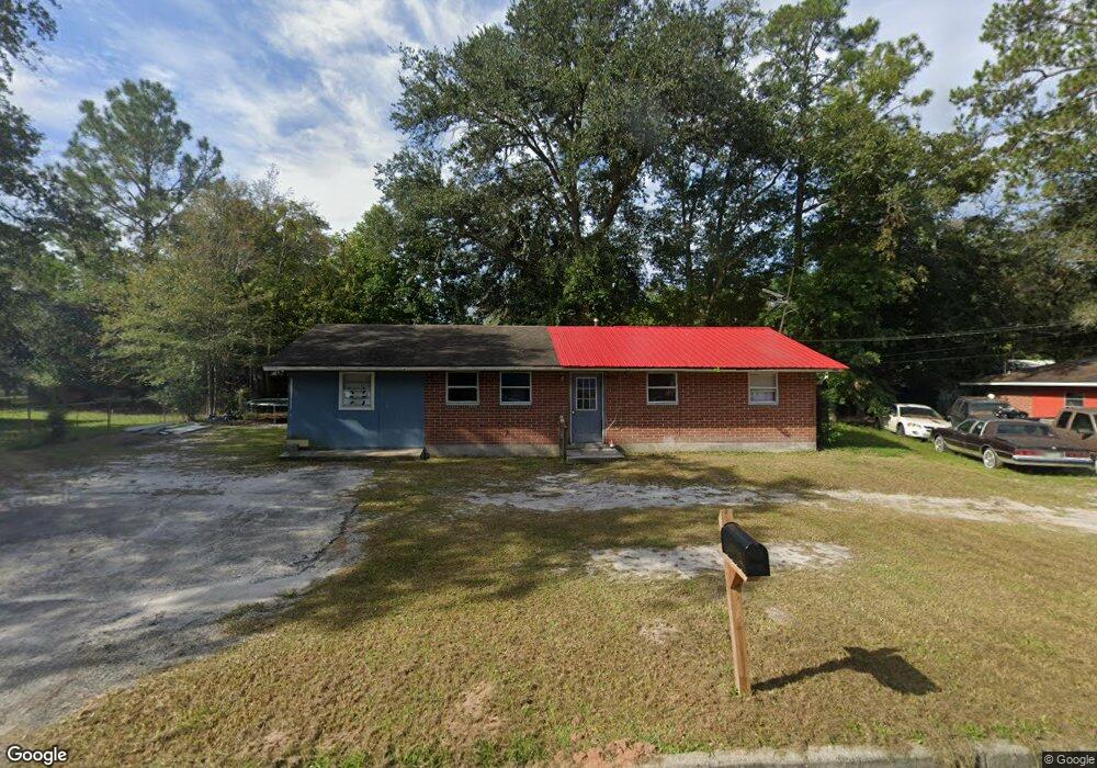
This home is located at 715 Sutton St, Jesup, GA 31545 and is currently estimated at $135,936, approximately $103 per square foot. 715 Sutton St is a home located in Wayne County with nearby schools including Martha Rawls Smith Elementary School, Martha Puckett Middle School, and Wayne County High School.
Ownership History
Date
Name
Owned For
Owner Type
Purchase Details
Closed on
Oct 6, 2023
Sold by
Rooks Bertha
Bought by
Rooks Arthur and Veale Nancy
Current Estimated Value
Purchase Details
Closed on
Jul 29, 2022
Sold by
Rooks Arthur
Bought by
Rooks Arthur and Veale Nancy
Purchase Details
Closed on
Sep 11, 2015
Sold by
Rooks Arthur and Rooks Bertha
Bought by
Rooks Bertha
Purchase Details
Closed on
Jun 30, 2015
Sold by
Rooks Arthur
Bought by
Rooks Bertha
Purchase Details
Closed on
Feb 1, 1989
Sold by
Secretary Of Housing
Bought by
Rooks Arthur and Rooks Bertha
Purchase Details
Closed on
Apr 1, 1988
Bought by
Secretary Of Housing
Purchase Details
Closed on
Mar 1, 1970
Purchase Details
Closed on
Sep 1, 1969
Create a Home Valuation Report for This Property
The Home Valuation Report is an in-depth analysis detailing your home's value as well as a comparison with similar homes in the area
Purchase History
| Date | Buyer | Sale Price | Title Company |
|---|---|---|---|
| Rooks Arthur | -- | -- | |
| Veale Nancy | -- | -- | |
| Veale Nancy | -- | -- | |
| Veale Nancy | -- | -- | |
| Rooks Arthur | -- | -- | |
| Rooks Bertha | -- | -- | |
| Rooks Bertha | -- | -- | |
| Rooks Arthur | $9,900 | -- | |
| Secretary Of Housing | $10,300 | -- | |
| -- | -- | -- | |
| -- | -- | -- |
Source: Public Records
Tax History
| Year | Tax Paid | Tax Assessment Tax Assessment Total Assessment is a certain percentage of the fair market value that is determined by local assessors to be the total taxable value of land and additions on the property. | Land | Improvement |
|---|---|---|---|---|
| 2025 | $1,104 | $34,982 | $1,163 | $33,819 |
| 2024 | $1,035 | $33,839 | $1,163 | $32,676 |
| 2023 | $744 | $21,020 | $1,152 | $19,868 |
| 2022 | $662 | $21,020 | $1,152 | $19,868 |
| 2021 | $709 | $21,020 | $1,152 | $19,868 |
| 2020 | $733 | $21,020 | $1,152 | $19,868 |
| 2019 | $755 | $21,020 | $1,152 | $19,868 |
| 2018 | $72 | $21,020 | $1,152 | $19,868 |
| 2017 | $650 | $21,020 | $1,152 | $19,868 |
| 2016 | $629 | $21,020 | $1,152 | $19,868 |
| 2014 | $631 | $21,020 | $1,152 | $19,868 |
| 2013 | -- | $21,020 | $1,152 | $19,868 |
Source: Public Records
Map
Nearby Homes
- 618 Robinson Dr
- 611 N Fourth St
- 0 N Fourth St Unit 25773373
- 0 N 3rd Ln
- 356 N 4th St
- 356 N Fourth St
- 344 N Fourth St
- 0 N 4th St Unit 1660016
- 0 N 4th St Unit 166837
- 0 N 4th St Unit 10697567
- 110 E Pine St
- 447 NE Broad St
- 197 NW Broad St
- 498 NE Broad St
- 169 Pine Ridge Rd
- 104 Mangrove Ct
- 108 Mangrove Ct
- 102 Mangrove Ct
- 110 Mangrove Ct
- 000 Hamburg St
- 721 Sutton St
- 707 Sutton St
- 707 Sutton St
- 730 W Poplar St
- 716 Sutton St
- 734 W Poplar St
- 732 Sutton St
- 733 Sutton St
- 706 W Poplar St
- 738 Sutton St
- 719 W Poplar St
- 717 W Poplar St
- 701 Sutton St
- 715 W Poplar St
- 704 Sutton St
- 723 W Poplar St
- 740 W Poplar St
- 737 W Poplar St
- 724 Williams St
- 716 Williams St
Your Personal Tour Guide
Ask me questions while you tour the home.