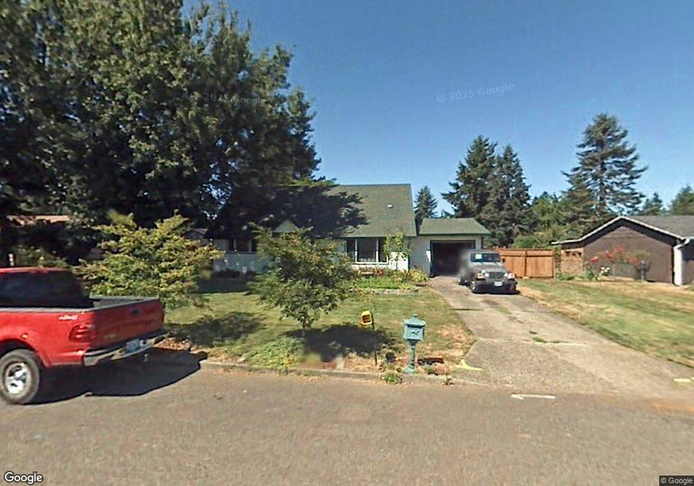
715 SW 15th St Troutdale, OR 97060
Sunrise NeighborhoodEstimated Value: $439,588 - $480,000
4
Beds
1
Bath
1,488
Sq Ft
$311/Sq Ft
Est. Value
About This Home
This home is located at 715 SW 15th St, Troutdale, OR 97060 and is currently estimated at $462,897, approximately $311 per square foot. 715 SW 15th St is a home located in Multnomah County with nearby schools including Troutdale Elementary School, Walt Morey Middle School, and Reynolds High School.
Ownership History
Date
Name
Owned For
Owner Type
Purchase Details
Closed on
Aug 6, 1998
Sold by
Mellon Properties
Bought by
Penfold Timothy W and Penfold Cindy L
Current Estimated Value
Home Financials for this Owner
Home Financials are based on the most recent Mortgage that was taken out on this home.
Original Mortgage
$132,158
Outstanding Balance
$26,881
Interest Rate
6.93%
Mortgage Type
FHA
Estimated Equity
$436,016
Purchase Details
Closed on
Apr 20, 1998
Sold by
Mellon Mtg Company
Bought by
Mellon Properties
Purchase Details
Closed on
Nov 13, 1997
Sold by
Hall Monty R
Bought by
Mellon Mtg Company
Create a Home Valuation Report for This Property
The Home Valuation Report is an in-depth analysis detailing your home's value as well as a comparison with similar homes in the area
Home Values in the Area
Average Home Value in this Area
Purchase History
| Date | Buyer | Sale Price | Title Company |
|---|---|---|---|
| Penfold Timothy W | $134,000 | First American Title Ins Co | |
| Mellon Properties | -- | Transnation Title Insurance | |
| Mellon Mtg Company | $105,084 | -- |
Source: Public Records
Mortgage History
| Date | Status | Borrower | Loan Amount |
|---|---|---|---|
| Open | Penfold Timothy W | $132,158 |
Source: Public Records
Tax History Compared to Growth
Tax History
| Year | Tax Paid | Tax Assessment Tax Assessment Total Assessment is a certain percentage of the fair market value that is determined by local assessors to be the total taxable value of land and additions on the property. | Land | Improvement |
|---|---|---|---|---|
| 2025 | $3,792 | $204,490 | -- | -- |
| 2024 | $3,585 | $198,540 | -- | -- |
| 2023 | $3,491 | $192,760 | $0 | $0 |
| 2022 | $3,408 | $187,150 | $0 | $0 |
| 2021 | $3,328 | $181,700 | $0 | $0 |
| 2020 | $3,111 | $176,410 | $0 | $0 |
| 2019 | $2,987 | $171,280 | $0 | $0 |
| 2018 | $2,967 | $166,300 | $0 | $0 |
| 2017 | $2,960 | $161,460 | $0 | $0 |
| 2016 | $2,862 | $156,760 | $0 | $0 |
| 2015 | $2,791 | $152,200 | $0 | $0 |
| 2014 | $2,714 | $147,770 | $0 | $0 |
Source: Public Records
Map
Nearby Homes
- 839 SW Grant Way
- 821 SW 14th St
- 1226 SW Hensley Rd
- 809 SW Crestview Way
- 1212 SW Edgefield Ave
- 735 SW Sunset Way
- 2020 SW Laura Ct
- 1106 SW Dottie Ct
- 665 SW 24th St
- 1021 SW 24th St
- 1427 SW 24th St
- 1392 SW Berryessa Place
- 2326 SW Mcginnis Ave
- 1953 SW Northstar Way
- 1018 SW Halsey St
- 2154 SE Sandy Ct
- 988 SW 2nd Way
- 176 SW Hewitt Ave
- 2511 S Troutdale Rd
- 2846 SW Faith Ct
- 725 SW 15th St
- 633 SW 15th St
- 636 SW 14th St
- 735 SW 15th St
- 704 SW 14th St
- 704 SW Do Not Dis St
- 722 SW 14th St
- 704 SW 15th St
- 732 SW 14th St
- 636 SW 15th St
- 1475 SW Hensley Rd
- 722 SW 15th St
- 1487 SW Hensley Rd
- 624 SW 14th St
- 624 SW 15th St
- 732 SW 15th St
- 801 SW 15th St
- 742 SW 14th St
- 606 SW 14th St
- 606 SW 15th St