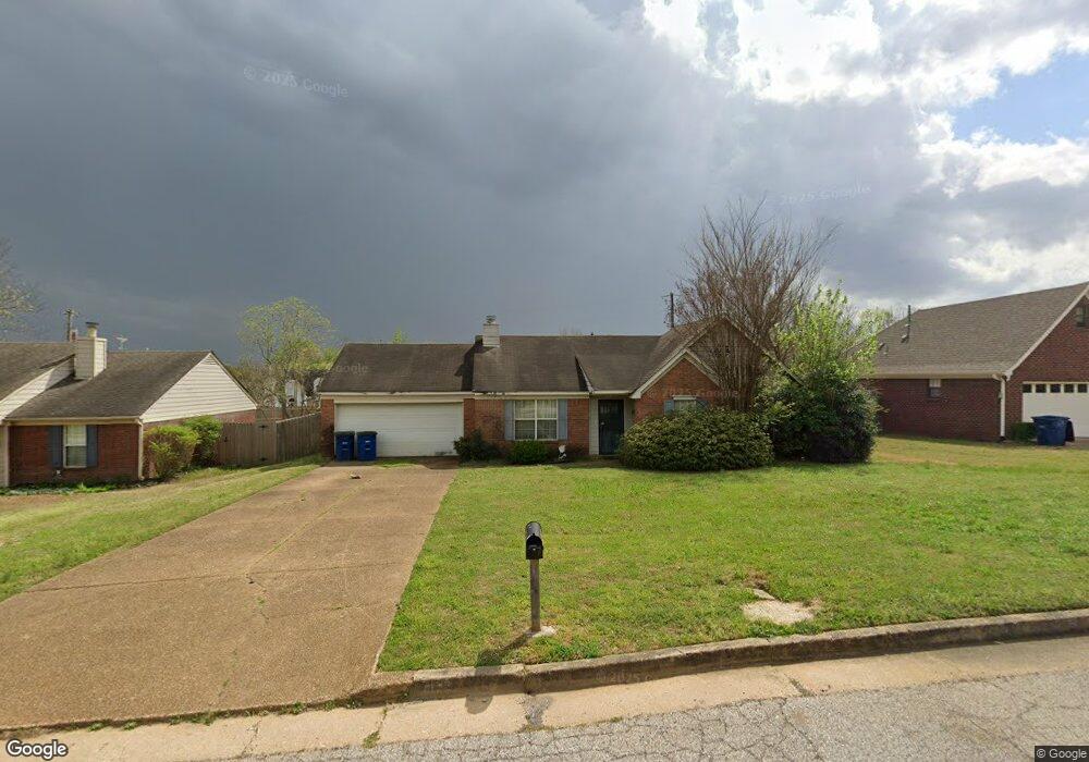
7153 Maplewood Rd Olive Branch, MS 38654
Estimated Value: $229,378 - $263,000
3
Beds
--
Bath
1,592
Sq Ft
$153/Sq Ft
Est. Value
About This Home
This home is located at 7153 Maplewood Rd, Olive Branch, MS 38654 and is currently estimated at $243,595, approximately $153 per square foot. 7153 Maplewood Rd is a home located in DeSoto County with nearby schools including Pleasant Hill Elementary School, DeSoto Central Middle School, and DeSoto Central High School.
Ownership History
Date
Name
Owned For
Owner Type
Purchase Details
Closed on
Aug 25, 2025
Sold by
Memphis Investment Properties Iv Llc
Bought by
Shah Munjal and Khatri Hiral Pravin
Current Estimated Value
Home Financials for this Owner
Home Financials are based on the most recent Mortgage that was taken out on this home.
Original Mortgage
$177,375
Outstanding Balance
$176,759
Interest Rate
6.75%
Mortgage Type
New Conventional
Estimated Equity
$66,836
Purchase Details
Closed on
May 15, 2025
Sold by
Mayer Regenia Nell and Jackson James Michael
Bought by
Memphis Investment Properties Iv Llc
Home Financials for this Owner
Home Financials are based on the most recent Mortgage that was taken out on this home.
Original Mortgage
$10,085,000
Interest Rate
6.64%
Mortgage Type
New Conventional
Create a Home Valuation Report for This Property
The Home Valuation Report is an in-depth analysis detailing your home's value as well as a comparison with similar homes in the area
Home Values in the Area
Average Home Value in this Area
Purchase History
| Date | Buyer | Sale Price | Title Company |
|---|---|---|---|
| Shah Munjal | -- | Southern States Title Llc | |
| Shah Munjal | -- | Southern States Title Llc | |
| Memphis Investment Properties Iv Llc | -- | None Listed On Document | |
| Memphis Investment Properties Iv Llc | -- | None Listed On Document |
Source: Public Records
Mortgage History
| Date | Status | Borrower | Loan Amount |
|---|---|---|---|
| Open | Shah Munjal | $177,375 | |
| Closed | Shah Munjal | $177,375 | |
| Previous Owner | Memphis Investment Properties Iv Llc | $10,085,000 |
Source: Public Records
Tax History
| Year | Tax Paid | Tax Assessment Tax Assessment Total Assessment is a certain percentage of the fair market value that is determined by local assessors to be the total taxable value of land and additions on the property. | Land | Improvement |
|---|---|---|---|---|
| 2025 | $254 | $9,692 | $2,500 | $7,192 |
| 2024 | $299 | $9,692 | $2,500 | $7,192 |
| 2023 | $299 | $9,692 | $0 | $0 |
| 2022 | $299 | $9,692 | $2,500 | $7,192 |
| 2021 | $299 | $9,692 | $2,500 | $7,192 |
| 2020 | $299 | $9,692 | $2,500 | $7,192 |
| 2019 | $299 | $9,692 | $2,500 | $7,192 |
| 2017 | $275 | $16,508 | $9,504 | $7,004 |
| 2016 | $275 | $9,504 | $2,500 | $7,004 |
| 2015 | $1,304 | $16,508 | $9,504 | $7,004 |
| 2014 | $276 | $9,509 | $0 | $0 |
| 2013 | $268 | $9,509 | $0 | $0 |
Source: Public Records
Map
Nearby Homes
- 7248 Kingcrest Rd
- 10190 May Flowers St
- 4777 Bolivar Trail N
- 10319 March Meadows Way
- 7235 Cedardale Rd
- 784 Arrow Cove
- 6934 Sunrise Loop W
- 6923 Silver Cloud Cove
- 0 S Hamilton Cir
- 6635 Renee Dr
- 7128 Apache Dr
- 6658 Indigo Lake Dr
- 6459 Cheyenne Dr
- 7501 Iron Loop
- 6363 Cheyenne Dr
- 6865 Blue Bird Ln
- 7402 Grandiflora Dr
- 6502 Timber Oaks Dr
- 6384 Acree Woods Dr
- 6394 Cody Cove
- 7139 Maplewood Rd
- 7185 Maplewood Rd
- 7127 Maplewood Rd
- 7125 Goodman Rd
- 7162 Maplewood Rd
- 7146 Maplewood Rd
- 7176 Maplewood Rd
- 7132 Maplewood Rd
- 7113 Maplewood Rd
- 7209 Maplewood Rd
- 7118 Maplewood Rd
- 7194 Maplewood Rd
- 7095 Maplewood Rd
- 7145 Goodman Rd
- 7102 Maplewood Rd
- 7145 Larkfield Rd
- 7161 Larkfield Rd
- 7131 Larkfield Rd
- 7212 Maplewood Rd
- 7179 Larkfield Rd