Estimated Value: $231,000 - $278,000
3
Beds
2
Baths
1,620
Sq Ft
$159/Sq Ft
Est. Value
About This Home
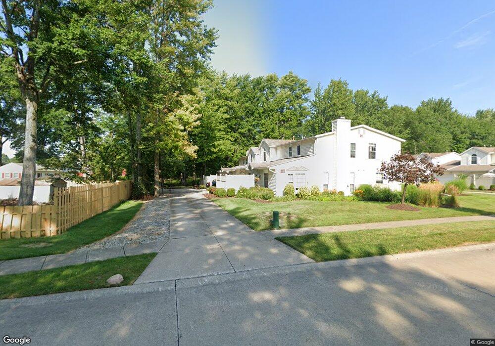
This home is located at 716 S Point Trail Unit C10, Berea, OH 44017 and is currently estimated at $258,042, approximately $159 per square foot. 716 S Point Trail Unit C10 is a home located in Cuyahoga County with nearby schools including Grindstone Elementary School, Berea-Midpark Middle School, and Berea-Midpark High School.
Ownership History
Date
Name
Owned For
Owner Type
Purchase Details
Closed on
Jul 5, 2000
Sold by
Wallings Jeffrey S
Bought by
Waple Sharon M
Current Estimated Value
Home Financials for this Owner
Home Financials are based on the most recent Mortgage that was taken out on this home.
Original Mortgage
$114,000
Outstanding Balance
$41,717
Interest Rate
8.55%
Estimated Equity
$216,325
Purchase Details
Closed on
Dec 2, 1996
Sold by
Coffee Thomas P
Bought by
Walling Jeffrey S
Home Financials for this Owner
Home Financials are based on the most recent Mortgage that was taken out on this home.
Original Mortgage
$106,000
Interest Rate
7.94%
Mortgage Type
Balloon
Purchase Details
Closed on
Jan 1, 1994
Bought by
Coffee Thomas P and S L
Create a Home Valuation Report for This Property
The Home Valuation Report is an in-depth analysis detailing your home's value as well as a comparison with similar homes in the area
Home Values in the Area
Average Home Value in this Area
Purchase History
| Date | Buyer | Sale Price | Title Company |
|---|---|---|---|
| Waple Sharon M | $144,000 | Executive Title Agency Corp | |
| Walling Jeffrey S | $106,000 | -- | |
| Coffee Thomas P | -- | -- |
Source: Public Records
Mortgage History
| Date | Status | Borrower | Loan Amount |
|---|---|---|---|
| Open | Waple Sharon M | $114,000 | |
| Previous Owner | Walling Jeffrey S | $106,000 |
Source: Public Records
Tax History Compared to Growth
Tax History
| Year | Tax Paid | Tax Assessment Tax Assessment Total Assessment is a certain percentage of the fair market value that is determined by local assessors to be the total taxable value of land and additions on the property. | Land | Improvement |
|---|---|---|---|---|
| 2024 | $4,741 | $82,005 | $7,945 | $74,060 |
| 2023 | $4,102 | $59,400 | $5,950 | $53,450 |
| 2022 | $5,831 | $59,400 | $5,950 | $53,450 |
| 2021 | $5,715 | $59,400 | $5,950 | $53,450 |
| 2020 | $5,130 | $47,150 | $4,730 | $42,420 |
| 2019 | $4,167 | $134,700 | $13,500 | $121,200 |
| 2018 | $3,823 | $47,150 | $4,730 | $42,420 |
| 2017 | $4,747 | $39,130 | $3,920 | $35,210 |
| 2016 | $3,866 | $39,130 | $3,920 | $35,210 |
| 2015 | $3,835 | $39,130 | $3,920 | $35,210 |
| 2014 | $3,835 | $45,500 | $4,550 | $40,950 |
Source: Public Records
Map
Nearby Homes
- 84 Sprague Rd
- 8627 Courtland Dr
- 104 Whitehall Dr
- 8036 Fair Rd
- 740 Fair St
- 243 Jananna Dr
- 9401 Pheasant Run Place
- 154 Best St
- 266 Jananna Dr
- 74 Aaron St
- 23 Hamilton St
- 8902 Lincolnshire Blvd
- 21292 Creekside Dr
- 585 Woodmere Dr
- 9829 Plum Brook Ln
- 458 Sprague Rd
- 255 Fairpark Dr
- 9598 Pebble Brook Ln
- 8746 Barton Dr
- 10353 Oak Branch Trail
- 714 S Point Trail Unit C12
- 720 S Point Trail Unit C9
- 718 S Point Trail Unit C11
- 706 S Point Trail Unit D-16
- 710 S Point Trail Unit D15
- 708 S Point Trail Unit D14
- 712 S Point Trail Unit D13
- 706 S Point Trail
- 636 S Point Trail S
- 49 Dorland Ave
- 55 Dorland Ave
- 713 S Point Trail Unit A4
- 715 S Point Trail Unit A2
- 717 S Point Trail Unit A3
- 719 S Point Trail Unit A1
- 39 Dorland Ave
- 69 Dorland Ave
- 705 S Point Trail Unit B8
- 711 S Point Trail
- 707 S Point Trail