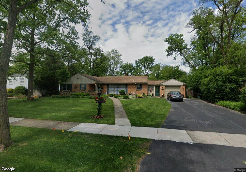
716 Sterling Ave Flossmoor, IL 60422
Estimated Value: $246,000 - $295,000
4
Beds
2
Baths
1,550
Sq Ft
$180/Sq Ft
Est. Value
About This Home
This home is located at 716 Sterling Ave, Flossmoor, IL 60422 and is currently estimated at $278,696, approximately $179 per square foot. 716 Sterling Ave is a home located in Cook County with nearby schools including Western Avenue Elementary School, Parker Junior High School, and Homewood-Flossmoor High School.
Ownership History
Date
Name
Owned For
Owner Type
Purchase Details
Closed on
Oct 30, 2000
Sold by
Thomas Myron and Thomas Ruth
Bought by
Gavin John P and Gavin Alicia L
Current Estimated Value
Home Financials for this Owner
Home Financials are based on the most recent Mortgage that was taken out on this home.
Original Mortgage
$85,000
Outstanding Balance
$29,639
Interest Rate
7.87%
Estimated Equity
$249,057
Create a Home Valuation Report for This Property
The Home Valuation Report is an in-depth analysis detailing your home's value as well as a comparison with similar homes in the area
Home Values in the Area
Average Home Value in this Area
Purchase History
| Date | Buyer | Sale Price | Title Company |
|---|---|---|---|
| Gavin John P | $125,000 | First American Title |
Source: Public Records
Mortgage History
| Date | Status | Borrower | Loan Amount |
|---|---|---|---|
| Open | Gavin John P | $85,000 |
Source: Public Records
Tax History
| Year | Tax Paid | Tax Assessment Tax Assessment Total Assessment is a certain percentage of the fair market value that is determined by local assessors to be the total taxable value of land and additions on the property. | Land | Improvement |
|---|---|---|---|---|
| 2025 | $9,230 | $23,413 | $9,680 | $13,733 |
| 2024 | $9,230 | $23,413 | $9,680 | $13,733 |
| 2023 | $5,873 | $25,000 | $9,680 | $15,320 |
| 2022 | $5,873 | $14,340 | $6,160 | $8,180 |
| 2021 | $5,932 | $14,339 | $6,160 | $8,179 |
| 2020 | $5,800 | $14,339 | $6,160 | $8,179 |
| 2019 | $5,795 | $14,183 | $5,720 | $8,463 |
| 2018 | $5,574 | $14,183 | $5,720 | $8,463 |
| 2017 | $5,748 | $14,664 | $5,720 | $8,944 |
| 2016 | $5,266 | $12,441 | $5,280 | $7,161 |
| 2015 | $5,225 | $12,441 | $5,280 | $7,161 |
| 2014 | $5,923 | $13,913 | $5,280 | $8,633 |
| 2013 | $7,107 | $17,503 | $5,280 | $12,223 |
Source: Public Records
Map
Nearby Homes
- 712 Gardner Rd
- 625 Perth Ave
- 2303 Hutchison Rd
- 625 Bruce Ave
- 18511 Argyle Ave
- 18646 Palmer Cir
- 18441 Stewart Ave
- 18509 Stedhall Rd
- 18537 Palmer Ave
- 18530 Stedhall Rd
- 2323 Clyde Terrace
- 18450 Stedhall Rd
- 18404 Perth Ave
- 18547 Lexington Ave
- 725 Braemar Rd
- 846 Park Dr
- 2622 Central Dr Unit 2N
- 2045 Downey Rd
- 2640 Central Dr Unit 1-N
- 18400 Cherry Creek Dr Unit 105
Your Personal Tour Guide
Ask me questions while you tour the home.