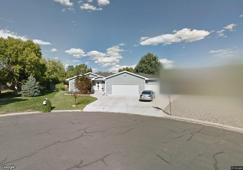
717 Beartooth Cir Laurel, MT 59044
Estimated Value: $436,000 - $562,992
4
Beds
3
Baths
4,216
Sq Ft
$120/Sq Ft
Est. Value
About This Home
This home is located at 717 Beartooth Cir, Laurel, MT 59044 and is currently estimated at $506,748, approximately $120 per square foot. 717 Beartooth Cir is a home located in Yellowstone County with nearby schools including West School, Fred W. Graff School, and Laurel Middle School.
Ownership History
Date
Name
Owned For
Owner Type
Purchase Details
Closed on
Jan 16, 2015
Sold by
Hart Sari Kaye
Bought by
Temporal Michael P and Temporal Vonda K
Current Estimated Value
Home Financials for this Owner
Home Financials are based on the most recent Mortgage that was taken out on this home.
Original Mortgage
$287,850
Outstanding Balance
$219,746
Interest Rate
3.75%
Mortgage Type
New Conventional
Estimated Equity
$287,002
Purchase Details
Closed on
Oct 3, 2008
Sold by
Fichtner Sari Hart
Bought by
Hart Sari Kaye
Home Financials for this Owner
Home Financials are based on the most recent Mortgage that was taken out on this home.
Original Mortgage
$135,000
Interest Rate
6.39%
Mortgage Type
Purchase Money Mortgage
Purchase Details
Closed on
Jul 24, 2008
Sold by
Fichtner Kenneth W
Bought by
Fichtner Sari Hart
Create a Home Valuation Report for This Property
The Home Valuation Report is an in-depth analysis detailing your home's value as well as a comparison with similar homes in the area
Home Values in the Area
Average Home Value in this Area
Purchase History
| Date | Buyer | Sale Price | Title Company |
|---|---|---|---|
| Temporal Michael P | -- | Stewart Title | |
| Hart Sari Kaye | -- | St | |
| Fichtner Sari Hart | -- | None Available |
Source: Public Records
Mortgage History
| Date | Status | Borrower | Loan Amount |
|---|---|---|---|
| Open | Temporal Michael P | $287,850 | |
| Previous Owner | Hart Sari Kaye | $135,000 |
Source: Public Records
Tax History
| Year | Tax Paid | Tax Assessment Tax Assessment Total Assessment is a certain percentage of the fair market value that is determined by local assessors to be the total taxable value of land and additions on the property. | Land | Improvement |
|---|---|---|---|---|
| 2025 | $4,010 | $577,200 | $63,863 | $513,337 |
| 2024 | $4,010 | $421,300 | $41,644 | $379,656 |
| 2023 | $3,687 | $421,300 | $41,644 | $379,656 |
| 2022 | $3,505 | $384,000 | $0 | $0 |
| 2021 | $3,536 | $384,000 | $0 | $0 |
| 2020 | $3,298 | $350,800 | $0 | $0 |
| 2019 | $3,236 | $350,800 | $0 | $0 |
| 2018 | $3,248 | $327,600 | $0 | $0 |
| 2017 | $3,015 | $327,600 | $0 | $0 |
| 2016 | $2,826 | $307,800 | $0 | $0 |
| 2015 | $2,791 | $307,800 | $0 | $0 |
| 2014 | $3,048 | $178,345 | $0 | $0 |
Source: Public Records
Map
Nearby Homes
- 1254 W Beartooth Dr
- 1216 W 12th Street Cir
- 1013 W 12th St
- 1109 10th Ave
- 1319 Valley Dr
- 1631 Valley Dr
- 1735 Lobo Dr
- 1014 Rochelle Ln
- TBD Block 3 Lot 6
- 1960 Coyote Ridge Rd N
- 603 5th Ave
- 319 6th Ave
- 310 (and 814 w 4) 8th Ave
- 1712 Paynes Place
- 110 E 5th St
- 516 Pennsylvania Ave
- 116 4th Ave
- 102 8th Ave Unit B
- 414 Wyoming Ave
- 601 E 5th St
- 1326 Nez Perce Dr
- 620 W 14th St
- 719 Beartooth Cir
- 1333 Beartooth Dr
- 713 Beartooth Cir
- 1320 Nez Perce Dr
- 1331 Nez Perce Dr
- 610 W 14th St
- 1313 Beartooth Dr
- 0 W 14th St
- 1304 Nez Perce Dr
- 1405 Willow Dr
- 1328 Beartooth Dr
- 1325 Nez Perce Dr
- 0 W Willow Rd and Retreat Dr
- 703 W 13th St
- 1305 Nez Perce Dr
- 705 W 14th St
- 1305 Beartooth Dr
- 1322 Beartooth Dr
Your Personal Tour Guide
Ask me questions while you tour the home.