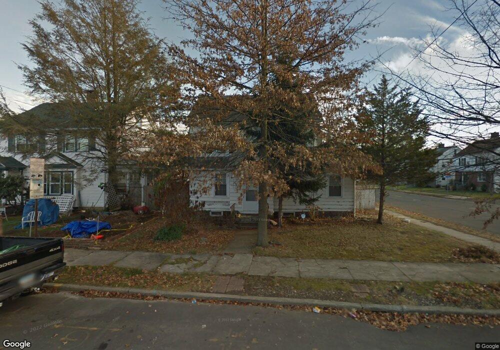
717 W Jackson Ave Bridgeport, CT 06604
Brooklawn-Saint Vincent NeighborhoodEstimated Value: $411,000 - $490,000
4
Beds
2
Baths
1,980
Sq Ft
$227/Sq Ft
Est. Value
About This Home
This home is located at 717 W Jackson Ave, Bridgeport, CT 06604 and is currently estimated at $450,230, approximately $227 per square foot. 717 W Jackson Ave is a home located in Fairfield County with nearby schools including Blackham School, Central High School, and Assumption Catholic School.
Ownership History
Date
Name
Owned For
Owner Type
Purchase Details
Closed on
Aug 28, 2025
Sold by
K2 Realty Llc
Bought by
Everstar Llc
Current Estimated Value
Home Financials for this Owner
Home Financials are based on the most recent Mortgage that was taken out on this home.
Original Mortgage
$340,000
Outstanding Balance
$339,413
Interest Rate
6.75%
Mortgage Type
Future Advance Clause Open End Mortgage
Estimated Equity
$110,817
Purchase Details
Closed on
Mar 22, 2024
Sold by
Hassan Fazla Est and Citibank Na
Bought by
K2 Realty Llc
Create a Home Valuation Report for This Property
The Home Valuation Report is an in-depth analysis detailing your home's value as well as a comparison with similar homes in the area
Home Values in the Area
Average Home Value in this Area
Purchase History
| Date | Buyer | Sale Price | Title Company |
|---|---|---|---|
| Everstar Llc | -- | -- | |
| K2 Realty Llc | $277,550 | None Available | |
| K2 Realty Llc | $277,550 | None Available | |
| K2 Realty Llc | $277,550 | None Available |
Source: Public Records
Mortgage History
| Date | Status | Borrower | Loan Amount |
|---|---|---|---|
| Open | Everstar Llc | $340,000 |
Source: Public Records
Tax History Compared to Growth
Tax History
| Year | Tax Paid | Tax Assessment Tax Assessment Total Assessment is a certain percentage of the fair market value that is determined by local assessors to be the total taxable value of land and additions on the property. | Land | Improvement |
|---|---|---|---|---|
| 2025 | $6,180 | $142,240 | $77,920 | $64,320 |
| 2024 | $6,180 | $142,240 | $77,920 | $64,320 |
| 2023 | $6,180 | $142,240 | $77,920 | $64,320 |
| 2022 | $6,180 | $142,240 | $77,920 | $64,320 |
| 2021 | $6,180 | $142,240 | $77,920 | $64,320 |
| 2020 | $7,386 | $136,800 | $47,210 | $89,590 |
| 2019 | $7,386 | $136,800 | $47,210 | $89,590 |
| 2018 | $7,438 | $136,800 | $47,210 | $89,590 |
| 2017 | $7,438 | $136,800 | $47,210 | $89,590 |
| 2016 | $7,438 | $136,800 | $47,210 | $89,590 |
| 2015 | $7,143 | $169,260 | $52,370 | $116,890 |
| 2014 | $7,143 | $169,260 | $52,370 | $116,890 |
Source: Public Records
Map
Nearby Homes
- 1213 Wood Ave
- 665 W Taft Ave
- 1480 Capitol Ave Unit 811
- 605 Brooklawn Ave
- 2345 Park Ave
- 2445 Park Ave Unit 23
- 1473 Wood Ave
- 366 Brooklawn Ave
- 1275 Capitol Ave
- 2625 Park Ave Unit 12L
- 2625 Park Ave Unit 12H
- 2625 Park Ave Unit 5S
- 2625 Park Ave Unit 6M
- 2625 Park Ave Unit 5N
- 184 Pacific St
- 2675 Park Ave Unit 3
- 2675 Park Ave Unit 22
- 687 Wood Ave
- 125 E Eaton St
- 100 Lorraine St
- 1202 Wood Ave
- 709 W Jackson Ave
- 128 Pierce Ave
- 699 W Jackson Ave
- 118 Pierce Ave
- 1207 Wood Ave
- 1209 Wood Ave
- 108 Pierce Ave
- 710 W Jackson Ave
- 1185 Wood Ave
- 720 W Jackson Ave
- 689 W Jackson Ave
- 10 Arcadia Ave
- 12 Arcadia Ave
- 1175 Wood Ave
- 700 W Jackson Ave
- 98 Pierce Ave
- 1223 Wood Ave
- 1229 Wood Ave
- 679 W Jackson Ave