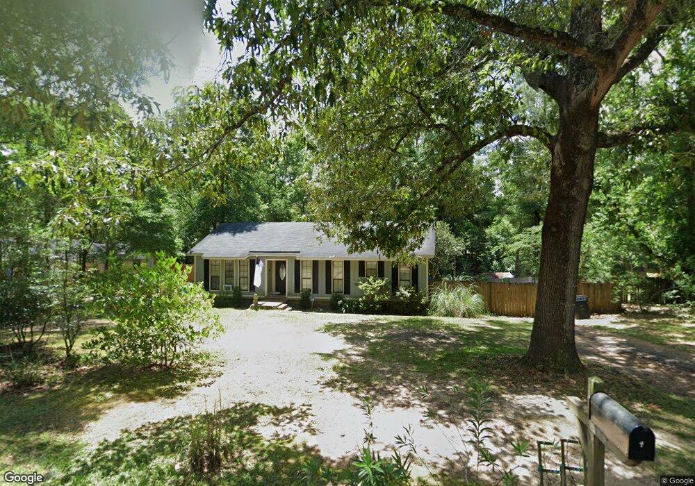
7175 Burning Tree Ct Mobile, AL 36695
Sheldon NeighborhoodEstimated Value: $175,656 - $225,000
3
Beds
2
Baths
1,544
Sq Ft
$135/Sq Ft
Est. Value
About This Home
This home is located at 7175 Burning Tree Ct, Mobile, AL 36695 and is currently estimated at $208,914, approximately $135 per square foot. 7175 Burning Tree Ct is a home with nearby schools including ER Dickson Elementary School, Burns Middle School, and WP Davidson High School.
Ownership History
Date
Name
Owned For
Owner Type
Purchase Details
Closed on
Nov 2, 2001
Sold by
Main Street Investments Llc
Bought by
Ross Frank R and Ross Robin L
Current Estimated Value
Home Financials for this Owner
Home Financials are based on the most recent Mortgage that was taken out on this home.
Original Mortgage
$80,733
Outstanding Balance
$30,399
Interest Rate
6.67%
Mortgage Type
FHA
Estimated Equity
$178,515
Purchase Details
Closed on
Feb 6, 1998
Sold by
Lee Vanguilder Edward
Bought by
Vanguilder Edward Lee and Vanguilder Kathryn Anne
Create a Home Valuation Report for This Property
The Home Valuation Report is an in-depth analysis detailing your home's value as well as a comparison with similar homes in the area
Home Values in the Area
Average Home Value in this Area
Purchase History
| Date | Buyer | Sale Price | Title Company |
|---|---|---|---|
| Ross Frank R | -- | -- | |
| Vanguilder Edward Lee | -- | -- |
Source: Public Records
Mortgage History
| Date | Status | Borrower | Loan Amount |
|---|---|---|---|
| Open | Ross Frank R | $80,733 |
Source: Public Records
Tax History
| Year | Tax Paid | Tax Assessment Tax Assessment Total Assessment is a certain percentage of the fair market value that is determined by local assessors to be the total taxable value of land and additions on the property. | Land | Improvement |
|---|---|---|---|---|
| 2025 | $510 | $13,010 | $2,000 | $11,010 |
| 2024 | $510 | $12,040 | $2,000 | $10,040 |
| 2023 | $475 | $11,130 | $2,000 | $9,130 |
| 2022 | $465 | $10,950 | $2,000 | $8,950 |
| 2021 | $467 | $11,000 | $2,500 | $8,500 |
| 2020 | $466 | $10,970 | $2,500 | $8,470 |
| 2019 | $444 | $10,530 | $2,500 | $8,030 |
| 2018 | $444 | $10,540 | $0 | $0 |
| 2017 | $402 | $9,680 | $0 | $0 |
| 2016 | $382 | $9,260 | $0 | $0 |
| 2013 | $432 | $10,060 | $0 | $0 |
Source: Public Records
Map
Nearby Homes
- 7183 Pine Barren Ct
- 1000 Choctaw Bluff Rd
- 7241 Spring Lake Dr S
- 664 Spring Lake Dr W
- 7382 Hawkins Manor
- 816 Willow Springs Dr
- 7348 Hawkins Manor N
- 7394 Hawkins W
- 7344 Hawkins Manor N
- 7340 Hawkins Manor N
- 7354 Willow Pointe Dr N
- 7340 Hawkins Manor S
- 7358 Willow Pointe Dr N
- 704 Providence Estates Dr W
- 7328 Hawkins Manor S
- 726 Willow Springs Dr
- 1130 Jonathan Ct
- 7310 Cheryl Ct
- 836 Willow Bridge Dr W
- 7232 Hawkins Manor
- 7171 Burning Tree Ct
- 7179 Burning Tree Ct
- 7167 Burning Tree Ct
- 7181 Burning Tree Ct
- 7176 Burning Tree Ct
- 7172 Burning Tree Ct
- 7168 Burning Tree Ct
- 855 Quail Hollow Rd
- 7161 Burning Tree Ct
- 921 Quail Hollow Rd
- 7162 Burning Tree Ct
- 854 Quail Hollow Rd
- 7211 Pine Barren Ct
- 7179 Pine Barren Ct
- 851 Quail Hollow Rd
- 7157 Burning Tree Ct
- 7158 Burning Tree Ct
- 931 Quail Hollow Rd
- 7201 Pine Barren Ct
- 7167 Pine Barren Ct
Your Personal Tour Guide
Ask me questions while you tour the home.