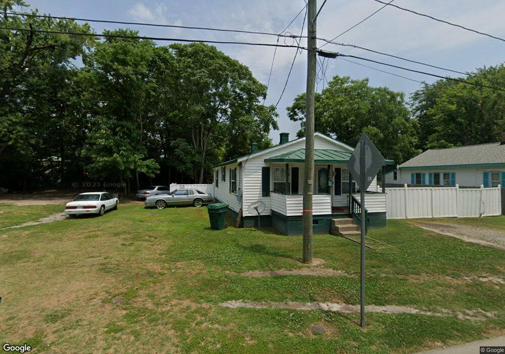
718 Battery Ave Suffolk, VA 23434
Holy Neck NeighborhoodEstimated Value: $268,000 - $312,000
3
Beds
3
Baths
1,200
Sq Ft
$241/Sq Ft
Est. Value
About This Home
This home is located at 718 Battery Ave, Suffolk, VA 23434 and is currently estimated at $289,063, approximately $240 per square foot. 718 Battery Ave is a home located in Suffolk City with nearby schools including Hillpoint Elementary School, Forest Glen Middle School, and Lakeland High School.
Ownership History
Date
Name
Owned For
Owner Type
Purchase Details
Closed on
Feb 14, 2022
Sold by
Hugh L Hooland Jr Trust
Bought by
Polk Pinewill Builders Llc
Current Estimated Value
Purchase Details
Closed on
Oct 6, 2021
Sold by
Holland Hugh L and Holland Joseph Jett
Bought by
Polk Pinewill Builders Llc
Home Financials for this Owner
Home Financials are based on the most recent Mortgage that was taken out on this home.
Original Mortgage
$1,000,000
Interest Rate
2.8%
Mortgage Type
Purchase Money Mortgage
Create a Home Valuation Report for This Property
The Home Valuation Report is an in-depth analysis detailing your home's value as well as a comparison with similar homes in the area
Home Values in the Area
Average Home Value in this Area
Purchase History
| Date | Buyer | Sale Price | Title Company |
|---|---|---|---|
| Polk Pinewill Builders Llc | -- | Titlequest | |
| Polk Pinewill Builders Llc | $11,723 | Titlequest Of Hampton Roads |
Source: Public Records
Mortgage History
| Date | Status | Borrower | Loan Amount |
|---|---|---|---|
| Previous Owner | Polk Pinewill Builders Llc | $1,000,000 |
Source: Public Records
Tax History
| Year | Tax Paid | Tax Assessment Tax Assessment Total Assessment is a certain percentage of the fair market value that is determined by local assessors to be the total taxable value of land and additions on the property. | Land | Improvement |
|---|---|---|---|---|
| 2025 | $3,138 | $251,200 | $36,800 | $214,400 |
| 2024 | $3,138 | $232,500 | $36,800 | $195,700 |
| 2023 | $2,881 | $35,100 | $35,100 | $0 |
| 2022 | $274 | $25,100 | $25,100 | $0 |
| 2021 | $223 | $20,100 | $20,100 | $0 |
| 2020 | $202 | $18,200 | $18,200 | $0 |
| 2019 | $202 | $18,200 | $18,200 | $0 |
| 2018 | $198 | $18,200 | $18,200 | $0 |
| 2017 | $195 | $18,200 | $18,200 | $0 |
| 2016 | $195 | $18,200 | $18,200 | $0 |
| 2015 | $88 | $18,200 | $18,200 | $0 |
| 2014 | $88 | $18,200 | $18,200 | $0 |
Source: Public Records
Map
Nearby Homes
- 721 Ashley Ave Unit A
- 814 Battery Ave
- 812 Battery Ave
- 731 Brook Ave
- 727 Brook Ave
- 711 Brook Ave
- 729 Brook Ave
- 608 Battery Ave
- 603 Mason Ave
- 532 Battery Ave
- 435 Wellons St
- 441 Wellons St
- 439 Wellons St
- 437 Wellons St
- 433 Wellons St
- 314 Linden Ave
- 309 Linden Ave
- 706 Maryland Ave
- 207 Causey Ave
- 212 Saint James Ave
- 720 Battery Ave
- 716 Battery Ave
- 712 Battery Ave
- 728 Battery Ave
- 708 Battery Ave
- 715 Battery Ave
- 723 Ashley Ave
- 713 Ashley Ave
- 711 Battery Ave
- 727 Ashley Ave
- 706 Battery Ave
- 732 Battery Ave
- 709 Battery Ave
- 729 Ashley Ave
- 707 Battery Ave
- 702 Battery Ave
- 600 Cannon St
- 731 Ashley Ave
- 705 Ashley Ave
- 705 Battery Ave
Your Personal Tour Guide
Ask me questions while you tour the home.