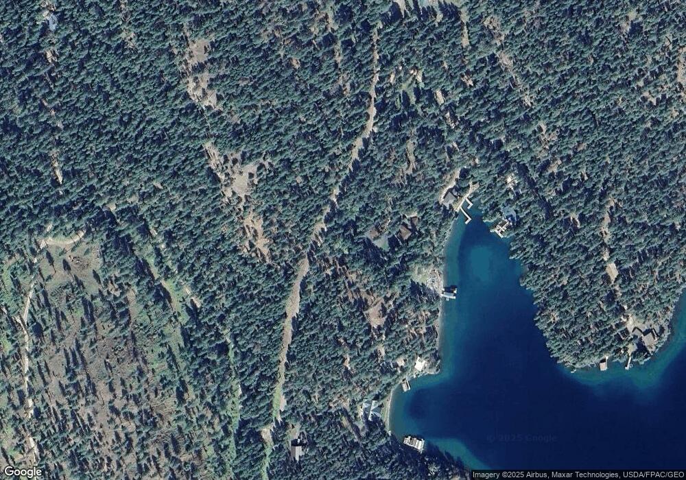
718 Black Point Rd Polson, MT 59860
Estimated Value: $3,914,000 - $4,211,912
3
Beds
3
Baths
4,403
Sq Ft
$923/Sq Ft
Est. Value
About This Home
This home is located at 718 Black Point Rd, Polson, MT 59860 and is currently estimated at $4,062,956, approximately $922 per square foot. 718 Black Point Rd is a home located in Lake County with nearby schools including Cherry Valley School, Linderman Elementary School, and Polson Middle School (7-8).
Ownership History
Date
Name
Owned For
Owner Type
Purchase Details
Closed on
Mar 10, 2021
Sold by
Milam Gilbert Anthoy
Bought by
Milam Gilbert and 11 11 Trust
Current Estimated Value
Purchase Details
Closed on
Jun 25, 2020
Sold by
Kirk Jesse and Kirk Milo M
Bought by
Milam Gilbert Anthony
Purchase Details
Closed on
Nov 25, 2014
Sold by
Kirk Jesse and Kirk Milo
Bought by
The Kirk Family Living Trust
Purchase Details
Closed on
Oct 28, 2011
Sold by
Cowan John S
Bought by
Kirk Jesse and Kirk Milo
Purchase Details
Closed on
Dec 17, 2009
Sold by
Cowan John S
Bought by
Cowan John S and John & Elaine Cowan Trust
Create a Home Valuation Report for This Property
The Home Valuation Report is an in-depth analysis detailing your home's value as well as a comparison with similar homes in the area
Purchase History
| Date | Buyer | Sale Price | Title Company |
|---|---|---|---|
| Milam Gilbert | -- | None Available | |
| Milam Gilbert Anthony | -- | First American Title Company | |
| The Kirk Family Living Trust | -- | None Available | |
| Kirk Jesse | -- | None Available | |
| Cowan John S | -- | None Available |
Source: Public Records
Tax History Compared to Growth
Tax History
| Year | Tax Paid | Tax Assessment Tax Assessment Total Assessment is a certain percentage of the fair market value that is determined by local assessors to be the total taxable value of land and additions on the property. | Land | Improvement |
|---|---|---|---|---|
| 2025 | $36,380 | $4,404,410 | $0 | $0 |
| 2024 | $19,729 | $3,130,080 | $0 | $0 |
| 2023 | $19,451 | $3,130,080 | $0 | $0 |
| 2022 | $17,394 | $2,477,990 | $0 | $0 |
| 2021 | $19,138 | $2,477,990 | $0 | $0 |
| 2020 | $18,132 | $2,294,020 | $0 | $0 |
| 2019 | $18,678 | $2,294,020 | $0 | $0 |
| 2018 | $9,063 | $1,106,350 | $0 | $0 |
| 2017 | $9,178 | $1,106,350 | $0 | $0 |
| 2016 | $8,501 | $1,038,520 | $0 | $0 |
| 2015 | $8,266 | $1,057,940 | $0 | $0 |
| 2014 | -- | $1,196,838 | $0 | $0 |
Source: Public Records
Map
Nearby Homes
- Nhn Rocky Point Rd
- 29137 Rocky Point Rd
- Nhn Blue Spruce Dr
- 32162 Rocky Point Rd
- 31402 Rocky Shores & 32162 Rocky Point Road Ln
- 31402 Rocky Shores Ln
- NHN (Lot 5) Burnt Tree Ln
- Nhn 6th St E
- NHN N Reservoir Rd Unit Parcel 1-A
- NHN N Reservoir Rd Unit Parcel 1-B
- 34310 Sweet Cherry Ln
- 300 Lynx Dr
- 32624 S Finley Point Rd
- Nhn S Finley Point Rd
- 41001 Canyon View Dr
- 31009 Canyon View Place
- 34238 Rocky Point Rd
- LOT 55 Jette Meadow Rd
- 40961 Us Highway 93
- 40566 S Terrace Cir
- 29645 Black Point Rd
- 60 Fjords Ln
- 943 Black Point Rd
- 60 Karlsgodt Fjords Ln
- 940 Black Point Rd
- 1348 Black Point Rd
- 29882 Black Point Rd
- 36957 Knestis Ln
- 168 Karlsgodt Fjords Ln
- 37052 Karlsgodt Fjords Ln
- 37058 Karlsgodt Fjords Ln
- 29343 Black Point Rd
- 36921 Safety Bay Ln
- 37112 Karlsgodt Fjords Ln
- 37161 Karlsgodt Fjords Ln
- 29490 Black Bear Trail
- 210 Black Bear Trail
- 201 Black Bear Trail
- LOT 15 Safety Bay Ln
- 29486 Black Bear Trail
