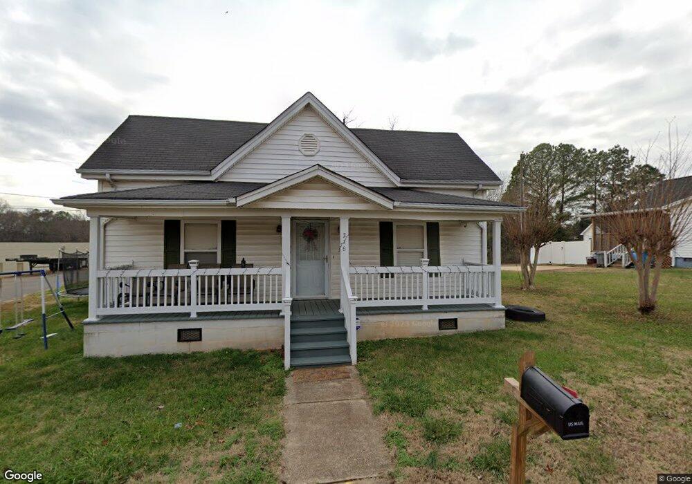
718 Brook St Belmont, NC 28012
Estimated Value: $279,000 - $314,000
2
Beds
1
Bath
1,070
Sq Ft
$270/Sq Ft
Est. Value
About This Home
This home is located at 718 Brook St, Belmont, NC 28012 and is currently estimated at $289,187, approximately $270 per square foot. 718 Brook St is a home located in Gaston County with nearby schools including J B Page Elementary School, Belmont Central Elementary School, and Belmont Middle School.
Ownership History
Date
Name
Owned For
Owner Type
Purchase Details
Closed on
Nov 16, 2006
Sold by
R L Stowe Mills Inc
Bought by
Jones Tommy R
Current Estimated Value
Home Financials for this Owner
Home Financials are based on the most recent Mortgage that was taken out on this home.
Original Mortgage
$72,115
Outstanding Balance
$42,752
Interest Rate
6.25%
Mortgage Type
FHA
Estimated Equity
$246,435
Create a Home Valuation Report for This Property
The Home Valuation Report is an in-depth analysis detailing your home's value as well as a comparison with similar homes in the area
Purchase History
| Date | Buyer | Sale Price | Title Company |
|---|---|---|---|
| Jones Tommy R | $73,500 | None Available |
Source: Public Records
Mortgage History
| Date | Status | Borrower | Loan Amount |
|---|---|---|---|
| Open | Jones Tommy R | $72,115 |
Source: Public Records
Tax History
| Year | Tax Paid | Tax Assessment Tax Assessment Total Assessment is a certain percentage of the fair market value that is determined by local assessors to be the total taxable value of land and additions on the property. | Land | Improvement |
|---|---|---|---|---|
| 2025 | $2,483 | $235,610 | $55,000 | $180,610 |
| 2024 | $2,483 | $235,610 | $55,000 | $180,610 |
| 2023 | $2,509 | $235,610 | $55,000 | $180,610 |
| 2022 | $1,648 | $126,310 | $22,500 | $103,810 |
| 2021 | $1,699 | $126,310 | $22,500 | $103,810 |
| 2019 | $1,712 | $126,310 | $22,500 | $103,810 |
| 2018 | $1,140 | $82,275 | $14,400 | $67,875 |
| 2017 | $1,107 | $82,275 | $14,400 | $67,875 |
| 2016 | $1,107 | $82,275 | $0 | $0 |
| 2014 | $1,077 | $80,067 | $18,000 | $62,067 |
Source: Public Records
Map
Nearby Homes
- 804 Caldwell St
- 901 Edgemont Ave
- 589 E Catawba St Unit 22
- 213 Sloan St
- 206 13th St
- 204 13th St
- 223 Howe St
- 241 6th St
- 100 Linestowe Dr
- 243 6th St
- 305 Linestowe Dr
- 205 Parkdale Dr
- 135 Parkdale Dr
- 1213 Sandra Ct
- 203 Ewing Dr
- 101 Morning Glory Ave
- 147 Mcleod Ave
- 104 Mckee Cir
- 6828 Wilkinson Blvd
- 175 Mcleod Ave
Your Personal Tour Guide
Ask me questions while you tour the home.