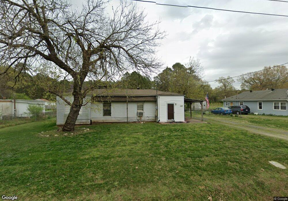
718 Martin St Durham, NC 27704
Northeast Durham NeighborhoodEstimated Value: $156,000 - $241,399
2
Beds
1
Bath
1,350
Sq Ft
$152/Sq Ft
Est. Value
About This Home
This home is located at 718 Martin St, Durham, NC 27704 and is currently estimated at $205,466, approximately $152 per square foot. 718 Martin St is a home located in Durham County with nearby schools including Sandy Ridge Elementary School, Lucas Middle School, and Northern High School.
Ownership History
Date
Name
Owned For
Owner Type
Purchase Details
Closed on
May 9, 2007
Sold by
Wilson Larry W and Wilson Myra
Bought by
Wells Frank D
Current Estimated Value
Home Financials for this Owner
Home Financials are based on the most recent Mortgage that was taken out on this home.
Original Mortgage
$55,000
Outstanding Balance
$44,173
Interest Rate
6.11%
Mortgage Type
Purchase Money Mortgage
Estimated Equity
$161,293
Purchase Details
Closed on
Apr 29, 2004
Sold by
Wilson Doris G
Bought by
Wilson Larry Wayne and Lockamy Donna Ann Wilson
Create a Home Valuation Report for This Property
The Home Valuation Report is an in-depth analysis detailing your home's value as well as a comparison with similar homes in the area
Home Values in the Area
Average Home Value in this Area
Purchase History
| Date | Buyer | Sale Price | Title Company |
|---|---|---|---|
| Wells Frank D | $55,000 | None Available | |
| Wilson Larry Wayne | $1,000 | -- |
Source: Public Records
Mortgage History
| Date | Status | Borrower | Loan Amount |
|---|---|---|---|
| Open | Wells Frank D | $55,000 |
Source: Public Records
Tax History
| Year | Tax Paid | Tax Assessment Tax Assessment Total Assessment is a certain percentage of the fair market value that is determined by local assessors to be the total taxable value of land and additions on the property. | Land | Improvement |
|---|---|---|---|---|
| 2025 | $1,638 | $165,274 | $91,250 | $74,024 |
| 2024 | $1,068 | $76,583 | $21,885 | $54,698 |
| 2023 | $1,003 | $76,583 | $21,885 | $54,698 |
| 2022 | $980 | $76,583 | $21,885 | $54,698 |
| 2021 | $976 | $76,583 | $21,885 | $54,698 |
| 2020 | $953 | $76,583 | $21,885 | $54,698 |
| 2019 | $953 | $101,560 | $21,885 | $79,675 |
| 2018 | $807 | $59,470 | $21,885 | $37,585 |
| 2017 | $801 | $59,470 | $21,885 | $37,585 |
| 2016 | $774 | $67,059 | $21,885 | $45,174 |
| 2015 | $844 | $60,959 | $22,296 | $38,663 |
| 2014 | $844 | $60,959 | $22,296 | $38,663 |
Source: Public Records
Map
Nearby Homes
- 422 Craven St
- 3024 3026 Ruth St
- 201 Denver Ave
- 714 Old Oxford Rd
- 3609 Cub Creek Rd
- 3615 Cub Creek Rd
- 1123 Allgood St
- 3103 Dearborn Dr
- 814 Shari Ct
- 620 Hoyle St
- 618 Hoyle St
- 2224 Clements Dr
- 928 Belvin Ave
- 918 Cartman Dr
- 2720 Thelma St
- 2718 Thelma St
- 1448 Maplewood Dr
- 1455 Maplewood Dr
- 3306 Prudence St
- 2609 Kingdom Way
Your Personal Tour Guide
Ask me questions while you tour the home.