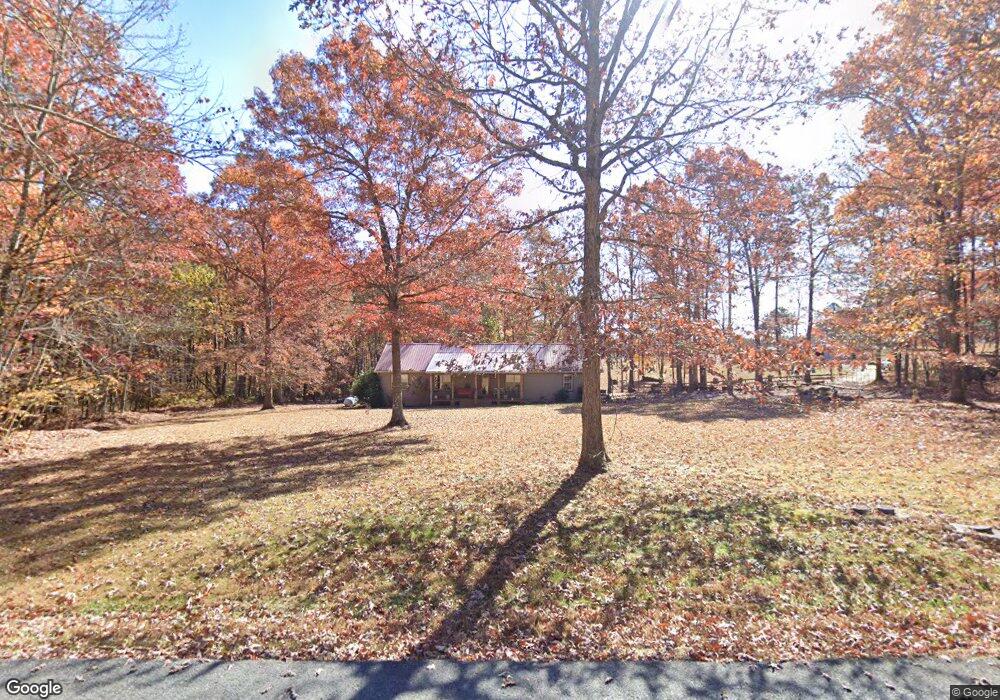
718 T Crowe Rd Soddy Daisy, TN 37379
Estimated Value: $347,143 - $420,000
--
Bed
2
Baths
1,344
Sq Ft
$282/Sq Ft
Est. Value
About This Home
This home is located at 718 T Crowe Rd, Soddy Daisy, TN 37379 and is currently estimated at $378,536, approximately $281 per square foot. 718 T Crowe Rd is a home located in Sequatchie County with nearby schools including Griffith Elementary School, Sequatchie County Middle School, and Sequatchie County High School.
Ownership History
Date
Name
Owned For
Owner Type
Purchase Details
Closed on
Jun 27, 2025
Sold by
Lewis Robert Ann
Bought by
Prueitt Timothy and Prueitt Amanda
Current Estimated Value
Home Financials for this Owner
Home Financials are based on the most recent Mortgage that was taken out on this home.
Original Mortgage
$368,207
Outstanding Balance
$367,579
Interest Rate
6.81%
Mortgage Type
FHA
Estimated Equity
$10,957
Purchase Details
Closed on
Sep 10, 2002
Sold by
David Moe
Bought by
Ann Lewis Robert
Purchase Details
Closed on
Oct 9, 1996
Bought by
David Moe
Home Financials for this Owner
Home Financials are based on the most recent Mortgage that was taken out on this home.
Original Mortgage
$63,630
Interest Rate
8.32%
Purchase Details
Closed on
Aug 21, 1992
Bought by
Hobbs Gary and Wife Sherry
Purchase Details
Closed on
Jan 1, 1982
Create a Home Valuation Report for This Property
The Home Valuation Report is an in-depth analysis detailing your home's value as well as a comparison with similar homes in the area
Home Values in the Area
Average Home Value in this Area
Purchase History
| Date | Buyer | Sale Price | Title Company |
|---|---|---|---|
| Prueitt Timothy | $375,000 | Bridge City Title | |
| Prueitt Timothy | $375,000 | Bridge City Title | |
| Ann Lewis Robert | -- | -- | |
| David Moe | $70,000 | -- | |
| Hobbs Gary | $6,000 | -- | |
| -- | $4,600 | -- |
Source: Public Records
Mortgage History
| Date | Status | Borrower | Loan Amount |
|---|---|---|---|
| Open | Prueitt Timothy | $368,207 | |
| Closed | Prueitt Timothy | $368,207 | |
| Previous Owner | -- | $63,630 |
Source: Public Records
Tax History Compared to Growth
Tax History
| Year | Tax Paid | Tax Assessment Tax Assessment Total Assessment is a certain percentage of the fair market value that is determined by local assessors to be the total taxable value of land and additions on the property. | Land | Improvement |
|---|---|---|---|---|
| 2024 | $951 | $51,775 | $9,750 | $42,025 |
| 2023 | $951 | $51,775 | $9,750 | $42,025 |
| 2022 | $769 | $31,475 | $8,275 | $23,200 |
| 2021 | $769 | $31,475 | $8,275 | $23,200 |
| 2020 | $769 | $31,475 | $8,275 | $23,200 |
| 2019 | $769 | $31,475 | $8,275 | $23,200 |
| 2018 | $763 | $31,225 | $8,275 | $22,950 |
| 2017 | $763 | $31,225 | $8,275 | $22,950 |
| 2016 | $767 | $29,875 | $6,425 | $23,450 |
| 2015 | $767 | $29,875 | $6,425 | $23,450 |
| 2014 | $768 | $29,900 | $6,425 | $23,475 |
Source: Public Records
Map
Nearby Homes
- 112 Henson Gap Rd
- 100 Henson Gap Rd
- 2996 Mowbray Pike
- 3069 Poe Rd
- 3087 Poe Rd
- 3057 Poe Rd
- 3086 Poe Rd
- 2907 Mowbray Pike
- 406 Green Brier Ln
- 4 Henson Gap Rd
- Highway 111
- 2740 Mowbray Pike
- 2664 Mowbray Pike
- 2796 Mowbray Pike
- 2772 Mowbray Pike
- 3075 Poe Rd
- 174 Buck Run Estates Rd
- 10600 Skyridge Trail
- 0 Henson Gap Rd Unit 1399012
- 2724 Snyder Loop