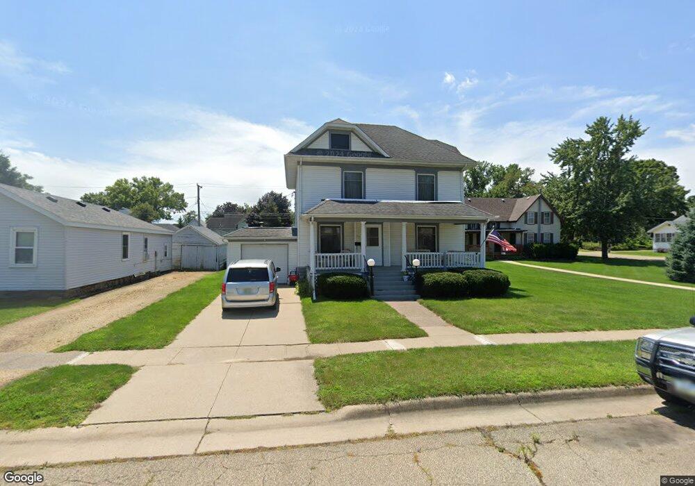
719 9th St de Witt, IA 52742
Estimated Value: $224,000 - $274,000
3
Beds
2
Baths
2,024
Sq Ft
$119/Sq Ft
Est. Value
About This Home
This home is located at 719 9th St, de Witt, IA 52742 and is currently estimated at $239,963, approximately $118 per square foot. 719 9th St is a home located in Clinton County with nearby schools including Ekstrand Elementary School, Central Dewitt Intermediate School, and Central Dewitt Middle School.
Ownership History
Date
Name
Owned For
Owner Type
Purchase Details
Closed on
May 10, 2011
Sold by
Schrader Alan J and Schrader Sheila A
Bought by
Anderson Troy B and Payne Lisa M
Current Estimated Value
Home Financials for this Owner
Home Financials are based on the most recent Mortgage that was taken out on this home.
Original Mortgage
$146,470
Outstanding Balance
$101,428
Interest Rate
4.88%
Mortgage Type
New Conventional
Estimated Equity
$138,535
Create a Home Valuation Report for This Property
The Home Valuation Report is an in-depth analysis detailing your home's value as well as a comparison with similar homes in the area
Home Values in the Area
Average Home Value in this Area
Purchase History
| Date | Buyer | Sale Price | Title Company |
|---|---|---|---|
| Anderson Troy B | $151,000 | None Available |
Source: Public Records
Mortgage History
| Date | Status | Borrower | Loan Amount |
|---|---|---|---|
| Open | Anderson Troy B | $146,470 |
Source: Public Records
Tax History
| Year | Tax Paid | Tax Assessment Tax Assessment Total Assessment is a certain percentage of the fair market value that is determined by local assessors to be the total taxable value of land and additions on the property. | Land | Improvement |
|---|---|---|---|---|
| 2025 | $3,808 | $231,680 | $20,590 | $211,090 |
| 2024 | $3,808 | $217,180 | $20,590 | $196,590 |
| 2023 | $3,492 | $217,180 | $20,590 | $196,590 |
| 2022 | $2,978 | $192,450 | $20,590 | $171,860 |
| 2021 | $2,894 | $155,590 | $25,340 | $130,250 |
| 2019 | $2,772 | $138,600 | $0 | $0 |
| 2018 | $2,702 | $138,600 | $0 | $0 |
| 2017 | $2,702 | $138,600 | $0 | $0 |
| 2016 | $2,694 | $138,000 | $0 | $0 |
| 2015 | $2,694 | $138,000 | $0 | $0 |
| 2014 | $2,728 | $138,000 | $0 | $0 |
| 2013 | $2,682 | $0 | $0 | $0 |
Source: Public Records
Map
Nearby Homes
- 285th St Old Hwy 61
- 627 12th St
- 401 10th St
- 308 8th St
- 00 3rd St
- 510 2nd St
- 102 8th St
- 1104 15th St
- 00 Maynard Way
- 1527 11th St
- 1037 Brookview Dr
- 119 14th Ave
- 1545 Silver Valley Dr
- 1144 Brookview Dr
- 1710 Mackin Dr
- 615 S 6th Ave
- 2307 18th Ave
- 302 Silver Creek Rd
- 0 285th Ave Old Hwy 61 Unit 2601452
- 0 285th Ave Old Hwy 61 Unit 2601448
Your Personal Tour Guide
Ask me questions while you tour the home.