Estimated Value: $2,313,219 - $2,970,000
5
Beds
5
Baths
3,227
Sq Ft
$823/Sq Ft
Est. Value
About This Home
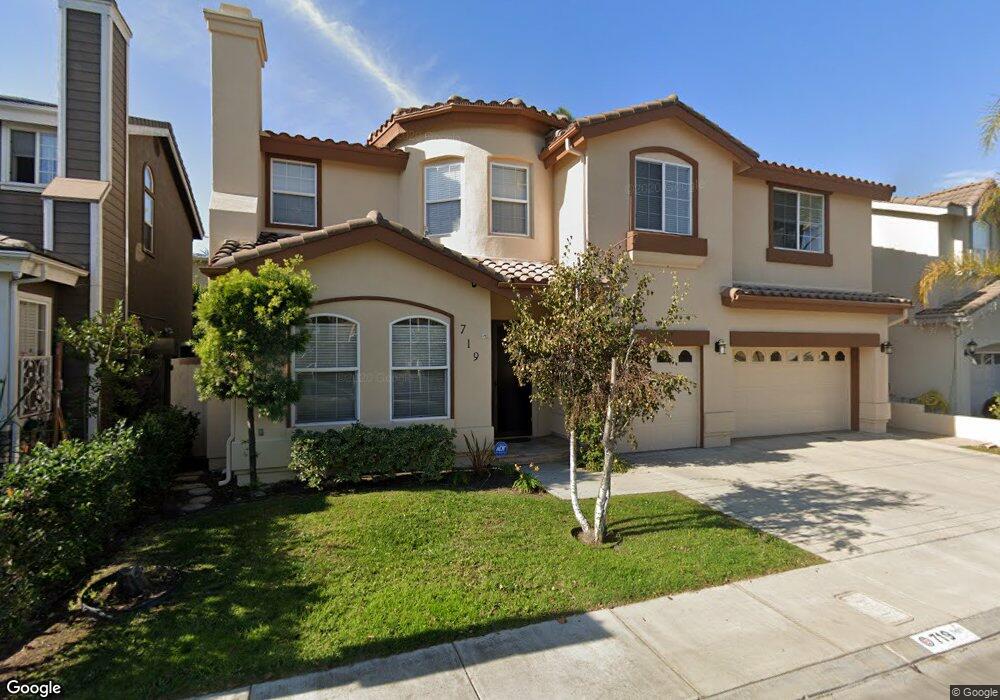
This home is located at 719 Amy Ln, Redondo Beach, CA 90278 and is currently estimated at $2,655,055, approximately $822 per square foot. 719 Amy Ln is a home located in Los Angeles County with nearby schools including Washington Elementary School, Adams Middle School, and Redondo Union High School.
Ownership History
Date
Name
Owned For
Owner Type
Purchase Details
Closed on
Jul 30, 2010
Sold by
Brown James Jeffrey and Brown Emi Kawasaki
Bought by
Brown James Jeffrey and Brown Emi Kawasaki
Current Estimated Value
Purchase Details
Closed on
Jun 6, 2000
Sold by
Anastasi Development Company Llc
Bought by
Brown James Jeffrey
Home Financials for this Owner
Home Financials are based on the most recent Mortgage that was taken out on this home.
Original Mortgage
$200,000
Interest Rate
8.19%
Create a Home Valuation Report for This Property
The Home Valuation Report is an in-depth analysis detailing your home's value as well as a comparison with similar homes in the area
Home Values in the Area
Average Home Value in this Area
Purchase History
| Date | Buyer | Sale Price | Title Company |
|---|---|---|---|
| Brown James Jeffrey | -- | Accommodation | |
| Brown James Jeffrey | $635,000 | Stewart Title |
Source: Public Records
Mortgage History
| Date | Status | Borrower | Loan Amount |
|---|---|---|---|
| Previous Owner | Brown James Jeffrey | $200,000 | |
| Closed | Brown James Jeffrey | $234,900 |
Source: Public Records
Tax History Compared to Growth
Tax History
| Year | Tax Paid | Tax Assessment Tax Assessment Total Assessment is a certain percentage of the fair market value that is determined by local assessors to be the total taxable value of land and additions on the property. | Land | Improvement |
|---|---|---|---|---|
| 2025 | $11,673 | $984,010 | $384,085 | $599,925 |
| 2024 | $11,673 | $964,716 | $376,554 | $588,162 |
| 2023 | $11,464 | $945,801 | $369,171 | $576,630 |
| 2022 | $11,268 | $927,257 | $361,933 | $565,324 |
| 2021 | $10,963 | $909,077 | $354,837 | $554,240 |
| 2019 | $10,709 | $882,114 | $344,313 | $537,801 |
| 2018 | $10,407 | $864,818 | $337,562 | $527,256 |
| 2016 | $10,055 | $831,238 | $324,455 | $506,783 |
| 2015 | $9,874 | $818,753 | $319,582 | $499,171 |
| 2014 | $9,783 | $802,715 | $313,322 | $489,393 |
Source: Public Records
Map
Nearby Homes
- 2345 190th St Unit 42
- 2345 190th St Unit 24
- 2345 W 190th St Unit 77
- 907 Lilienthal Ln
- 2420 Ives Ln Unit B
- 2420 Ives Ln Unit A
- 2221 Pullman Ln Unit B
- 2407 Ripley Ave
- 2400 Marshallfield Ln
- 2301 Marshallfield Ln Unit A
- 2600 Alvord Ln
- 19219 Beckworth Ave
- 2321 Clark Ln Unit B
- 2321 Clark Ln Unit A
- 2102 Marshallfield Ln Unit A
- 2617 Alvord Ln
- 2020 Clark Ln Unit B
- 2002 Marshallfield Ln
- 1908 Belmont Ln Unit A
- 19509 Hinsdale Ave