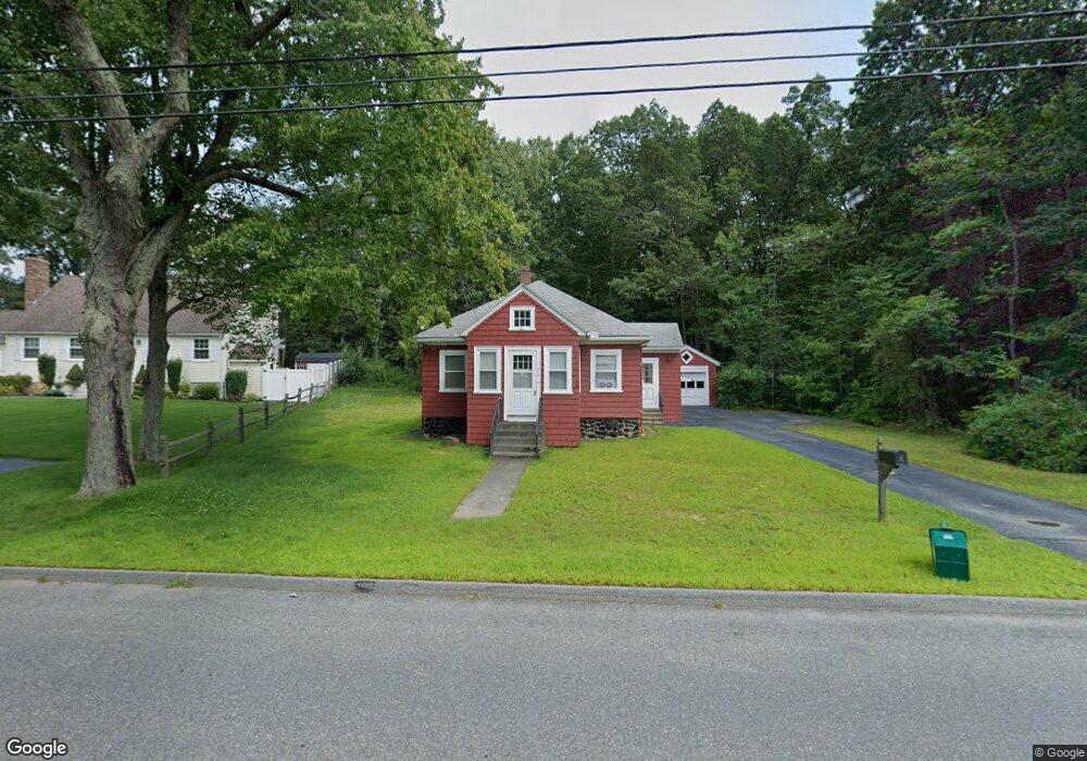
719 Burncoat St Unit 1 Worcester, MA 01606
Burncoat NeighborhoodEstimated Value: $356,000 - $389,000
2
Beds
1
Bath
900
Sq Ft
$414/Sq Ft
Est. Value
About This Home
This home is located at 719 Burncoat St Unit 1, Worcester, MA 01606 and is currently estimated at $372,911, approximately $414 per square foot. 719 Burncoat St Unit 1 is a home located in Worcester County with nearby schools including Norrback Avenue Elementary School, Jacob Hiatt Magnet School, and Chandler Magnet.
Ownership History
Date
Name
Owned For
Owner Type
Purchase Details
Closed on
Jun 1, 2011
Sold by
Novak Rita P
Bought by
Gold Star Assoc Llc
Current Estimated Value
Home Financials for this Owner
Home Financials are based on the most recent Mortgage that was taken out on this home.
Original Mortgage
$140,000
Outstanding Balance
$97,504
Interest Rate
4.85%
Mortgage Type
Purchase Money Mortgage
Estimated Equity
$275,407
Create a Home Valuation Report for This Property
The Home Valuation Report is an in-depth analysis detailing your home's value as well as a comparison with similar homes in the area
Home Values in the Area
Average Home Value in this Area
Purchase History
| Date | Buyer | Sale Price | Title Company |
|---|---|---|---|
| Gold Star Assoc Llc | $140,000 | -- |
Source: Public Records
Mortgage History
| Date | Status | Borrower | Loan Amount |
|---|---|---|---|
| Open | Gold Star Assoc Llc | $140,000 |
Source: Public Records
Tax History Compared to Growth
Tax History
| Year | Tax Paid | Tax Assessment Tax Assessment Total Assessment is a certain percentage of the fair market value that is determined by local assessors to be the total taxable value of land and additions on the property. | Land | Improvement |
|---|---|---|---|---|
| 2025 | $4,299 | $325,900 | $119,200 | $206,700 |
| 2024 | $4,232 | $307,800 | $119,200 | $188,600 |
| 2023 | $4,074 | $284,100 | $103,600 | $180,500 |
| 2022 | $3,608 | $237,200 | $82,900 | $154,300 |
| 2021 | $3,425 | $210,400 | $66,300 | $144,100 |
| 2020 | $3,312 | $194,800 | $66,200 | $128,600 |
| 2019 | $3,130 | $173,900 | $59,900 | $114,000 |
| 2018 | $3,056 | $161,600 | $59,900 | $101,700 |
| 2017 | $3,054 | $158,900 | $59,900 | $99,000 |
| 2016 | $2,955 | $143,400 | $45,000 | $98,400 |
| 2015 | $2,878 | $143,400 | $45,000 | $98,400 |
| 2014 | $2,802 | $143,400 | $45,000 | $98,400 |
Source: Public Records
Map
Nearby Homes
- 740 Burncoat St Unit B
- 7 Christy Ct
- 59 Santoro Rd
- 83 Hillside Village Dr
- 97 Hillside Village Dr
- 12 Birchbrush Ln
- 32 Whispering Pine Cir Unit 32
- 1110 W Boylston St Unit A
- 1097 W Boylston St
- 55 Angell Brook Dr
- 7 Angell Brook Dr
- 33 Meola Ave
- 39 Meola Ave
- 20 Hawthorne Dr
- 602 Burncoat St
- 55 Meola Ave
- 1 Highland Ave
- 44 Dixfield St
- 26 Danielles Way
- 22 Danielles Way
- 719 Burncoat St
- 721 Burncoat St
- 711 Burncoat St
- 725 Burncoat St
- 720 Burncoat St
- 716 Burncoat St
- 4 Northgate Cir
- 2 Northgate Cir
- 3 Eustis St
- 37 Cliveden St
- 708 Burncoat St
- 728 Burncoat St
- 729 Burncoat St
- 2A Eustis St
- 699 Burncoat St
- 0 Eustis St Unit B
- 0 Eustis St
- 2B Eustis St
- 2 Eustis St
- 731 Burncoat St