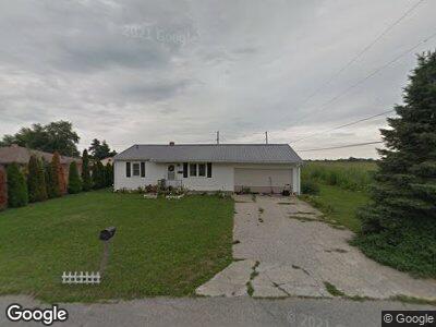
719 Charles St Anderson, IN 46017
Chesterfield NeighborhoodEstimated Value: $110,000 - $120,000
2
Beds
1
Bath
810
Sq Ft
$142/Sq Ft
Est. Value
About This Home
This home is located at 719 Charles St, Anderson, IN 46017 and is currently estimated at $114,992, approximately $141 per square foot. 719 Charles St is a home located in Madison County with nearby schools including Tenth Street Elementary School, Highland Junior High School, and Anderson High School.
Ownership History
Date
Name
Owned For
Owner Type
Purchase Details
Closed on
Oct 30, 2014
Sold by
Frank Stephen D and Frank Patricia E
Bought by
Biele Barbara
Current Estimated Value
Home Financials for this Owner
Home Financials are based on the most recent Mortgage that was taken out on this home.
Original Mortgage
$42,221
Outstanding Balance
$33,094
Interest Rate
4.25%
Mortgage Type
FHA
Estimated Equity
$81,898
Purchase Details
Closed on
Aug 16, 2007
Sold by
Federal National Mortgage Association
Bought by
Frank Stephen D and Frank Patricia E
Purchase Details
Closed on
Aug 1, 2007
Sold by
Abn Amro Mortgage Group Inc
Bought by
Federal National Mortgage Association
Purchase Details
Closed on
May 18, 2007
Sold by
Leisure Ty L
Bought by
Abn Amro Mortgage Group Inc
Create a Home Valuation Report for This Property
The Home Valuation Report is an in-depth analysis detailing your home's value as well as a comparison with similar homes in the area
Home Values in the Area
Average Home Value in this Area
Purchase History
| Date | Buyer | Sale Price | Title Company |
|---|---|---|---|
| Biele Barbara | -- | -- | |
| Frank Stephen D | -- | -- | |
| Federal National Mortgage Association | -- | -- | |
| Abn Amro Mortgage Group Inc | $49,288 | -- |
Source: Public Records
Mortgage History
| Date | Status | Borrower | Loan Amount |
|---|---|---|---|
| Open | Biele Barbara | $42,221 | |
| Previous Owner | Frank Stephen D | $60,000 |
Source: Public Records
Tax History Compared to Growth
Tax History
| Year | Tax Paid | Tax Assessment Tax Assessment Total Assessment is a certain percentage of the fair market value that is determined by local assessors to be the total taxable value of land and additions on the property. | Land | Improvement |
|---|---|---|---|---|
| 2024 | $64 | $62,900 | $9,800 | $53,100 |
| 2023 | $1 | $57,500 | $9,300 | $48,200 |
| 2022 | $0 | $59,800 | $8,800 | $51,000 |
| 2021 | $0 | $55,500 | $8,800 | $46,700 |
| 2020 | $0 | $52,700 | $8,300 | $44,400 |
| 2019 | $0 | $51,400 | $8,300 | $43,100 |
| 2018 | $0 | $49,000 | $8,300 | $40,700 |
| 2017 | $0 | $47,500 | $8,300 | $39,200 |
| 2016 | $0 | $47,600 | $8,300 | $39,300 |
| 2014 | $327 | $46,700 | $8,300 | $38,400 |
| 2013 | $327 | $46,700 | $8,300 | $38,400 |
Source: Public Records
Map
Nearby Homes
- 411 McCullen St
- 413 Vasbinder Dr
- 625 North St
- 128 Mulberry Rd
- 212 Vasbinder Dr
- 400 North St
- 5 W Main St
- 5311 Larita Ln
- 2110 Round Barn Rd
- 2212 Larita Ln
- 2230 Mindy Ct
- 0 Eastwood Way Unit MBR22029212
- 0 Eastwood Way Unit 202509709
- 1009 Avalon Ln
- 4930 Founders Ct
- 2328 Discovery Dr
- 3780 Cameron Ct
- 3521 Manchester Rd
- 28 Cambridge Ct
- 923 Woodcrest Way