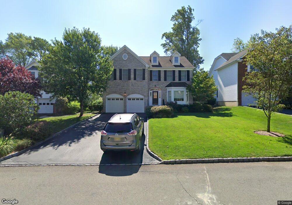
719 Clarence St Westfield, NJ 07090
Estimated Value: $1,303,008 - $1,669,000
--
Bed
--
Bath
2,670
Sq Ft
$572/Sq Ft
Est. Value
About This Home
This home is located at 719 Clarence St, Westfield, NJ 07090 and is currently estimated at $1,526,752, approximately $571 per square foot. 719 Clarence St is a home located in Union County with nearby schools including McKinley Elementary School, Westfield Senior High School, and Holy Trinity School.
Ownership History
Date
Name
Owned For
Owner Type
Purchase Details
Closed on
Jun 14, 1999
Sold by
Mahoney Michael
Bought by
Rittendale Patrick L and Rittendale Mary P
Current Estimated Value
Home Financials for this Owner
Home Financials are based on the most recent Mortgage that was taken out on this home.
Original Mortgage
$270,000
Outstanding Balance
$70,856
Interest Rate
6.99%
Mortgage Type
Purchase Money Mortgage
Estimated Equity
$1,455,896
Purchase Details
Closed on
Jun 11, 1999
Sold by
Robinson Sandra Shubitz
Bought by
Mahoney Michael
Home Financials for this Owner
Home Financials are based on the most recent Mortgage that was taken out on this home.
Original Mortgage
$270,000
Outstanding Balance
$70,856
Interest Rate
6.99%
Mortgage Type
Purchase Money Mortgage
Estimated Equity
$1,455,896
Purchase Details
Closed on
Mar 18, 1998
Sold by
William Wallace Associates
Bought by
Mahoney Michael
Purchase Details
Closed on
Aug 15, 1997
Sold by
Robinson Sandra Shubitz
Bought by
William Wallace Associates
Create a Home Valuation Report for This Property
The Home Valuation Report is an in-depth analysis detailing your home's value as well as a comparison with similar homes in the area
Home Values in the Area
Average Home Value in this Area
Purchase History
| Date | Buyer | Sale Price | Title Company |
|---|---|---|---|
| Rittendale Patrick L | $449,900 | -- | |
| Mahoney Michael | -- | -- | |
| Mahoney Michael | $170,000 | -- | |
| William Wallace Associates | $60,000 | -- |
Source: Public Records
Mortgage History
| Date | Status | Borrower | Loan Amount |
|---|---|---|---|
| Open | Rittendale Patrick L | $270,000 | |
| Closed | Mahoney Michael | $270,000 |
Source: Public Records
Tax History Compared to Growth
Tax History
| Year | Tax Paid | Tax Assessment Tax Assessment Total Assessment is a certain percentage of the fair market value that is determined by local assessors to be the total taxable value of land and additions on the property. | Land | Improvement |
|---|---|---|---|---|
| 2025 | $20,971 | $931,200 | $529,600 | $401,600 |
| 2024 | $20,542 | $931,200 | $529,600 | $401,600 |
| 2023 | $20,542 | $931,200 | $529,600 | $401,600 |
| 2022 | $20,114 | $931,200 | $529,600 | $401,600 |
| 2021 | $20,142 | $931,200 | $529,600 | $401,600 |
| 2020 | $20,095 | $931,200 | $529,600 | $401,600 |
| 2019 | $20,021 | $931,200 | $529,600 | $401,600 |
| 2018 | $18,594 | $200,000 | $60,100 | $139,900 |
| 2017 | $18,492 | $200,000 | $60,100 | $139,900 |
| 2016 | $18,058 | $200,000 | $60,100 | $139,900 |
| 2015 | $17,698 | $200,000 | $60,100 | $139,900 |
| 2014 | $17,114 | $200,000 | $60,100 | $139,900 |
Source: Public Records
Map
Nearby Homes
- 314 Highgate Ave
- 1466 Lamberts Mill Rd
- 119 Lamberts Mill Rd
- 2154 W Broad St
- 525 Edgar Rd
- 524 Edgar Rd
- 614 Dorian Rd
- 2 Brookside Ct
- 724 South Ave W Unit 724A
- 2116 Newark Ave
- 538 Westfield Ave
- 1933 W Broad St
- 676 Vermont St
- 350 W Dudley Ave
- 1933 Mary Ellen Ln
- 522 Boulevard
- 2 Dutch Ln
- 215 Ross Place Unit J
- 834 Tice Place
- 2314 Longfellow Ave
- 711 Clarence St
- 727 Clarence St
- 709 Clarence St
- 729 Clarence St
- 718 Warren St
- 722 Warren St
- 716 Warren St
- 712 Warren St
- 728 Warren St
- 718 Clarence St
- 731 Clarence St
- 724 Clarence St
- 716 Clarence St
- 712 Clarence St
- 252 S Scotch Plains Ave
- 258 S Scotch Plains Ave
- 732 Warren St
- 728 Clarence St
- 739 Clarence St
- 242 S Scotch Plains Ave