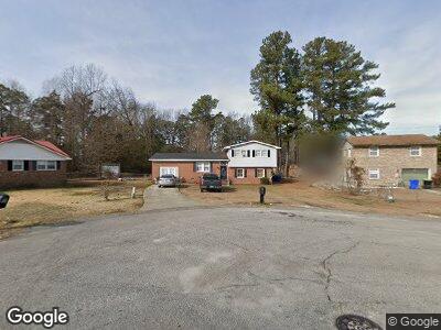
719 Curtis Cir Spring Lake, NC 28390
Estimated Value: $183,000 - $197,000
4
Beds
3
Baths
1,597
Sq Ft
$120/Sq Ft
Est. Value
About This Home
This home is located at 719 Curtis Cir, Spring Lake, NC 28390 and is currently estimated at $190,982, approximately $119 per square foot. 719 Curtis Cir is a home located in Cumberland County with nearby schools including Manchester Elementary School, Spring Lake Middle, and Pine Forest High.
Ownership History
Date
Name
Owned For
Owner Type
Purchase Details
Closed on
Dec 10, 2021
Sold by
Crocker Michael Terrell and Crocker Marchealmarcheal
Bought by
Crocker Michael Terrell and Crocker Marcheal
Current Estimated Value
Purchase Details
Closed on
Dec 11, 2015
Sold by
Crocker Patricia A
Bought by
Crocker Michael Terrell and Crocker Marcheal
Purchase Details
Closed on
Jun 29, 2011
Sold by
Ross Thomas J
Bought by
Crocker Michael T
Home Financials for this Owner
Home Financials are based on the most recent Mortgage that was taken out on this home.
Original Mortgage
$96,388
Interest Rate
4.75%
Mortgage Type
FHA
Purchase Details
Closed on
Nov 3, 2005
Sold by
Mangum Dedrick J
Bought by
Ross Thomas J
Home Financials for this Owner
Home Financials are based on the most recent Mortgage that was taken out on this home.
Original Mortgage
$84,273
Interest Rate
5.84%
Mortgage Type
VA
Create a Home Valuation Report for This Property
The Home Valuation Report is an in-depth analysis detailing your home's value as well as a comparison with similar homes in the area
Home Values in the Area
Average Home Value in this Area
Purchase History
| Date | Buyer | Sale Price | Title Company |
|---|---|---|---|
| Crocker Michael Terrell | -- | None Available | |
| Crocker Michael Terrell | -- | None Available | |
| Crocker Michael T | $99,000 | -- | |
| Ross Thomas J | $82,500 | -- |
Source: Public Records
Mortgage History
| Date | Status | Borrower | Loan Amount |
|---|---|---|---|
| Open | Crocker Michael Terrell | $11,903 | |
| Previous Owner | Crocker Michael T | $96,388 | |
| Previous Owner | Ross Thomas J | $84,273 |
Source: Public Records
Tax History Compared to Growth
Tax History
| Year | Tax Paid | Tax Assessment Tax Assessment Total Assessment is a certain percentage of the fair market value that is determined by local assessors to be the total taxable value of land and additions on the property. | Land | Improvement |
|---|---|---|---|---|
| 2024 | $1,821 | $102,813 | $11,000 | $91,813 |
| 2023 | $1,821 | $102,813 | $11,000 | $91,813 |
| 2022 | $1,638 | $102,813 | $11,000 | $91,813 |
| 2021 | $1,638 | $102,813 | $11,000 | $91,813 |
| 2019 | $1,609 | $86,600 | $11,000 | $75,600 |
| 2018 | $1,609 | $86,600 | $11,000 | $75,600 |
| 2017 | $1,609 | $86,600 | $11,000 | $75,600 |
| 2016 | $1,827 | $105,300 | $11,000 | $94,300 |
| 2015 | $1,827 | $105,300 | $11,000 | $94,300 |
| 2014 | $1,827 | $105,300 | $11,000 | $94,300 |
Source: Public Records
Map
Nearby Homes
- 719 Curtis Cir
- 721 Goodyear Dr
- 723 Goodyear Dr
- 715 Curtis Cir
- 713 Curtis Cir
- 711 Goodyear Dr
- 722 Goodyear Dr
- 724 Goodyear Dr
- 712 Goodyear Dr
- 726 Goodyear Dr
- 727 Goodyear Dr
- 708 Goodyear Dr
- 707 Goodyear Dr
- 729 Goodyear Dr
- 707 Francis Ct
- 706 Goodyear Dr
- 705 Francis Ct
- 709 Francis Ct
- 730 Goodyear Dr
- 705 Goodyear Dr