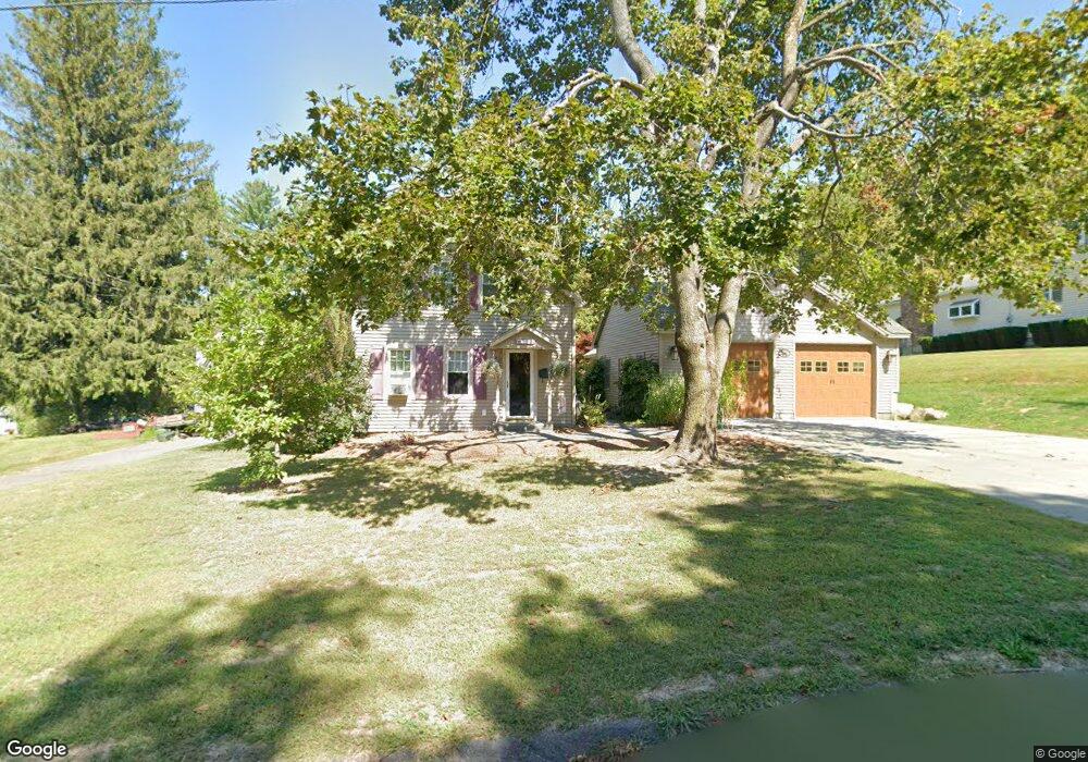
719 E Main St North Adams, MA 01247
Estimated Value: $324,000 - $371,000
About This Home
This home is located at 719 E Main St, North Adams, MA 01247 and is currently estimated at $341,171, approximately $185 per square foot. 719 E Main St is a home located in Berkshire County with nearby schools including Colegrove Park Elementary School and Drury High School.
Ownership History
We collect this data history from publicly available records. To have your information removed, we recommend requesting removal directly through your county’s website.
Purchase Details
Home Financials for this Owner
Home Financials are based on the most recent Mortgage that was taken out on this home.Purchase Details
Home Values in the Area
Average Home Value in this Area
Purchase History
We collect this data history from publicly available records. To have your information removed, we recommend requesting removal directly through your county’s website.
| Date | Buyer | Sale Price | Title Company |
|---|---|---|---|
| $90,000 | -- | ||
| $90,000 | -- | ||
| $81,500 | -- |
Mortgage History
We collect this data history from publicly available records. To have your information removed, we recommend requesting removal directly through your county’s website.
| Date | Status | Borrower | Loan Amount |
|---|---|---|---|
| Closed | $89,928 | ||
| Previous Owner | $95,400 | ||
| Previous Owner | $16,000 |
Tax History
We collect this data history from publicly available records. To have your information removed, we recommend requesting removal directly through your county’s website.
| Year | Tax Paid | Tax Assessment Tax Assessment Total Assessment is a certain percentage of the fair market value that is determined by local assessors to be the total taxable value of land and additions on the property. | Land | Improvement |
|---|---|---|---|---|
| 2025 | $5,142 | $307,700 | $39,700 | $268,000 |
| 2024 | $4,830 | $281,800 | $36,400 | $245,400 |
| 2023 | $4,734 | $267,900 | $36,400 | $231,500 |
| 2022 | $4,249 | $229,300 | $36,400 | $192,900 |
| 2021 | $3,953 | $212,400 | $33,700 | $178,700 |
| 2020 | $3,651 | $196,100 | $33,500 | $162,600 |
| 2019 | $3,491 | $182,700 | $33,500 | $149,200 |
| 2018 | $3,341 | $181,800 | $35,200 | $146,600 |
| 2017 | $3,181 | $180,000 | $34,900 | $145,100 |
| 2016 | $3,082 | $177,200 | $34,900 | $142,300 |
| 2015 | $3,128 | $187,400 | $36,100 | $151,300 |
Map
- 0 Mohawk Trail
- 124 Walker St
- 54 Pinehill Terrace
- 0 Beaver St
- 263 Walker St
- 0 Oak Hill Unit 237953
- 960 W Shaft Rd
- 350 Mohawk Trail
- 306 Union St
- 82 Cherry St
- 115 Cliff St
- 144 Pleasant St Unit 1
- 104 Tremont St
- 84 Washington Ave
- 130 Franklin St
- 168 Prospect St
- 49A Arnold Place
- 41 Prospect St
- 138 Church St
- 19-21 Blackinton St Unit 2
Ask me questions while you tour the home.