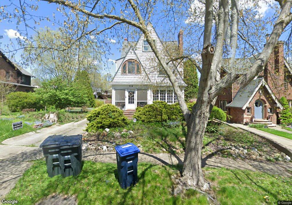
719 Ecton Rd Akron, OH 44303
Merriman Hills NeighborhoodEstimated Value: $295,000 - $330,000
6
Beds
3
Baths
2,455
Sq Ft
$126/Sq Ft
Est. Value
About This Home
This home is located at 719 Ecton Rd, Akron, OH 44303 and is currently estimated at $308,402, approximately $125 per square foot. 719 Ecton Rd is a home located in Summit County with nearby schools including King Community Learning Center, Towpath Trail High School, and Our Lady Of The Elms Elementary School.
Ownership History
Date
Name
Owned For
Owner Type
Purchase Details
Closed on
Mar 14, 2001
Sold by
Westfall Jerold D and Westfall Nancy S
Bought by
Piepho Scott R and Reiley Elizabeth A
Current Estimated Value
Home Financials for this Owner
Home Financials are based on the most recent Mortgage that was taken out on this home.
Original Mortgage
$148,300
Outstanding Balance
$54,445
Interest Rate
7.13%
Estimated Equity
$253,957
Create a Home Valuation Report for This Property
The Home Valuation Report is an in-depth analysis detailing your home's value as well as a comparison with similar homes in the area
Home Values in the Area
Average Home Value in this Area
Purchase History
| Date | Buyer | Sale Price | Title Company |
|---|---|---|---|
| Piepho Scott R | $174,500 | Midland Commerce Group |
Source: Public Records
Mortgage History
| Date | Status | Borrower | Loan Amount |
|---|---|---|---|
| Open | Piepho Scott R | $148,300 |
Source: Public Records
Tax History
| Year | Tax Paid | Tax Assessment Tax Assessment Total Assessment is a certain percentage of the fair market value that is determined by local assessors to be the total taxable value of land and additions on the property. | Land | Improvement |
|---|---|---|---|---|
| 2024 | $4,559 | $87,315 | $13,888 | $73,427 |
| 2023 | $4,559 | $87,315 | $13,888 | $73,427 |
| 2022 | $4,396 | $66,147 | $10,521 | $55,626 |
| 2021 | $4,401 | $66,147 | $10,521 | $55,626 |
| 2020 | $4,333 | $66,150 | $10,520 | $55,630 |
| 2019 | $3,800 | $52,540 | $9,990 | $42,550 |
| 2018 | $3,748 | $52,540 | $9,990 | $42,550 |
| 2017 | $3,808 | $52,540 | $9,990 | $42,550 |
| 2016 | $3,812 | $52,540 | $9,990 | $42,550 |
| 2015 | $3,808 | $52,520 | $9,990 | $42,530 |
| 2014 | $3,531 | $49,020 | $9,990 | $39,030 |
| 2013 | $3,462 | $49,080 | $9,990 | $39,090 |
Source: Public Records
Map
Nearby Homes
- 674 Upper Merriman Dr
- 569 Barwell St
- 505 Ridgecrest Rd
- 430 Delaware Ave
- 456 Merriman Rd
- 754 Merriman Rd
- 255 N Portage Path Unit 409
- 255 N Portage Path Unit 507
- 255 N Portage Path Unit 108
- 333 N Portage Path Unit 6
- 333 N Portage Path Unit 25
- 275 N Portage Path Unit 8A
- 275 N Portage Path Unit 7B
- 275 N Portage Path Unit 7g
- 467 Aqueduct St
- 428 Aqueduct St
- Plot A Weber Ave
- Plot B Weber Ave
- 481 Letchworth Dr
- 205 Edgerton Rd
Your Personal Tour Guide
Ask me questions while you tour the home.