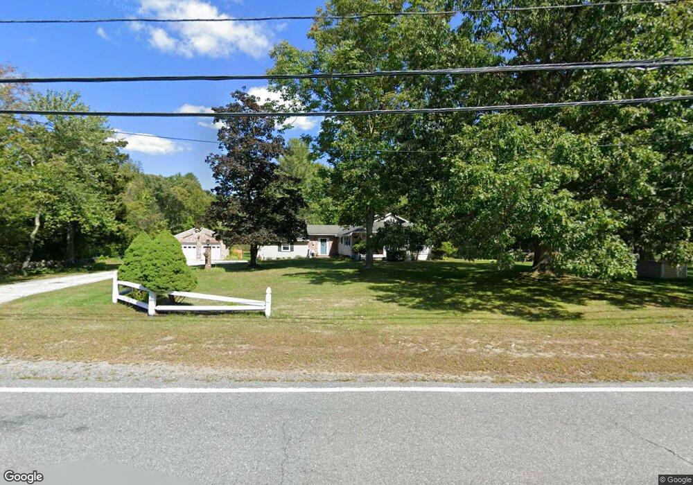
719 Main St Dunstable, MA 01827
Estimated Value: $523,127 - $669,000
3
Beds
1
Bath
1,156
Sq Ft
$495/Sq Ft
Est. Value
About This Home
This home is located at 719 Main St, Dunstable, MA 01827 and is currently estimated at $572,282, approximately $495 per square foot. 719 Main St is a home located in Middlesex County with nearby schools including Groton Dunstable Regional High School and 2nd Nature Academy.
Ownership History
Date
Name
Owned For
Owner Type
Purchase Details
Closed on
Oct 17, 2014
Sold by
Drew Lawrence A and Drew Jane
Bought by
Lawrence&Jane Drew Ret and Drew Lawrence A
Current Estimated Value
Purchase Details
Closed on
Nov 17, 2003
Sold by
Drew Lawrence A
Bought by
Drew Jane and Drew Lawrence A
Purchase Details
Closed on
Nov 19, 1990
Sold by
Bissell Todd
Bought by
Drew Lawrence A
Create a Home Valuation Report for This Property
The Home Valuation Report is an in-depth analysis detailing your home's value as well as a comparison with similar homes in the area
Home Values in the Area
Average Home Value in this Area
Purchase History
| Date | Buyer | Sale Price | Title Company |
|---|---|---|---|
| Lawrence&Jane Drew Ret | -- | -- | |
| Drew Jane | -- | -- | |
| Drew Lawrence A | $116,500 | -- |
Source: Public Records
Mortgage History
| Date | Status | Borrower | Loan Amount |
|---|---|---|---|
| Previous Owner | Drew Lawrence A | $81,000 |
Source: Public Records
Tax History Compared to Growth
Tax History
| Year | Tax Paid | Tax Assessment Tax Assessment Total Assessment is a certain percentage of the fair market value that is determined by local assessors to be the total taxable value of land and additions on the property. | Land | Improvement |
|---|---|---|---|---|
| 2025 | $6,241 | $453,900 | $225,800 | $228,100 |
| 2024 | $5,961 | $427,000 | $206,400 | $220,600 |
| 2023 | $6,168 | $412,000 | $206,400 | $205,600 |
| 2022 | $5,931 | $388,900 | $206,400 | $182,500 |
| 2021 | $14,274 | $326,700 | $188,600 | $138,100 |
| 2020 | $5,407 | $321,100 | $188,600 | $132,500 |
| 2019 | $5,478 | $321,100 | $188,600 | $132,500 |
| 2018 | $13,211 | $311,300 | $187,000 | $124,300 |
| 2017 | $5,249 | $308,400 | $187,000 | $121,400 |
| 2016 | $4,958 | $299,600 | $178,800 | $120,800 |
| 2015 | $4,574 | $273,400 | $151,100 | $122,300 |
| 2014 | $4,312 | $273,400 | $151,100 | $122,300 |
Source: Public Records
Map
Nearby Homes
- 62 Brook St
- 319 Pleasant St
- 4 Thorndike St
- 153 Off Pond St
- 0 Lowell St
- 121 Cherrywood Dr
- 5 Doucet Ave
- 11 Lojko Dr
- 1 Doucet Ave
- 58 Wilderness Dr
- 2 Wilderness Dr
- 1 Wilderness Dr
- 7 Wilderness Dr
- 79 Wilderness Dr
- 4 Wilderness Dr
- 65 Wilderness Dr
- 3 Wilderness Dr
- 6 Wilderness Dr
- 57 Wilderness Dr
- 59 Wilderness Dr