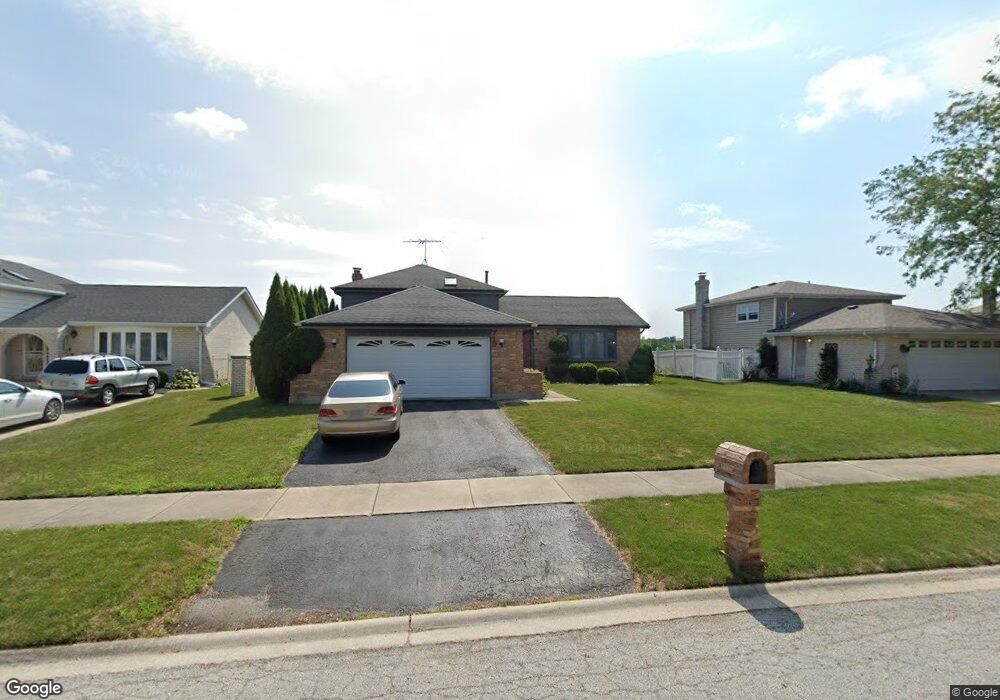
719 Old Meadow Rd Matteson, IL 60443
West Matteson NeighborhoodEstimated Value: $252,000 - $275,000
3
Beds
2
Baths
1,386
Sq Ft
$190/Sq Ft
Est. Value
About This Home
This home is located at 719 Old Meadow Rd, Matteson, IL 60443 and is currently estimated at $263,054, approximately $189 per square foot. 719 Old Meadow Rd is a home located in Cook County with nearby schools including Colin Powell Middle School.
Ownership History
Date
Name
Owned For
Owner Type
Purchase Details
Closed on
Feb 22, 2001
Sold by
Moore Brenda
Bought by
Williams Ronnie A
Current Estimated Value
Home Financials for this Owner
Home Financials are based on the most recent Mortgage that was taken out on this home.
Original Mortgage
$137,750
Outstanding Balance
$47,237
Interest Rate
6.91%
Estimated Equity
$215,817
Purchase Details
Closed on
Feb 8, 1996
Sold by
Moore Williams Brenda
Bought by
Moore Brenda
Home Financials for this Owner
Home Financials are based on the most recent Mortgage that was taken out on this home.
Original Mortgage
$117,000
Interest Rate
5.75%
Purchase Details
Closed on
Feb 7, 1996
Sold by
Williams Ronnie A and Moore Williams Brenda
Bought by
Moore Williams Brenda
Home Financials for this Owner
Home Financials are based on the most recent Mortgage that was taken out on this home.
Original Mortgage
$117,000
Interest Rate
5.75%
Create a Home Valuation Report for This Property
The Home Valuation Report is an in-depth analysis detailing your home's value as well as a comparison with similar homes in the area
Home Values in the Area
Average Home Value in this Area
Purchase History
| Date | Buyer | Sale Price | Title Company |
|---|---|---|---|
| Williams Ronnie A | $145,000 | -- | |
| Moore Brenda | -- | -- | |
| Moore Williams Brenda | -- | -- |
Source: Public Records
Mortgage History
| Date | Status | Borrower | Loan Amount |
|---|---|---|---|
| Open | Williams Ronnie A | $137,750 | |
| Previous Owner | Moore Brenda | $117,000 |
Source: Public Records
Tax History
| Year | Tax Paid | Tax Assessment Tax Assessment Total Assessment is a certain percentage of the fair market value that is determined by local assessors to be the total taxable value of land and additions on the property. | Land | Improvement |
|---|---|---|---|---|
| 2025 | $7,562 | $21,558 | $3,360 | $18,198 |
| 2024 | $7,562 | $21,558 | $3,360 | $18,198 |
| 2023 | $5,858 | $21,558 | $3,360 | $18,198 |
| 2022 | $5,858 | $14,361 | $2,940 | $11,421 |
| 2021 | $5,961 | $14,361 | $2,940 | $11,421 |
| 2020 | $6,712 | $15,955 | $2,940 | $13,015 |
| 2019 | $5,260 | $13,056 | $2,730 | $10,326 |
| 2018 | $6,309 | $15,153 | $2,730 | $12,423 |
| 2017 | $6,166 | $15,153 | $2,730 | $12,423 |
| 2016 | $6,040 | $14,168 | $2,520 | $11,648 |
| 2015 | $5,866 | $14,168 | $2,520 | $11,648 |
| 2014 | $5,734 | $14,168 | $2,520 | $11,648 |
| 2013 | $6,007 | $15,688 | $2,520 | $13,168 |
Source: Public Records
Map
Nearby Homes
- 6125 Sunflower Dr
- 6021 Spring Ln
- 6037 Spring Ln
- 6158 White Birch Ln
- 6306 Beaver Dam Rd
- 6216 Pond View Dr
- 443 Danielle Rd
- 5804 Kathryn Ln
- 5631 Colgate Ln
- 829 Princeton Ave
- 5808 Allemong Dr
- 912 Princeton Ave
- 152 Oakhurst Rd
- 1010 Regent Dr
- 997 Regent Dr
- 124 Oriole Rd
- 123 Oriole Rd
- 156 Cloverleaf Rd
- 133 Deerpath Rd
- 5620 Feathercreek Rd
- 727 Old Meadow Rd
- 713 Old Meadow Rd
- 705 Old Meadow Rd
- 718 Old Meadow Rd
- 726 Old Meadow Rd
- 712 Old Meadow Rd
- 741 Old Meadow Rd
- 732 Old Meadow Rd
- 704 Old Meadow Rd
- 740 Old Meadow Rd
- 657 Old Meadow Rd
- 725 Old Farm Rd
- 6033 Sunflower Dr
- 6040 White Birch Ln
- 748 Old Meadow Rd
- 6020 Sunflower Dr
- 739 Old Farm Rd
- 755 Old Meadow Rd
- 651 Old Meadow Rd
- 6039 Sunflower Dr
Your Personal Tour Guide
Ask me questions while you tour the home.