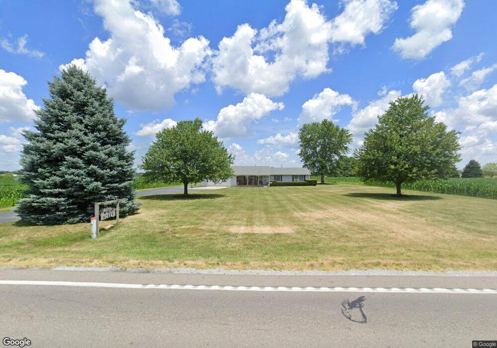
7195 W State Route 41 Covington, OH 45318
Estimated Value: $259,000 - $417,016
3
Beds
2
Baths
1,512
Sq Ft
$206/Sq Ft
Est. Value
About This Home
This home is located at 7195 W State Route 41, Covington, OH 45318 and is currently estimated at $311,004, approximately $205 per square foot. 7195 W State Route 41 is a home located in Miami County with nearby schools including Covington Elementary/Junior High School, Covington Junior High School, and Covington High School.
Ownership History
Date
Name
Owned For
Owner Type
Purchase Details
Closed on
Jan 8, 2021
Sold by
Johnson Keith F and Johnson Kevin
Bought by
Helman Anthony A and Helman Nicole S
Current Estimated Value
Home Financials for this Owner
Home Financials are based on the most recent Mortgage that was taken out on this home.
Original Mortgage
$180,000
Outstanding Balance
$158,801
Interest Rate
2.71%
Mortgage Type
Future Advance Clause Open End Mortgage
Estimated Equity
$152,203
Purchase Details
Closed on
Aug 21, 2000
Sold by
Johnson Keith E and Johnson Emily C
Bought by
Johnson Keith E and Johnson Emily C
Purchase Details
Closed on
Jan 1, 1990
Bought by
Johnson Keith E
Create a Home Valuation Report for This Property
The Home Valuation Report is an in-depth analysis detailing your home's value as well as a comparison with similar homes in the area
Purchase History
| Date | Buyer | Sale Price | Title Company |
|---|---|---|---|
| Helman Anthony A | $180,000 | None Available | |
| Helman Anthony A | -- | None Listed On Document | |
| Johnson Keith E | -- | -- | |
| Johnson Keith E | -- | -- |
Source: Public Records
Mortgage History
| Date | Status | Borrower | Loan Amount |
|---|---|---|---|
| Open | Helman Anthony A | $180,000 | |
| Closed | Helman Anthony A | $180,000 |
Source: Public Records
Tax History
| Year | Tax Paid | Tax Assessment Tax Assessment Total Assessment is a certain percentage of the fair market value that is determined by local assessors to be the total taxable value of land and additions on the property. | Land | Improvement |
|---|---|---|---|---|
| 2025 | $2,950 | $97,080 | $24,280 | $72,800 |
| 2024 | $2,950 | $75,590 | $18,220 | $57,370 |
| 2023 | $2,532 | $75,590 | $18,220 | $57,370 |
| 2022 | $2,564 | $75,590 | $18,220 | $57,370 |
| 2021 | $2,166 | $59,580 | $15,440 | $44,140 |
| 2020 | $1,853 | $59,580 | $15,440 | $44,140 |
| 2019 | $1,848 | $59,580 | $15,440 | $44,140 |
| 2018 | $1,783 | $58,480 | $19,170 | $39,310 |
| 2017 | $1,819 | $58,480 | $19,170 | $39,310 |
| 2016 | $1,747 | $58,480 | $19,170 | $39,310 |
| 2015 | $1,591 | $53,820 | $16,750 | $37,070 |
| 2014 | $1,591 | $53,820 | $16,750 | $37,070 |
| 2013 | $1,599 | $53,820 | $16,750 | $37,070 |
Source: Public Records
Map
Nearby Homes
- 7121 W State Route 41
- 7071 W State Route 41
- 7401 W State Route 41
- 7015 W State Route 41
- 6831 W State Route 41
- 2000 Industrial Ct
- 2000 Industrial Ct
- 7020 W State Route 41
- 2111 Mote Dr
- 6797 W State Route 41
- 2600 Mote Dr
- 2064 Industrial Ct
- 2450 Mote Dr
- 114 Crosby St
- 8262 W State Route 41
- 112 Crosby St
- 1000 Dick Minnich Dr
- 110 Crosby St
- 113 Crosby St
- 108 Crosby St
Your Personal Tour Guide
Ask me questions while you tour the home.