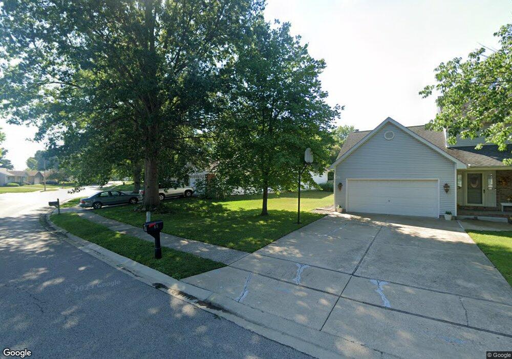
72 Brighton Rd Springfield, IL 62702
Estimated Value: $219,000 - $225,000
3
Beds
2
Baths
1,580
Sq Ft
$141/Sq Ft
Est. Value
About This Home
This home is located at 72 Brighton Rd, Springfield, IL 62702 and is currently estimated at $222,073, approximately $140 per square foot. 72 Brighton Rd is a home located in Sangamon County with nearby schools including Dubois Elementary School, U.S. Grant Middle School, and Springfield High School.
Ownership History
Date
Name
Owned For
Owner Type
Purchase Details
Closed on
Aug 31, 2009
Current Estimated Value
Purchase Details
Closed on
May 8, 2009
Purchase Details
Closed on
Apr 28, 2009
Purchase Details
Closed on
Sep 3, 2008
Purchase Details
Closed on
May 16, 2007
Purchase Details
Closed on
May 13, 2004
Purchase Details
Closed on
Sep 11, 2002
Purchase Details
Closed on
May 24, 2002
Purchase Details
Closed on
May 31, 2000
Purchase Details
Closed on
Apr 1, 1999
Purchase Details
Closed on
Oct 16, 1996
Create a Home Valuation Report for This Property
The Home Valuation Report is an in-depth analysis detailing your home's value as well as a comparison with similar homes in the area
Purchase History
| Date | Buyer | Sale Price | Title Company |
|---|---|---|---|
| -- | $113,900 | -- | |
| -- | -- | -- | |
| -- | $143,000 | -- | |
| -- | -- | -- | |
| -- | -- | -- | |
| -- | $147,000 | -- | |
| -- | $137,500 | -- | |
| -- | -- | -- | |
| -- | $134,900 | -- | |
| -- | $118,900 | -- | |
| -- | -- | -- |
Source: Public Records
Tax History
| Year | Tax Paid | Tax Assessment Tax Assessment Total Assessment is a certain percentage of the fair market value that is determined by local assessors to be the total taxable value of land and additions on the property. | Land | Improvement |
|---|---|---|---|---|
| 2024 | $3,967 | $53,232 | $12,207 | $41,025 |
| 2023 | $3,592 | $48,623 | $11,150 | $37,473 |
| 2022 | $3,416 | $46,123 | $10,577 | $35,546 |
| 2021 | $3,276 | $44,396 | $10,181 | $34,215 |
| 2020 | $3,170 | $43,991 | $10,196 | $33,795 |
| 2019 | $4,173 | $56,101 | $10,161 | $45,940 |
| 2018 | $2,900 | $40,326 | $10,112 | $30,214 |
| 2017 | $2,834 | $39,804 | $9,981 | $29,823 |
| 2016 | $2,771 | $39,223 | $9,835 | $29,388 |
| 2015 | $2,738 | $38,754 | $9,717 | $29,037 |
| 2014 | $2,738 | $38,503 | $9,654 | $28,849 |
| 2013 | $2,677 | $39,041 | $9,654 | $29,387 |
Source: Public Records
Map
Nearby Homes
- 3400 Briana Dr
- 6 Redwood Ln
- 3229 W Point Dr
- 36 Trailridge Ln Unit 152
- 804 Fairfax Ct
- 1038 N Koke Mill Rd
- 3424 Bluff Rd
- 160 S Durkin Dr Unit 4
- 243 S Durkin Dr Unit 24
- 3613 Briana Dr
- 3612 Melissa Dr
- 504 Brandywine Rd
- 2900 W Lawrence Ave
- 812 Roanoke Dr
- 2651 W Lawrence Ave Unit 2
- 107 Collier Dr
- 608 Rock River Rd
- 609 Rock River Rd
- 612 Rock River Rd
- 613 Rock River Rd
- 68 Brighton Rd
- 233 Westbrook Dr
- 240 Westbrook Dr
- 83 Brighton Rd
- 229 Westbrook Dr
- 236 Westbrook Dr
- 216 Prestwick Rd
- 52 Brighton Rd
- 69 Brighton Rd
- 225 Westbrook Dr
- 232 Westbrook Dr
- 87 Springbrook Dr
- 212 Prestwick Rd
- 1 Hollybrook Dr
- 63 Brighton Rd
- 228 Westbrook Dr
- 91 Springbrook Dr
- 221 Westbrook Dr
- 208 Prestwick Rd
- 5 Hollybrook Dr
Your Personal Tour Guide
Ask me questions while you tour the home.