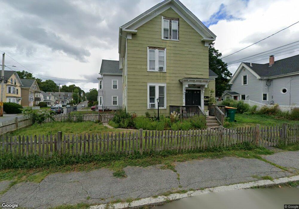
72 Broad St North Attleboro, MA 02760
Estimated Value: $620,000 - $778,000
8
Beds
3
Baths
2,916
Sq Ft
$237/Sq Ft
Est. Value
About This Home
This home is located at 72 Broad St, North Attleboro, MA 02760 and is currently estimated at $691,992, approximately $237 per square foot. 72 Broad St is a home located in Bristol County with nearby schools including North Attleboro High School and Discovery Daycare Center.
Ownership History
Date
Name
Owned For
Owner Type
Purchase Details
Closed on
Nov 29, 2016
Sold by
Jjob Llc
Bought by
Short Michael
Current Estimated Value
Home Financials for this Owner
Home Financials are based on the most recent Mortgage that was taken out on this home.
Original Mortgage
$343,561
Outstanding Balance
$276,990
Interest Rate
3.47%
Mortgage Type
FHA
Estimated Equity
$415,002
Purchase Details
Closed on
May 11, 2016
Sold by
Northeast Assets Inc
Bought by
Jjob Llc
Home Financials for this Owner
Home Financials are based on the most recent Mortgage that was taken out on this home.
Original Mortgage
$375,000
Interest Rate
3.71%
Mortgage Type
New Conventional
Purchase Details
Closed on
Aug 20, 2004
Sold by
Hofmann Scott
Bought by
Amaya Rosa and Amaya Sebastian
Home Financials for this Owner
Home Financials are based on the most recent Mortgage that was taken out on this home.
Original Mortgage
$297,400
Interest Rate
6.03%
Mortgage Type
Purchase Money Mortgage
Purchase Details
Closed on
Nov 19, 2001
Sold by
Baskin Gennady and Baskin Emma
Bought by
Hofmann Scott
Home Financials for this Owner
Home Financials are based on the most recent Mortgage that was taken out on this home.
Original Mortgage
$290,343
Interest Rate
6.7%
Mortgage Type
Purchase Money Mortgage
Purchase Details
Closed on
Feb 24, 1999
Sold by
Fleet Mtg Corp
Bought by
Baskin Gennady N and Baskin Emma
Home Financials for this Owner
Home Financials are based on the most recent Mortgage that was taken out on this home.
Original Mortgage
$140,000
Interest Rate
6.78%
Mortgage Type
Purchase Money Mortgage
Purchase Details
Closed on
Nov 4, 1998
Sold by
Leonard Darren J
Bought by
Fleet Mtg Corp
Purchase Details
Closed on
Jan 31, 1989
Sold by
George Frederick A
Bought by
Leonard Darren J
Home Financials for this Owner
Home Financials are based on the most recent Mortgage that was taken out on this home.
Original Mortgage
$158,400
Interest Rate
10.66%
Mortgage Type
Purchase Money Mortgage
Create a Home Valuation Report for This Property
The Home Valuation Report is an in-depth analysis detailing your home's value as well as a comparison with similar homes in the area
Home Values in the Area
Average Home Value in this Area
Purchase History
| Date | Buyer | Sale Price | Title Company |
|---|---|---|---|
| Short Michael | $349,900 | -- | |
| Jjob Llc | $325,000 | -- | |
| Amaya Rosa | $424,900 | -- | |
| Hofmann Scott | $294,900 | -- | |
| Baskin Gennady N | $114,250 | -- | |
| Fleet Mtg Corp | $135,000 | -- | |
| Leonard Darren J | $176,000 | -- |
Source: Public Records
Mortgage History
| Date | Status | Borrower | Loan Amount |
|---|---|---|---|
| Open | Short Michael | $343,561 | |
| Previous Owner | Jjob Llc | $375,000 | |
| Previous Owner | Amaya Rosa | $297,400 | |
| Previous Owner | Leonard Darren J | $290,343 | |
| Previous Owner | Leonard Darren J | $140,000 | |
| Previous Owner | Leonard Darren J | $158,400 |
Source: Public Records
Tax History
| Year | Tax Paid | Tax Assessment Tax Assessment Total Assessment is a certain percentage of the fair market value that is determined by local assessors to be the total taxable value of land and additions on the property. | Land | Improvement |
|---|---|---|---|---|
| 2025 | $5,764 | $488,900 | $100,000 | $388,900 |
| 2024 | $5,642 | $488,900 | $100,000 | $388,900 |
| 2023 | $5,912 | $462,200 | $100,000 | $362,200 |
| 2022 | $5,507 | $395,300 | $100,000 | $295,300 |
| 2021 | $2,515 | $399,400 | $100,000 | $299,400 |
| 2020 | $2,750 | $317,300 | $100,000 | $217,300 |
| 2019 | $2,752 | $312,800 | $90,800 | $222,000 |
| 2018 | $4,173 | $312,800 | $90,800 | $222,000 |
| 2017 | $2,716 | $266,800 | $90,800 | $176,000 |
| 2016 | $3,453 | $261,200 | $101,000 | $160,200 |
| 2015 | $3,303 | $251,400 | $106,000 | $145,400 |
| 2014 | $3,280 | $247,700 | $98,100 | $149,600 |
Source: Public Records
Map
Nearby Homes
- 3 Riley Ct
- 271 N Washington St
- 117 Church St Unit 4
- 16 Richards Ave Unit 306
- 16 Richards Ave Unit 204
- 85 Bank St
- 200 Smith St
- 157 Fisher St
- 6 Al Pace Dr Unit B
- 32-34 Columbia St
- 218 High St
- 35-R Whiting St
- 31 Whiting St
- 212 Fisher St Unit A13
- 84 Barrows St
- 42 2nd Ave Unit 20
- 173 Elm St
- 23-R Eddy Street (Eddy St Rear)
- 16 Johnson St
- 173 S Washington St
- 70 Broad St Unit 3
- 70 Broad St Unit 2
- 70 Broad St Unit 1
- 70 Broad St
- 66 Broad St
- 76 Broad St
- 9 Leonard St Unit 2
- 9 Leonard St Unit 3
- 64 Broad St
- 64 Broad St Unit 2
- 64 Broad St Unit 3
- 64 Broad St Unit 1
- 71 Broad St
- 75 Broad St
- 65 Broad St
- 65 Broad St Unit 3
- 65 Broad St Unit 2
- 65 Broad St Unit 1
- 86 Broad St
- 86 Broad St Unit 2
Your Personal Tour Guide
Ask me questions while you tour the home.