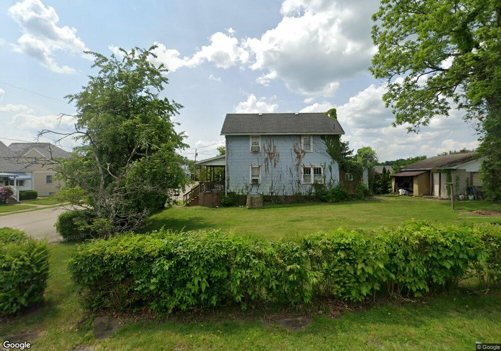
72 Connor St Uniontown, PA 15401
Estimated Value: $131,000 - $171,000
3
Beds
2
Baths
1,558
Sq Ft
$95/Sq Ft
Est. Value
About This Home
This home is located at 72 Connor St, Uniontown, PA 15401 and is currently estimated at $148,302, approximately $95 per square foot. 72 Connor St is a home located in Fayette County with nearby schools including Laurel Highlands Senior High School, St. John the Evangelist School, and Chestnut Ridge Christian Academy.
Ownership History
Date
Name
Owned For
Owner Type
Purchase Details
Closed on
Apr 15, 2025
Sold by
Fischer David Roy
Bought by
Fischer Robert Paul
Current Estimated Value
Purchase Details
Closed on
Mar 31, 2022
Sold by
Fischer Roy P and Fischer Linda J
Bought by
Fischer Robert Paul
Purchase Details
Closed on
Oct 8, 2014
Sold by
Murray Helen J and Murray James D
Bought by
Bontrager Joanna J and Fischer Robert F
Purchase Details
Closed on
Jan 1, 1968
Bought by
Bontrager Joanna J
Create a Home Valuation Report for This Property
The Home Valuation Report is an in-depth analysis detailing your home's value as well as a comparison with similar homes in the area
Home Values in the Area
Average Home Value in this Area
Purchase History
| Date | Buyer | Sale Price | Title Company |
|---|---|---|---|
| Fischer Robert Paul | -- | None Listed On Document | |
| Fischer Robert Paul | -- | None Listed On Document | |
| Fischer Robert Paul | $3,500 | None Listed On Document | |
| Bontrager Joanna J | -- | None Available | |
| Bontrager Joanna J | -- | -- |
Source: Public Records
Tax History Compared to Growth
Tax History
| Year | Tax Paid | Tax Assessment Tax Assessment Total Assessment is a certain percentage of the fair market value that is determined by local assessors to be the total taxable value of land and additions on the property. | Land | Improvement |
|---|---|---|---|---|
| 2025 | $739 | $25,910 | $9,630 | $16,280 |
| 2024 | $718 | $25,910 | $9,630 | $16,280 |
| 2023 | $1,382 | $25,910 | $9,630 | $16,280 |
| 2022 | $1,369 | $25,910 | $9,630 | $16,280 |
| 2021 | $1,331 | $25,910 | $9,630 | $16,280 |
| 2020 | $1,331 | $25,910 | $9,630 | $16,280 |
| 2019 | $1,222 | $25,910 | $9,630 | $16,280 |
| 2018 | $1,185 | $25,910 | $9,630 | $16,280 |
| 2017 | $1,185 | $25,910 | $9,630 | $16,280 |
| 2016 | -- | $25,910 | $9,630 | $16,280 |
| 2015 | -- | $25,910 | $9,630 | $16,280 |
| 2014 | -- | $51,820 | $19,260 | $32,560 |
Source: Public Records
Map
Nearby Homes