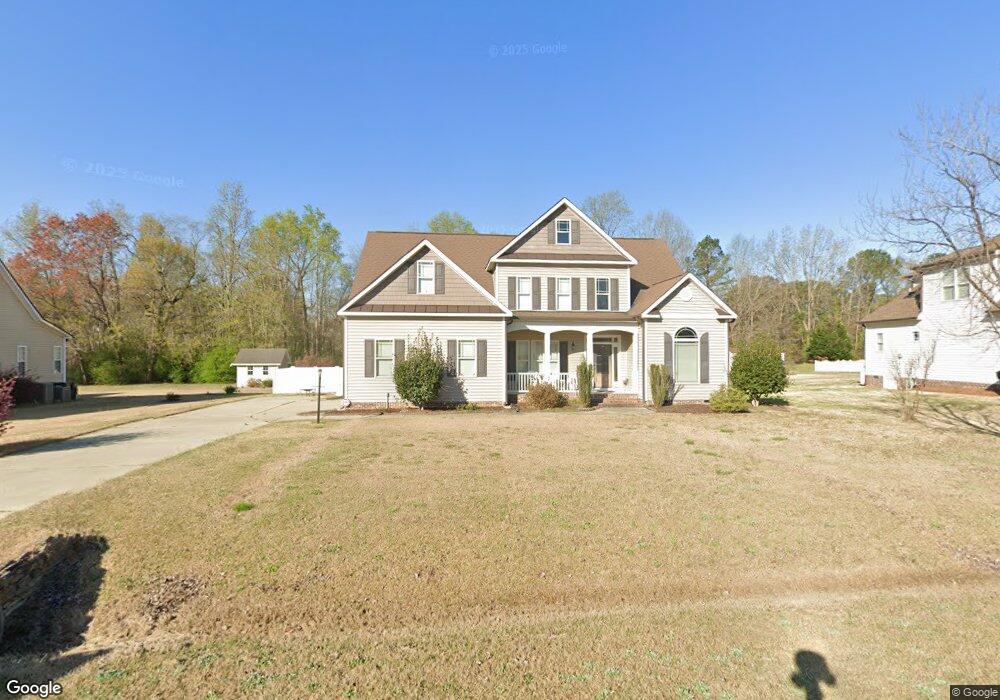
72 Elmhurst Ln Willow Spring, NC 27592
Pleasant Grove NeighborhoodEstimated Value: $451,000 - $493,000
3
Beds
4
Baths
2,757
Sq Ft
$171/Sq Ft
Est. Value
About This Home
This home is located at 72 Elmhurst Ln, Willow Spring, NC 27592 and is currently estimated at $470,537, approximately $170 per square foot. 72 Elmhurst Ln is a home located in Johnston County with nearby schools including Dixon Road Elementary School, McGee's Crossroads Middle School, and West Johnston High School.
Ownership History
Date
Name
Owned For
Owner Type
Purchase Details
Closed on
May 19, 2011
Sold by
Carolina Classic Construction Inc
Bought by
Brown Donna P
Current Estimated Value
Home Financials for this Owner
Home Financials are based on the most recent Mortgage that was taken out on this home.
Original Mortgage
$100,000
Outstanding Balance
$69,207
Interest Rate
4.79%
Mortgage Type
New Conventional
Estimated Equity
$401,330
Purchase Details
Closed on
Aug 20, 2010
Sold by
S & S Land Development Llc
Bought by
Carolina Classic Construction Inc
Home Financials for this Owner
Home Financials are based on the most recent Mortgage that was taken out on this home.
Original Mortgage
$202,220
Interest Rate
4.59%
Mortgage Type
Credit Line Revolving
Create a Home Valuation Report for This Property
The Home Valuation Report is an in-depth analysis detailing your home's value as well as a comparison with similar homes in the area
Home Values in the Area
Average Home Value in this Area
Purchase History
| Date | Buyer | Sale Price | Title Company |
|---|---|---|---|
| Brown Donna P | $267,000 | Chicago Title Insurance Co | |
| Carolina Classic Construction Inc | $53,000 | Chicago Title Insurance Co |
Source: Public Records
Mortgage History
| Date | Status | Borrower | Loan Amount |
|---|---|---|---|
| Open | Brown Donna P | $100,000 | |
| Previous Owner | Carolina Classic Construction Inc | $202,220 |
Source: Public Records
Tax History
| Year | Tax Paid | Tax Assessment Tax Assessment Total Assessment is a certain percentage of the fair market value that is determined by local assessors to be the total taxable value of land and additions on the property. | Land | Improvement |
|---|---|---|---|---|
| 2025 | $2,649 | $417,190 | $75,000 | $342,190 |
| 2024 | $693 | $270,770 | $45,000 | $225,770 |
| 2023 | $2,126 | $270,770 | $45,000 | $225,770 |
| 2022 | $2,193 | $270,770 | $45,000 | $225,770 |
| 2021 | $2,193 | $270,770 | $45,000 | $225,770 |
| 2020 | $2,274 | $270,770 | $45,000 | $225,770 |
| 2019 | $2,220 | $270,770 | $45,000 | $225,770 |
| 2018 | $0 | $247,850 | $40,000 | $207,850 |
| 2017 | $2,082 | $247,850 | $40,000 | $207,850 |
| 2016 | $2,082 | $247,850 | $40,000 | $207,850 |
| 2015 | $2,082 | $247,850 | $40,000 | $207,850 |
| 2014 | -- | $247,850 | $40,000 | $207,850 |
Source: Public Records
Map
Nearby Homes
- 55 Dolores Ct
- 200 Reese Dr
- 50 Linden Ct
- 102 Ina Joe Place
- 368 Artic Cir
- 304 Artic Cir
- 58 Tractor Place
- 131 Artic Cir
- 111 Artic Cir
- 181 Fawn Hill Ct
- 232 Fawn Hill Ct
- 160 W Fountainhead Ln
- 122 Fountainhead Ln
- 48 Banbury Ct
- 336 Tennyson Dr
- 16 Saddle Ridge Dr
- 142 Jacqueline Dr
- 127 Wagon Trail
- 268 Tennyson Dr
- 623 Ravensworth Dr Unit Lot 149
Your Personal Tour Guide
Ask me questions while you tour the home.