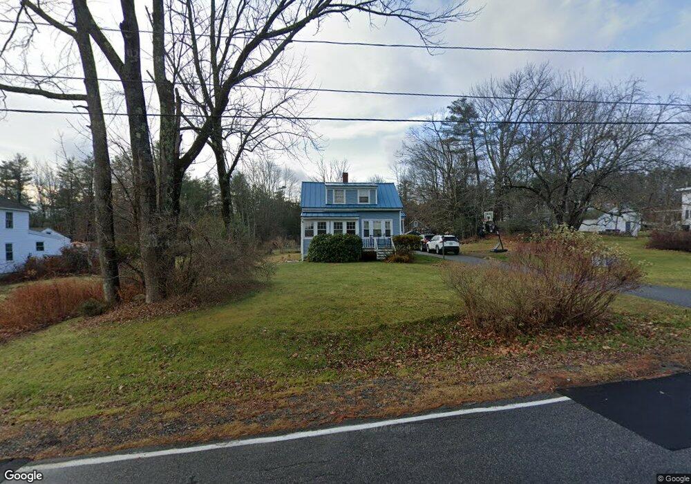
72 Elmwood Ave Westbrook, ME 04092
Estimated Value: $341,000 - $369,000
2
Beds
1
Bath
782
Sq Ft
$449/Sq Ft
Est. Value
About This Home
This home is located at 72 Elmwood Ave, Westbrook, ME 04092 and is currently estimated at $350,857, approximately $448 per square foot. 72 Elmwood Ave is a home located in Cumberland County with nearby schools including Westbrook High School, St. Brigid School, and Breakwater School.
Ownership History
Date
Name
Owned For
Owner Type
Purchase Details
Closed on
Jun 3, 2013
Sold by
Shaw Tina M
Bought by
Hibbard Jessica and Hibbard Chester
Current Estimated Value
Home Financials for this Owner
Home Financials are based on the most recent Mortgage that was taken out on this home.
Original Mortgage
$139,112
Outstanding Balance
$98,780
Interest Rate
3.45%
Mortgage Type
FHA
Estimated Equity
$252,077
Create a Home Valuation Report for This Property
The Home Valuation Report is an in-depth analysis detailing your home's value as well as a comparison with similar homes in the area
Home Values in the Area
Average Home Value in this Area
Purchase History
| Date | Buyer | Sale Price | Title Company |
|---|---|---|---|
| Hibbard Jessica | -- | -- |
Source: Public Records
Mortgage History
| Date | Status | Borrower | Loan Amount |
|---|---|---|---|
| Open | Hibbard Jessica | $139,112 |
Source: Public Records
Tax History Compared to Growth
Tax History
| Year | Tax Paid | Tax Assessment Tax Assessment Total Assessment is a certain percentage of the fair market value that is determined by local assessors to be the total taxable value of land and additions on the property. | Land | Improvement |
|---|---|---|---|---|
| 2023 | $3,388 | $203,100 | $90,300 | $112,800 |
| 2022 | $3,063 | $169,200 | $75,200 | $94,000 |
| 2021 | $3,017 | $169,200 | $75,200 | $94,000 |
| 2020 | $3,022 | $169,200 | $75,200 | $94,000 |
| 2019 | $3,022 | $169,200 | $75,200 | $94,000 |
| 2018 | $2,334 | $140,200 | $65,400 | $74,800 |
| 2017 | $2,647 | $140,200 | $65,400 | $74,800 |
| 2016 | $2,580 | $140,200 | $65,400 | $74,800 |
| 2015 | $2,518 | $140,200 | $65,400 | $74,800 |
| 2014 | $2,411 | $140,200 | $65,400 | $74,800 |
| 2013 | $2,360 | $137,200 | $65,400 | $71,800 |
Source: Public Records
Map
Nearby Homes
- 20 Elmwood Ave
- 171 Brook St Unit 2
- 171 Brook St Unit 1
- 171 Brook St Unit 41
- 171 Brook St Unit 45
- 171 Brook St Unit 65
- 171 Brook St Unit 76
- 375 Bridgton Rd Unit 43
- 300 Brook St
- 128 Grandview Dr Unit 8
- 18 Calla Lilly Ln Unit 95
- 290 Bridgton Rd Unit 1
- 145 Brooks Edge Farm Rd Unit 66
- 21 Virginia St
- 151 Brooks Edge Farm Rd Unit 68
- 42 Villa Rd
- 155 Bridgton Rd
- 0 Reed St
- 384 Austin St
- 317 Austin St Unit 7
- 64 Elmwood Ave
- 82 Elmwood Ave
- 71 Elmwood Ave
- Lot 3 Berkshire Way
- Lot 8 Berkshire Way
- 465 Bridgton Rd
- 6 Berkshire Way
- 6 Berkshire Way
- 90 Elmwood Ave
- 5 Berkshire Way
- 61 Elmwood Ave
- 445 Bridgton Rd
- 456 Bridgton Rd
- 460 Bridgton Rd
- 85 Elmwood Ave
- 485 Bridgton Rd
- 115 Wildwood Cir
- 468 Bridgton Rd
- 452 Bridgton Rd
- 49 Elmwood Ave