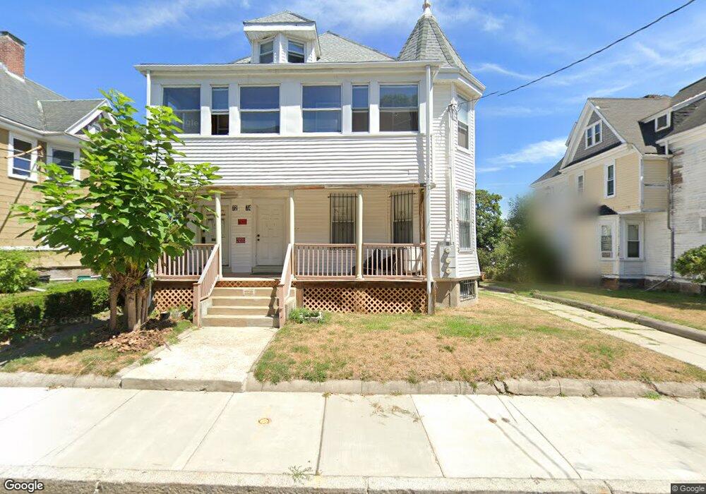
72 Homestead St Dorchester, MA 02121
Washington Park NeighborhoodEstimated Value: $836,000 - $957,000
6
Beds
3
Baths
3,728
Sq Ft
$239/Sq Ft
Est. Value
About This Home
This home is located at 72 Homestead St, Dorchester, MA 02121 and is currently estimated at $891,255, approximately $239 per square foot. 72 Homestead St is a home located in Suffolk County with nearby schools including Bridge Boston Charter School and Mother Caroline Academy & Education Center.
Ownership History
Date
Name
Owned For
Owner Type
Purchase Details
Closed on
Feb 14, 2003
Sold by
Lobo Maria G and Lobo Eric G
Bought by
Sobers Athelston
Current Estimated Value
Purchase Details
Closed on
Mar 6, 1995
Sold by
Homestead St Re
Bought by
Lobo Maria G
Purchase Details
Closed on
Dec 27, 1994
Sold by
Money Store Mass Inc
Bought by
Homestead St Re T
Purchase Details
Closed on
Aug 2, 1994
Sold by
Lynch Delphia E and Money Store/Mass Inc
Bought by
Money Store Mass Inc
Purchase Details
Closed on
Sep 26, 1991
Sold by
Money Store-Mass Inc
Bought by
Lynch Delphia E and Lynch Joan C
Purchase Details
Closed on
Jun 7, 1990
Sold by
Peaks Frederick L
Bought by
Money Store-Mass Inc
Create a Home Valuation Report for This Property
The Home Valuation Report is an in-depth analysis detailing your home's value as well as a comparison with similar homes in the area
Home Values in the Area
Average Home Value in this Area
Purchase History
| Date | Buyer | Sale Price | Title Company |
|---|---|---|---|
| Sobers Athelston | $177,000 | -- | |
| Lobo Maria G | $159,000 | -- | |
| Homestead St Re T | $33,000 | -- | |
| Money Store Mass Inc | $40,000 | -- | |
| Lynch Delphia E | $125,000 | -- | |
| Money Store-Mass Inc | $140,000 | -- |
Source: Public Records
Mortgage History
| Date | Status | Borrower | Loan Amount |
|---|---|---|---|
| Open | Money Store-Mass Inc | $360,800 |
Source: Public Records
Tax History Compared to Growth
Tax History
| Year | Tax Paid | Tax Assessment Tax Assessment Total Assessment is a certain percentage of the fair market value that is determined by local assessors to be the total taxable value of land and additions on the property. | Land | Improvement |
|---|---|---|---|---|
| 2025 | $8,191 | $707,300 | $270,100 | $437,200 |
| 2024 | $7,602 | $697,400 | $226,200 | $471,200 |
| 2023 | $7,002 | $652,000 | $211,500 | $440,500 |
| 2022 | $6,450 | $592,800 | $192,300 | $400,500 |
| 2021 | $5,911 | $554,000 | $179,700 | $374,300 |
| 2020 | $4,934 | $467,200 | $178,300 | $288,900 |
| 2019 | $4,617 | $438,000 | $140,000 | $298,000 |
| 2018 | $4,251 | $405,600 | $140,000 | $265,600 |
| 2017 | $4,129 | $389,900 | $140,000 | $249,900 |
| 2016 | $3,830 | $348,200 | $140,000 | $208,200 |
| 2015 | $3,628 | $299,600 | $107,000 | $192,600 |
| 2014 | $3,241 | $257,600 | $107,000 | $150,600 |
Source: Public Records
Map
Nearby Homes
- 75 Ruthven St
- 9 Abbotsford St Unit 1
- 214 Humboldt Ave
- 4 Ruthven St
- 78 Hutchings St Unit 1
- 136-138 Homestead St
- 164 Ruthven St Unit 1
- 28 Wabon St
- 25 Hutchings St
- 99 Harrishof St
- 41 W Walnut Park
- 151 Townsend St
- 7 Waumbeck St Unit 3
- 4 Wyoming St Unit 2
- 27 Dixwell St Unit 11
- 27 Dixwell St Unit 12
- 27 Dixwell St Unit 4
- 495 Warren St
- 1-3 Glines Ave
- 90 Munroe St
- 74 Homestead St Unit 1
- 76 Homestead St
- 68 Homestead St
- 95 Ruthven St
- 97 Ruthven St
- 99 Ruthven St Unit 101
- 89 Ruthven St
- 89 Ruthven St Unit 2
- 89 Ruthven St Unit 3
- 89 Ruthven St Unit 1
- 71 Homestead St
- 71 Homestead St Unit 2
- 71 Homestead St Unit 1
- 75 Homestead St
- 75 Homestead St Unit 4
- 75 Homestead St Unit 3
- 75 Homestead St Unit 6
- 75 Homestead St Unit 5
- 75 Homestead St Unit 2
- 75 Homestead St Unit 1