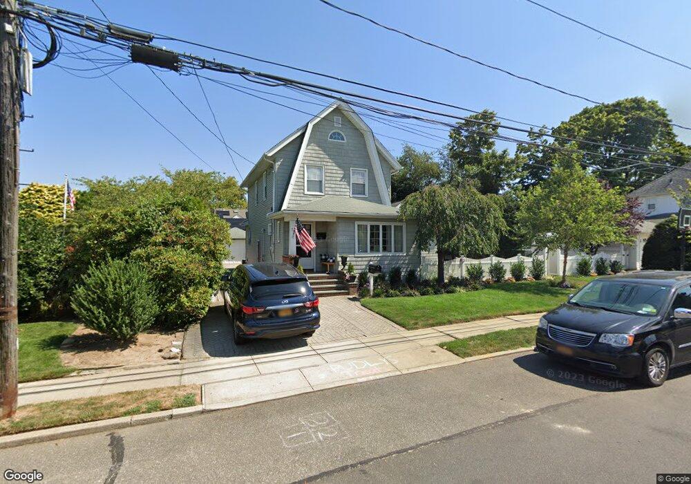
72 Horton St Malverne, NY 11565
Estimated Value: $785,733 - $849,000
--
Bed
2
Baths
1,920
Sq Ft
$426/Sq Ft
Est. Value
About This Home
This home is located at 72 Horton St, Malverne, NY 11565 and is currently estimated at $817,367, approximately $425 per square foot. 72 Horton St is a home located in Nassau County with nearby schools including Our Lady of Lourdes School, Grace Lutheran School, and Cheder at the Ohel.
Ownership History
Date
Name
Owned For
Owner Type
Purchase Details
Closed on
Jun 7, 2016
Sold by
Burns Barry and Burns Kathleen M
Bought by
Kunz Michael and Shaw Jessica
Current Estimated Value
Home Financials for this Owner
Home Financials are based on the most recent Mortgage that was taken out on this home.
Original Mortgage
$440,000
Outstanding Balance
$350,191
Interest Rate
3.57%
Mortgage Type
New Conventional
Estimated Equity
$467,176
Create a Home Valuation Report for This Property
The Home Valuation Report is an in-depth analysis detailing your home's value as well as a comparison with similar homes in the area
Home Values in the Area
Average Home Value in this Area
Purchase History
| Date | Buyer | Sale Price | Title Company |
|---|---|---|---|
| Kunz Michael | $550,000 | None Available |
Source: Public Records
Mortgage History
| Date | Status | Borrower | Loan Amount |
|---|---|---|---|
| Open | Kunz Michael | $440,000 |
Source: Public Records
Tax History Compared to Growth
Tax History
| Year | Tax Paid | Tax Assessment Tax Assessment Total Assessment is a certain percentage of the fair market value that is determined by local assessors to be the total taxable value of land and additions on the property. | Land | Improvement |
|---|---|---|---|---|
| 2025 | $10,607 | $598 | $242 | $356 |
| 2024 | $1,212 | $565 | $228 | $337 |
| 2023 | $9,836 | $595 | $240 | $355 |
| 2022 | $9,836 | $600 | $242 | $358 |
| 2021 | $14,036 | $594 | $240 | $354 |
| 2020 | $10,071 | $770 | $597 | $173 |
| 2019 | $10,121 | $825 | $476 | $349 |
| 2018 | $10,235 | $1,109 | $0 | $0 |
| 2017 | $10,907 | $1,109 | $640 | $469 |
| 2016 | $12,510 | $1,109 | $640 | $469 |
| 2015 | $1,633 | $1,109 | $640 | $469 |
| 2014 | $1,633 | $1,109 | $640 | $469 |
| 2013 | $1,486 | $1,109 | $640 | $469 |
Source: Public Records
Map
Nearby Homes
- 405 Cornwell Ave
- 27 Coolidge St
- 216 Home St
- 27 Victor St
- 35 Carlton St
- 313 Emerson Place
- 487 Emerson Place
- 182 Ann St
- 172 Roberta St
- 52 Legion Place
- 281 Wheeler Ave Unit 7
- 299 E Euclid St
- 200 E Euclid St
- 165 Wheeler Ave
- 57 Carol St
- 35 Roosevelt Ave
- 12 Roosevelt Ave
- 263 Foster Ave
- 69 Lamberson St
- 100 Morris Pkwy