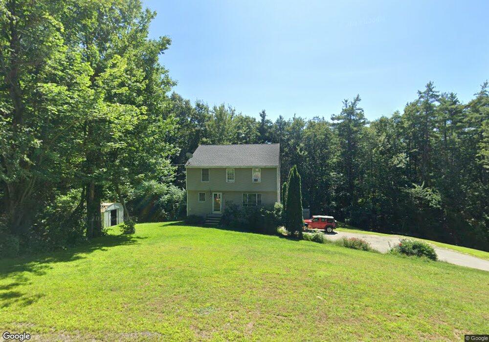
72 October Ln Gilford, NH 03249
Estimated Value: $506,137 - $615,000
3
Beds
2
Baths
1,760
Sq Ft
$317/Sq Ft
Est. Value
About This Home
This home is located at 72 October Ln, Gilford, NH 03249 and is currently estimated at $557,284, approximately $316 per square foot. 72 October Ln is a home located in Belknap County with nearby schools including Gilford Elementary School, Gilford Middle School, and Gilford High School.
Ownership History
Date
Name
Owned For
Owner Type
Purchase Details
Closed on
Nov 18, 2003
Sold by
Gray Matthew A and Gray Tammy L
Bought by
Gately John F and Gately Corey E
Current Estimated Value
Home Financials for this Owner
Home Financials are based on the most recent Mortgage that was taken out on this home.
Original Mortgage
$177,500
Outstanding Balance
$81,202
Interest Rate
5.81%
Estimated Equity
$476,082
Create a Home Valuation Report for This Property
The Home Valuation Report is an in-depth analysis detailing your home's value as well as a comparison with similar homes in the area
Home Values in the Area
Average Home Value in this Area
Purchase History
| Date | Buyer | Sale Price | Title Company |
|---|---|---|---|
| Gately John F | $111,000 | -- |
Source: Public Records
Mortgage History
| Date | Status | Borrower | Loan Amount |
|---|---|---|---|
| Open | Gately John F | $177,500 |
Source: Public Records
Tax History Compared to Growth
Tax History
| Year | Tax Paid | Tax Assessment Tax Assessment Total Assessment is a certain percentage of the fair market value that is determined by local assessors to be the total taxable value of land and additions on the property. | Land | Improvement |
|---|---|---|---|---|
| 2024 | $4,703 | $418,020 | $122,120 | $295,900 |
| 2023 | $4,306 | $418,020 | $122,120 | $295,900 |
| 2022 | $3,839 | $313,380 | $75,780 | $237,600 |
| 2021 | $3,848 | $313,380 | $75,780 | $237,600 |
| 2020 | $4,131 | $274,850 | $70,650 | $204,200 |
| 2019 | $4,075 | $256,950 | $41,450 | $215,500 |
| 2018 | $3,970 | $233,000 | $47,100 | $185,900 |
| 2017 | $4,022 | $233,000 | $47,100 | $185,900 |
| 2016 | $3,960 | $220,600 | $47,100 | $173,500 |
| 2015 | $3,907 | $217,440 | $47,940 | $169,500 |
| 2011 | $3,686 | $198,690 | $52,690 | $146,000 |
Source: Public Records
Map
Nearby Homes
- 7 Countryside Dr
- 162 Morrill St
- 102 Woodland Ave
- 96 Clinton St
- 122 Valley St
- 74 Morrill St
- 6 Colonial Dr
- 468 Union Ave
- 0 Sanborn St Unit 8 5059863
- 233 Stark St
- 75 Stark St Unit 3
- 88 Stark St
- 239 Gilford Ave
- 26 Saint Catherine St
- 29 Strafford St
- 50 Belvidere St
- 32 David Lewis Rd
- Lot 1 Winter St
- 84 Spring St
- 7 Riverside Ct