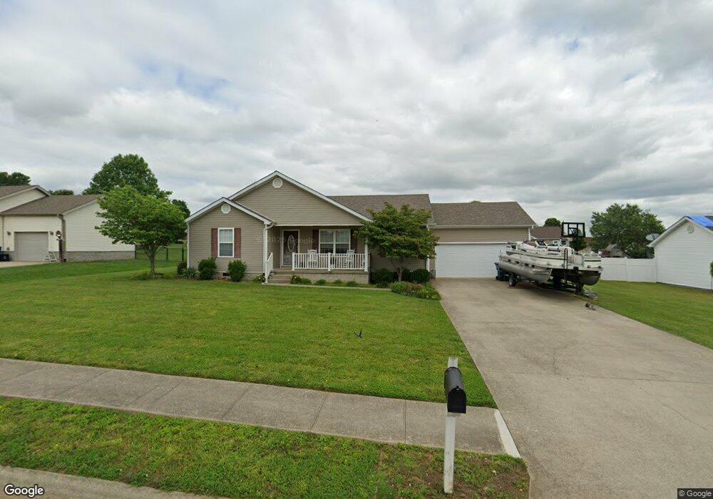
72 Rolling Meadows Dr Stanford, KY 40484
Estimated Value: $223,000 - $232,000
3
Beds
2
Baths
1,352
Sq Ft
$167/Sq Ft
Est. Value
About This Home
This home is located at 72 Rolling Meadows Dr, Stanford, KY 40484 and is currently estimated at $226,293, approximately $167 per square foot. 72 Rolling Meadows Dr is a home located in Lincoln County with nearby schools including Lincoln County High School.
Ownership History
Date
Name
Owned For
Owner Type
Purchase Details
Closed on
Sep 22, 2012
Sold by
Campbell Terry M and Campbell Connie S
Bought by
Tibbs Marty Eugene and Tibbs Ashley Nicole
Current Estimated Value
Purchase Details
Closed on
Apr 12, 2010
Sold by
Whidden Miltono and Whidden Tina L
Bought by
Lucas William Grant and Lucas Kristen T
Home Financials for this Owner
Home Financials are based on the most recent Mortgage that was taken out on this home.
Original Mortgage
$115,000
Interest Rate
4.94%
Mortgage Type
Unknown
Purchase Details
Closed on
Jun 16, 2006
Sold by
Shelton Gary and Shelton Lisa
Bought by
Lucas William Grant and Fitzgerald Kristen T
Home Financials for this Owner
Home Financials are based on the most recent Mortgage that was taken out on this home.
Original Mortgage
$96,000
Interest Rate
6.57%
Mortgage Type
New Conventional
Create a Home Valuation Report for This Property
The Home Valuation Report is an in-depth analysis detailing your home's value as well as a comparison with similar homes in the area
Home Values in the Area
Average Home Value in this Area
Purchase History
| Date | Buyer | Sale Price | Title Company |
|---|---|---|---|
| Tibbs Marty Eugene | $95,000 | None Available | |
| Lucas William Grant | $115,000 | None Available | |
| Lucas William Grant | $109,000 | None Available |
Source: Public Records
Mortgage History
| Date | Status | Borrower | Loan Amount |
|---|---|---|---|
| Closed | Lucas William Grant | $115,000 | |
| Previous Owner | Lucas William Grant | $96,000 |
Source: Public Records
Tax History Compared to Growth
Tax History
| Year | Tax Paid | Tax Assessment Tax Assessment Total Assessment is a certain percentage of the fair market value that is determined by local assessors to be the total taxable value of land and additions on the property. | Land | Improvement |
|---|---|---|---|---|
| 2024 | $1,259 | $131,000 | $25,000 | $106,000 |
| 2023 | $1,272 | $131,000 | $25,000 | $106,000 |
| 2022 | $1,275 | $131,000 | $25,000 | $106,000 |
| 2021 | $1,306 | $131,000 | $0 | $0 |
| 2020 | $1,113 | $109,000 | $0 | $0 |
| 2019 | $1,125 | $109,000 | $0 | $0 |
| 2018 | $1,113 | $109,000 | $0 | $0 |
| 2017 | -- | $109,000 | $0 | $0 |
| 2016 | $1,092 | $109,000 | $0 | $0 |
| 2015 | $900 | $109,000 | $0 | $0 |
| 2012 | $900 | $109,000 | $18,000 | $91,000 |
Source: Public Records
Map
Nearby Homes
- 279 Turkeyfoot Ln
- 000 Foster Ln
- 301 Redwood Dr
- 115 Mckinney Ct
- 305 Red Barn Rd
- 104 Clover Ct
- 127 Eastwood Dr
- 931 Lancaster St
- 108 Logan Ave
- 392 Tanner Cir
- 228 Powell St
- 828 E Main St
- 1414 Ky Hwy 590
- Tract A Goshen Rd
- 25 A&B Jessica Way
- 43 A&B Jessica Way
- 90 Wrsl Rd
- 17 Jessica Way
- 115 Shady Brook Dr
- 230 S Loop Dr
- 90 Rolling Meadows Dr
- 3095 Us Highway 150 W
- 3095 Us Highway 150 W
- 54 Rolling Meadows Dr
- 75 Rolling Meadows Dr
- 207 Foster Ln
- 57 Rolling Meadows Dr
- 93 Rolling Meadows Dr
- 205 Foster Ln
- 108 Rolling Meadows Dr
- 209 Foster Ln
- 36 Rolling Meadows Dr
- 39 Rolling Meadows Dr
- 111 Rolling Meadows Dr
- 211 Foster Ln
- 126 Rolling Meadows Dr
- 144 Rolling Meadows Dr
- 203 Foster Ln
- 213 Foster Ln
- 216 Foster Ln