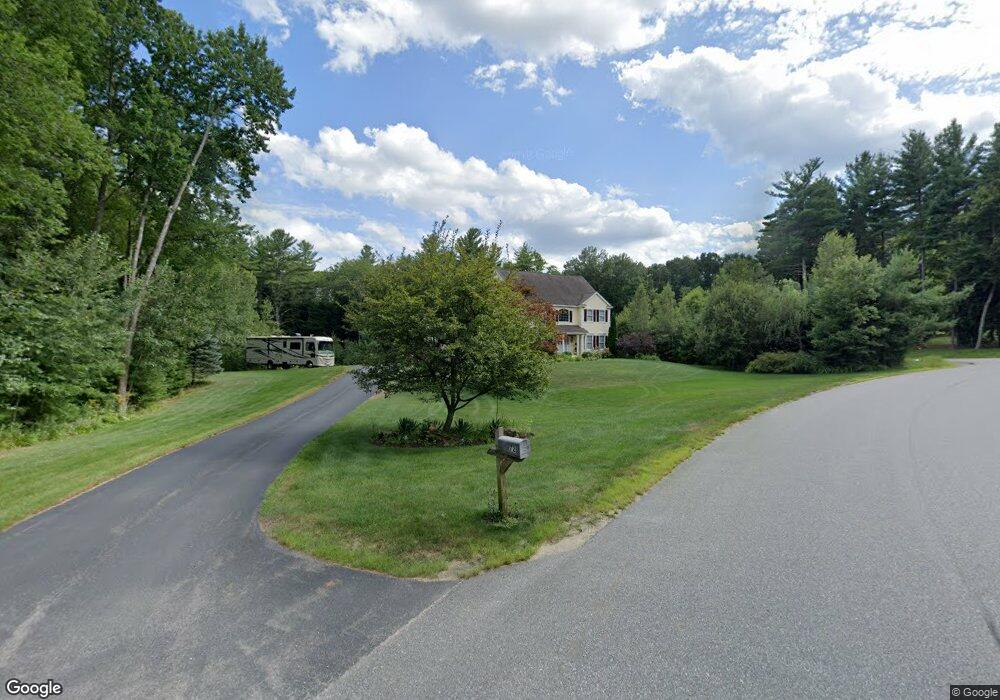
72 Tirrell Rd Bedford, NH 03110
Bedford NeighborhoodEstimated Value: $906,000 - $1,117,000
4
Beds
3
Baths
3,322
Sq Ft
$303/Sq Ft
Est. Value
About This Home
This home is located at 72 Tirrell Rd, Bedford, NH 03110 and is currently estimated at $1,007,937, approximately $303 per square foot. 72 Tirrell Rd is a home located in Hillsborough County with nearby schools including Mckelvie Intermediate School, Ross A. Lurgio Middle School, and Bedford High School.
Ownership History
Date
Name
Owned For
Owner Type
Purchase Details
Closed on
Dec 11, 2024
Sold by
Pereira Stephen M and Pereira Donna M
Bought by
Pereira Ft and Pereira
Current Estimated Value
Purchase Details
Closed on
Aug 20, 2003
Sold by
Homes By Emerson Desig
Bought by
Pereira Stephen M and Pereira Donna M
Purchase Details
Closed on
Feb 26, 2001
Sold by
Merriam Richard P
Bought by
Raymond Ft
Purchase Details
Closed on
Jun 30, 2000
Sold by
Merriam Richard P
Bought by
Klardie Christos and Klardie Donna M
Purchase Details
Closed on
Jun 22, 2000
Sold by
Little Pond Est Bedfrd
Bought by
Merriam Richard P
Purchase Details
Closed on
Feb 9, 2000
Sold by
Seph Rlty Inc
Bought by
Maher James J and Maher Maura J
Purchase Details
Closed on
Jun 21, 1999
Sold by
Little Pond Est Bedfrd
Bought by
Desantis Scott
Home Financials for this Owner
Home Financials are based on the most recent Mortgage that was taken out on this home.
Original Mortgage
$91,496
Interest Rate
6.99%
Purchase Details
Closed on
Apr 19, 1999
Sold by
Twb Re Holdings Inc
Bought by
Ackerson Peter T and Ackerson Christiane
Purchase Details
Closed on
Mar 18, 1999
Sold by
Little Pond Est Bedfrd
Bought by
Twb Real Est Holdings
Purchase Details
Closed on
Feb 11, 1999
Sold by
Little Pond Est Bedfrd
Bought by
Twb Real Est Holdings
Purchase Details
Closed on
Jul 28, 1998
Sold by
Dudka Est Daniel
Bought by
Bedfo Little Pond Ests
Purchase Details
Closed on
Jun 8, 1998
Sold by
Dudka Est Diana R
Bought by
Levasseur Donald J
Create a Home Valuation Report for This Property
The Home Valuation Report is an in-depth analysis detailing your home's value as well as a comparison with similar homes in the area
Home Values in the Area
Average Home Value in this Area
Purchase History
| Date | Buyer | Sale Price | Title Company |
|---|---|---|---|
| Pereira Ft | -- | None Available | |
| Pereira Ft | -- | None Available | |
| Pereira Ft | -- | None Available | |
| Pereira Stephen M | $155,000 | -- | |
| Raymond Ft | $381,200 | -- | |
| Klardie Christos | $430,200 | -- | |
| Merriam Richard P | $165,000 | -- | |
| Maher James J | $105,000 | -- | |
| Desantis Scott | $95,000 | -- | |
| Ackerson Peter T | $389,900 | -- | |
| Twb Real Est Holdings | $173,500 | -- | |
| Twb Real Est Holdings | $82,500 | -- | |
| Bedfo Little Pond Ests | $116,100 | -- | |
| Bedfo Little Pond Ests | $200,000 | -- | |
| Levasseur Donald J | $31,000 | -- | |
| Pereira Stephen M | $155,000 | -- | |
| Raymond Ft | $381,200 | -- | |
| Klardie Christos | $430,200 | -- | |
| Merriam Richard P | $165,000 | -- | |
| Maher James J | $105,000 | -- | |
| Desantis Scott | $95,000 | -- | |
| Ackerson Peter T | $389,900 | -- | |
| Twb Real Est Holdings | $173,500 | -- | |
| Twb Real Est Holdings | $82,500 | -- | |
| Little Pond Ests Bedfo | $200,000 | -- | |
| Levasseur Donald J | $31,000 | -- |
Source: Public Records
Mortgage History
| Date | Status | Borrower | Loan Amount |
|---|---|---|---|
| Previous Owner | Levasseur Donald J | $91,496 |
Source: Public Records
Tax History Compared to Growth
Tax History
| Year | Tax Paid | Tax Assessment Tax Assessment Total Assessment is a certain percentage of the fair market value that is determined by local assessors to be the total taxable value of land and additions on the property. | Land | Improvement |
|---|---|---|---|---|
| 2024 | $15,775 | $997,800 | $357,200 | $640,600 |
| 2023 | $14,767 | $997,800 | $357,200 | $640,600 |
| 2022 | $13,362 | $759,200 | $264,800 | $494,400 |
| 2021 | $13,013 | $759,200 | $264,800 | $494,400 |
| 2020 | $13,069 | $652,800 | $210,800 | $442,000 |
| 2019 | $12,371 | $652,800 | $210,800 | $442,000 |
| 2018 | $12,634 | $619,300 | $210,800 | $408,500 |
| 2017 | $11,711 | $619,300 | $210,800 | $408,500 |
| 2016 | $12,046 | $538,500 | $168,600 | $369,900 |
| 2015 | $12,256 | $538,500 | $168,600 | $369,900 |
| 2014 | $12,116 | $538,500 | $168,600 | $369,900 |
| 2013 | $11,939 | $538,500 | $168,600 | $369,900 |
Source: Public Records
Map
Nearby Homes
- 197 Liberty Hill Rd
- 10 Barrington Dr
- 7 Hamilton Way
- 116 Nashua Rd
- 29 Pebble Beach Dr
- 15 Spyglass Point Cir
- 20 Pebble Beach Dr Unit 22-89-20
- 82 Pilgrim Dr
- 17-4-28 Boiling Kettle Way
- 17-4-28 Boiling Kettle Way Unit 28
- 155 Wallace Rd
- 20 Liberty Hill Rd
- 18 Horizon Dr
- 150 Wallace Rd
- 12 Knoll Crest Dr Unit Lot 5 - The Hannah
- 80 Wendover Way
- 34 Briston Ct
- 40 Seton Dr
- 10 Pimlico Ct Unit UN66
- 3 Churchill Ct Unit UN111
- 78 Tirrell Rd
- 75 Tirrell Rd
- 81 Tirrell Rd
- 82 Tirrell Rd
- 36 Old Sawmill Rd
- 83 Tirrell Rd
- 32 Old Sawmill Rd
- 71 Tirrell Rd
- 40 Old Sawmill Rd
- 30 Old Sawmill Rd
- 86 Tirrell Rd
- 67 Tirrell Rd
- 42 Old Sawmill Rd
- 62 Tirrell Rd
- 87 Tirrell Rd
- 26 Old Sawmill Rd
- 44 Old Sawmill Rd
- 89 Tirrell Rd
- 63 Tirrell Rd
- 88 Tirrell Rd