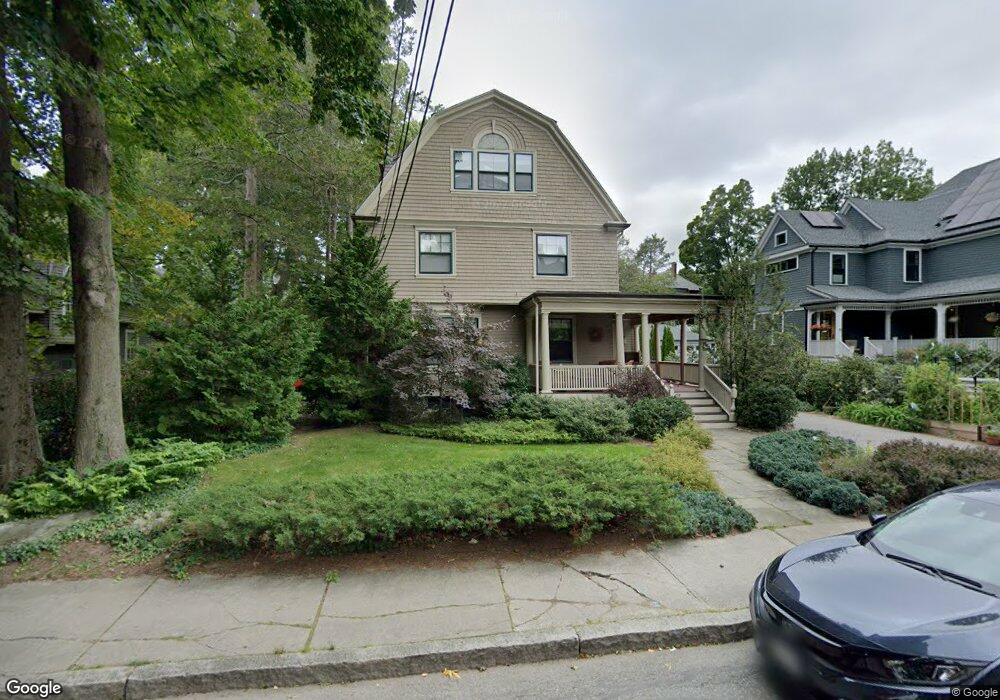
72 Toxteth St Brookline, MA 02446
Coolidge Corner NeighborhoodEstimated Value: $3,343,000 - $4,327,000
5
Beds
4
Baths
3,619
Sq Ft
$1,102/Sq Ft
Est. Value
About This Home
This home is located at 72 Toxteth St, Brookline, MA 02446 and is currently estimated at $3,987,247, approximately $1,101 per square foot. 72 Toxteth St is a home located in Norfolk County with nearby schools including Amos A. Lawrence School, St. Mary of the Assumption Elementary School, and Maimonides School.
Ownership History
Date
Name
Owned For
Owner Type
Purchase Details
Closed on
Jun 2, 2025
Sold by
Emily Anne Jonas 2020 Ft and Jonas
Bought by
72 Toxteth Street Nt and Mason
Current Estimated Value
Purchase Details
Closed on
Sep 14, 2022
Sold by
Tevald Emily
Bought by
Emily J Tevald 2020 Ft and Tevald
Home Financials for this Owner
Home Financials are based on the most recent Mortgage that was taken out on this home.
Original Mortgage
$1,000,000
Interest Rate
5.89%
Mortgage Type
New Conventional
Purchase Details
Closed on
Aug 9, 2022
Sold by
Tevald Jeremy
Bought by
Tevald Emily
Home Financials for this Owner
Home Financials are based on the most recent Mortgage that was taken out on this home.
Original Mortgage
$1,000,000
Interest Rate
5.89%
Mortgage Type
New Conventional
Purchase Details
Closed on
Jul 30, 2020
Sold by
Levine Jay R and Levine Mimi R
Bought by
Tevald Jeremy and Tevald Emly
Purchase Details
Closed on
Mar 6, 2007
Sold by
Levine Jay R and Levine Mimi R
Bought by
Levine Jay R and Levine Mimi R
Purchase Details
Closed on
Jan 16, 1998
Sold by
Mills Margaret T Est and Mills
Bought by
Levine Jay R and Levine Mimi R
Create a Home Valuation Report for This Property
The Home Valuation Report is an in-depth analysis detailing your home's value as well as a comparison with similar homes in the area
Home Values in the Area
Average Home Value in this Area
Purchase History
| Date | Buyer | Sale Price | Title Company |
|---|---|---|---|
| 72 Toxteth Street Nt | $4,900,000 | None Available | |
| 72 Toxteth Street Nt | $4,900,000 | None Available | |
| Emily J Tevald 2020 Ft | -- | None Available | |
| Emily J Tevald 2020 Ft | -- | None Available | |
| Emily J Tevald 2020 Ft | -- | None Available | |
| Tevald Emily | -- | None Available | |
| Tevald Emily | -- | None Available | |
| Tevald Emily | -- | None Available | |
| Tevald Jeremy | $3,325,000 | None Available | |
| Tevald Jeremy | $3,325,000 | None Available | |
| Tevald Jeremy | $3,325,000 | None Available | |
| Levine Jay R | -- | -- | |
| Levine Jay R | -- | -- | |
| Levine Jay R | $580,000 | -- | |
| Levine Jay R | -- | -- | |
| Levine Jay R | $580,000 | -- |
Source: Public Records
Mortgage History
| Date | Status | Borrower | Loan Amount |
|---|---|---|---|
| Previous Owner | Emily J Tevald 2020 Ft | $1,000,000 | |
| Previous Owner | Levine Jay R | $687,000 | |
| Previous Owner | Levine Jay R | $687,000 |
Source: Public Records
Tax History Compared to Growth
Tax History
| Year | Tax Paid | Tax Assessment Tax Assessment Total Assessment is a certain percentage of the fair market value that is determined by local assessors to be the total taxable value of land and additions on the property. | Land | Improvement |
|---|---|---|---|---|
| 2025 | $30,565 | $3,096,800 | $1,414,900 | $1,681,900 |
| 2024 | $29,117 | $2,980,200 | $1,360,500 | $1,619,700 |
| 2023 | $26,736 | $2,681,600 | $1,126,600 | $1,555,000 |
| 2022 | $26,025 | $2,554,000 | $1,073,000 | $1,481,000 |
| 2021 | $23,598 | $2,408,000 | $1,031,700 | $1,376,300 |
| 2020 | $21,685 | $2,294,700 | $937,900 | $1,356,800 |
| 2019 | $20,477 | $2,185,400 | $893,200 | $1,292,200 |
| 2018 | $18,882 | $1,996,000 | $745,300 | $1,250,700 |
| 2017 | $18,604 | $1,883,000 | $703,100 | $1,179,900 |
| 2016 | $18,337 | $1,759,800 | $657,100 | $1,102,700 |
| 2015 | $16,969 | $1,588,900 | $558,300 | $1,030,600 |
| 2014 | $17,670 | $1,551,400 | $507,300 | $1,044,100 |
Source: Public Records
Map
Nearby Homes
- 65 Francis St Unit 65
- 65 Francis St
- 57 Saint Paul St Unit 19
- 98 Saint Paul St Unit A1
- 106 Brook St
- 216 Aspinwall Ave
- 214 Aspinwall Ave Unit 2
- 120 Brook St Unit 1
- 151 Longwood Ave Unit 1
- 30 Stearns Rd Unit 302
- 45 Longwood Ave Unit 812
- 45 Longwood Ave Unit PHA
- 60 Longwood Ave Unit 307
- 60 Longwood Ave Unit 403
- 123 Sewall Ave Unit LC
- 50 Longwood Ave Unit 611
- 50 Longwood Ave Unit 518
- 14 Linden St Unit 8
- 58 Kent St Unit 302
- 58 Kent St Unit 404