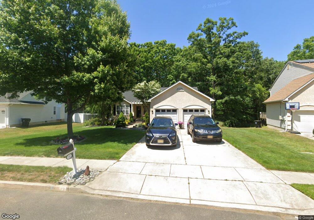
72 Wildcat Branch Dr Sicklerville, NJ 08081
Winslow Township NeighborhoodEstimated Value: $371,000 - $440,000
--
Bed
--
Bath
1,495
Sq Ft
$275/Sq Ft
Est. Value
About This Home
This home is located at 72 Wildcat Branch Dr, Sicklerville, NJ 08081 and is currently estimated at $410,574, approximately $274 per square foot. 72 Wildcat Branch Dr is a home located in Camden County with nearby schools including Winslow Township High School, Erial Community Church Christian School, and South Jersey Christian Academy.
Ownership History
Date
Name
Owned For
Owner Type
Purchase Details
Closed on
Nov 8, 2002
Sold by
Cato Adrienne R
Bought by
Cato Adrienne R and Cato Willie L
Current Estimated Value
Home Financials for this Owner
Home Financials are based on the most recent Mortgage that was taken out on this home.
Original Mortgage
$153,000
Interest Rate
6.02%
Purchase Details
Closed on
May 30, 2001
Sold by
Millner Larry E
Bought by
Cato Adrienne R
Home Financials for this Owner
Home Financials are based on the most recent Mortgage that was taken out on this home.
Original Mortgage
$139,650
Interest Rate
7.15%
Purchase Details
Closed on
Jun 16, 1995
Sold by
Paparone Housing Co
Bought by
Millner Larry E
Home Financials for this Owner
Home Financials are based on the most recent Mortgage that was taken out on this home.
Original Mortgage
$123,000
Interest Rate
7.82%
Create a Home Valuation Report for This Property
The Home Valuation Report is an in-depth analysis detailing your home's value as well as a comparison with similar homes in the area
Home Values in the Area
Average Home Value in this Area
Purchase History
| Date | Buyer | Sale Price | Title Company |
|---|---|---|---|
| Cato Adrienne R | -- | -- | |
| Cato Adrienne R | $150,750 | -- | |
| Millner Larry E | $137,500 | -- |
Source: Public Records
Mortgage History
| Date | Status | Borrower | Loan Amount |
|---|---|---|---|
| Previous Owner | Cato Adrienne R | $153,000 | |
| Previous Owner | Cato Adrienne R | $139,650 | |
| Previous Owner | Millner Larry E | $123,000 |
Source: Public Records
Tax History Compared to Growth
Tax History
| Year | Tax Paid | Tax Assessment Tax Assessment Total Assessment is a certain percentage of the fair market value that is determined by local assessors to be the total taxable value of land and additions on the property. | Land | Improvement |
|---|---|---|---|---|
| 2025 | $7,652 | $196,100 | $55,000 | $141,100 |
| 2024 | $7,450 | $196,100 | $55,000 | $141,100 |
| 2023 | $7,450 | $196,100 | $55,000 | $141,100 |
| 2022 | $7,220 | $196,100 | $55,000 | $141,100 |
| 2021 | $6,594 | $196,100 | $55,000 | $141,100 |
| 2020 | $7,075 | $196,100 | $55,000 | $141,100 |
| 2019 | $7,032 | $196,100 | $55,000 | $141,100 |
| 2018 | $6,936 | $196,100 | $55,000 | $141,100 |
| 2017 | $6,813 | $196,100 | $55,000 | $141,100 |
| 2016 | $6,726 | $196,100 | $55,000 | $141,100 |
| 2015 | $6,628 | $196,100 | $55,000 | $141,100 |
| 2014 | $6,481 | $196,100 | $55,000 | $141,100 |
Source: Public Records
Map
Nearby Homes
- 5 Kelly Dr
- 45 Wiltons Landing Rd
- 50 Wildcat Branch Dr
- 196 Sandy Ridge Rd
- 51 Tailor Ln
- 117 Clinton St
- 163 Sandy Ridge Rd
- 113 Clinton St
- 159 Sandy Ridge Rd
- 119 Clinton St
- 161 Sandy Ridge Rd
- 115 Clinton St
- 111 Clinton St
- 6 Twisting Ln
- 109 Harmony Circle Rd
- 33 Tailor Ln
- 117 Plaza Dr
- 13 Tailor Ln
- 30 Champlain St
- LAFAYETTE Plan at
- 70 Wildcat Branch Dr
- 76 Wildcat Branch Dr
- 68 Wildcat Branch Dr
- 61 Wildcat Branch Dr
- 59 Wildcat Branch Dr
- 63 Wildcat Branch Dr
- 66 Wildcat Branch Dr
- 57 Wildcat Branch Dr
- 2 Duchess Dr
- 6 Patricks Mill Ct
- 8 Patricks Mill Ct
- 64 Wildcat Branch Dr
- 26 Log Cabin Rd
- 1 Duchess Dr
- 4 Patricks Mill Ct
- 4 Duchess Dr
- 2 Endfield St
- 24 Log Cabin Rd
- 144 Quiet Crescent