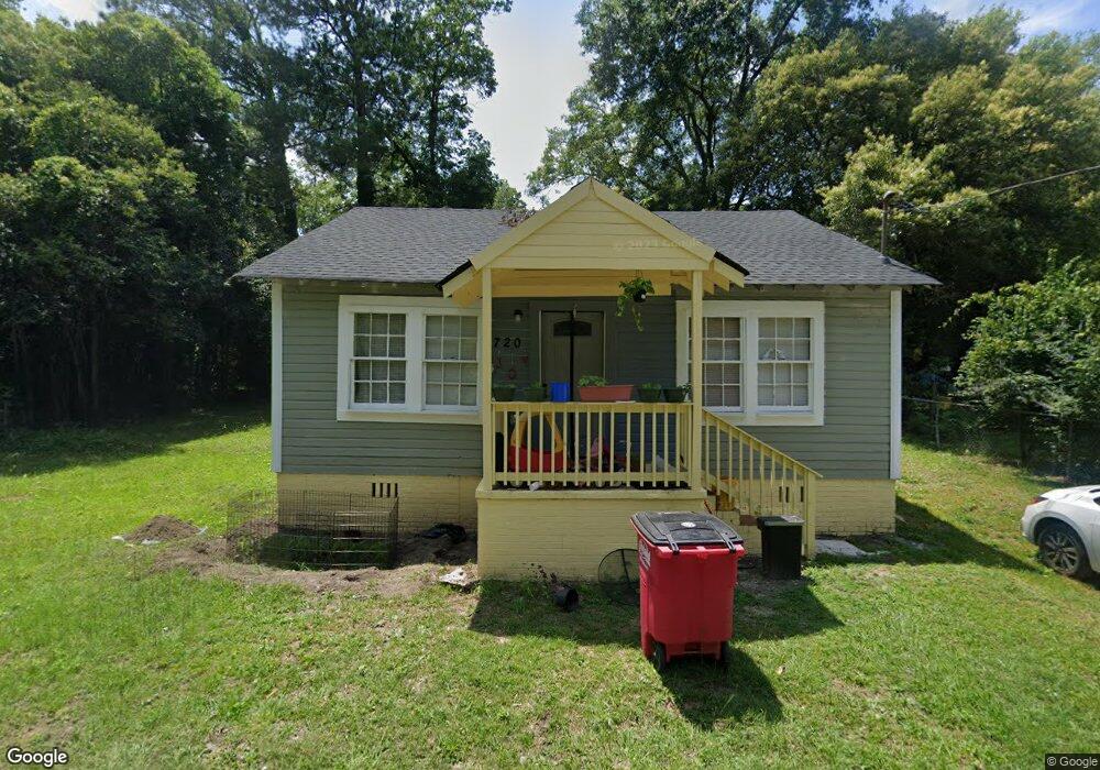
720 Baker St Macon, GA 31217
Estimated Value: $59,619 - $93,000
2
Beds
1
Bath
784
Sq Ft
$92/Sq Ft
Est. Value
About This Home
This home is located at 720 Baker St, Macon, GA 31217 and is currently estimated at $72,155, approximately $92 per square foot. 720 Baker St is a home located in Bibb County with nearby schools including Martin Luther King Jr. Elementary School, Appling Middle School, and Northeast High School.
Ownership History
Date
Name
Owned For
Owner Type
Purchase Details
Closed on
May 26, 2023
Sold by
Carter Horace
Bought by
Carter-Hazel & Associates Inc
Current Estimated Value
Home Financials for this Owner
Home Financials are based on the most recent Mortgage that was taken out on this home.
Original Mortgage
$45,000
Outstanding Balance
$43,701
Interest Rate
6.39%
Mortgage Type
New Conventional
Estimated Equity
$28,454
Purchase Details
Closed on
Mar 12, 2020
Sold by
Macon Bibb County
Bought by
Carter Hazel & Associates Inc
Purchase Details
Closed on
Nov 11, 1993
Sold by
Johnson Rosa L 1224 and Johnson 12
Bought by
Ellis Barbara Jean
Create a Home Valuation Report for This Property
The Home Valuation Report is an in-depth analysis detailing your home's value as well as a comparison with similar homes in the area
Home Values in the Area
Average Home Value in this Area
Purchase History
| Date | Buyer | Sale Price | Title Company |
|---|---|---|---|
| Carter-Hazel & Associates Inc | -- | None Listed On Document | |
| Carter Horace | -- | None Listed On Document | |
| Carter Horace | -- | None Listed On Document | |
| Carter Hazel & Associates Inc | $7,000 | None Available | |
| Ellis Barbara Jean | $100 | -- |
Source: Public Records
Mortgage History
| Date | Status | Borrower | Loan Amount |
|---|---|---|---|
| Open | Carter Horace | $45,000 | |
| Closed | Carter Horace | $45,000 |
Source: Public Records
Tax History Compared to Growth
Tax History
| Year | Tax Paid | Tax Assessment Tax Assessment Total Assessment is a certain percentage of the fair market value that is determined by local assessors to be the total taxable value of land and additions on the property. | Land | Improvement |
|---|---|---|---|---|
| 2025 | $289 | $11,746 | $3,300 | $8,446 |
| 2024 | $239 | $9,402 | $1,800 | $7,602 |
| 2023 | $182 | $9,102 | $1,500 | $7,602 |
| 2022 | $137 | $3,968 | $2,050 | $1,918 |
| 2021 | $57 | $1,496 | $1,025 | $471 |
| 2020 | $56 | $1,449 | $1,025 | $424 |
| 2019 | $54 | $1,382 | $911 | $471 |
| 2018 | $263 | $1,382 | $911 | $471 |
| 2017 | $70 | $1,861 | $911 | $950 |
| 2016 | $64 | $1,861 | $911 | $950 |
| 2015 | $91 | $1,861 | $911 | $950 |
| 2014 | $105 | $1,861 | $911 | $950 |
Source: Public Records
Map
Nearby Homes
- 1008 Sunnydale Dr
- 1030 Forsyth Ave
- 684 Reese St
- 909 Johnson St
- 769 Bowman St
- 747 Bowman St
- 1024 Clarks Ln
- 1213 Eastview Ave
- 1012 Emery Hwy
- 1209 Eastview Ave
- 875 Artic Place
- 4436 Jeffersonville Rd
- 837 Artic Cir
- 845 Norris St
- 1818 Kinder Kare Dr
- 875 Artic Cir
- 1840 Kinder Kare Dr
- 866 Stewart St
- 972 Norris St
- 857 Mitchell St
- 755 Dorothy St
- 736 Baker St
- 1378 Jeffersonville Rd
- 1394 Jeffersonville Rd
- 747 Dorothy St
- 1408 Jeffersonville Rd
- 1438 Jeffersonville Rd
- 735 Dorothy St
- 1364 Jeffersonville Rd
- 741 Baker St
- 778 Dorothy St
- 770 Sunnydale Dr
- 725 Magnolia Dr
- 750 Sunnydale Dr
- 760 Sunnydale Dr
- 781 Dorothy St
- 1383 Jeffersonville Rd
- 780 Sunnydale Dr
- 1433 Jeffersonville Rd
- 1356 Jeffersonville Rd